Suffrage, political franchise, or simply franchise is the right to vote in public, political elections and referendums. In some languages, and occasionally in English, the right to vote is called active suffrage, as distinct from passive suffrage, which is the right to stand for election. The combination of active and passive suffrage is sometimes called full suffrage.

Burgenland is the easternmost and least populous state of Austria. It consists of two statutory cities and seven rural districts, with a total of 171 municipalities. It is 166 km (103 mi) long from north to south but much narrower from west to east. The region is part of the Centrope Project. The name of Burgenland was invented/coined in 1922, after its territories became part of Austria.

Zalaegerszeg is the administrative center of Zala county in western Hungary.

Hódmezővásárhely is a city with county rights in southeast Hungary, on the Great Hungarian Plain, at the meeting point of the Békés-Csanádi Ridge and the clay grassland surrounding the river Tisza. In 2017, it had a population of 44,009.

Nagykanizsa, known colloquially as Kanizsa, is a medium-sized city in Zala County in southwestern Hungary. It is a city with county rights.
Elections in Hungary are held at two levels: general elections to elect the members of the National Assembly and local elections to elect local authorities. European Parliament elections are also held every 5 years.

The Duchy of Bukovina was a constituent land of the Austrian Empire from 1849 and a Cisleithanian crown land of Austria-Hungary from 1867 until 1918.

Transdanubia is a traditional region of Hungary. It is also referred to as Hungarian Pannonia, or Pannonian Hungary.

Sárbogárd is a town in Fejér county, Hungary. The town is at the intersection of important railroad routes in Hungary: this is where electrified routes from Balaton and Pécs merge with non-electrified railways from Baja and Szekszárd. A double electrified track runs from Sárbogárd to Budapest allowing MÁV trains to provide quick access to the capital.
Gárdony is a town in Fejér county, Hungary. It is located 55 km from Budapest, the capital of Hungary.
The Diet of Bosnia and Herzegovina was a representative assembly with competence over the Austro-Hungarian Condominium of Bosnia and Herzegovina. The parliament established in 1910 had a certain legislative authority, however, its resolutions were subject to approval by the Austrian and Hungarian government. It ceased its operation in July 1914 and was legally abolished in 1915.

Szabadegyháza is a village in Fejér county, Hungary.

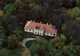
Nadap is a village in Fejér county in central Hungary, with population of 460. Lying among low Velence Hills, it is the point of departure for sightseeing tours on the countryside. The obelisk in the vicinity, called "ancient mark of Nadap" serves as a geodetic point of reference at elevation of 173.8 m. Mihály Vörösmarty was christened in the Catholic church of Saint Rosalia in the village, and the christening basin is still preserved in the church.

Pákozd is a village in Fejér county, Hungary.
Pázmánd is a village in Fejér county, Hungary. As of 2004, it had 2,015 residents.
Pusztaszabolcs is a town in Fejér County, Hungary.

Veszprémgalsa is the village of Galsa in Veszprém county, in the district of Sümeg. Prior to 1969 it was referred to as Galsa or Zalagalsa, Zala being the former county affiliation. However, in 1969 the villages of Veszprémpinkóc and Zalagalsa were combined creating Veszprémgalsa.

Balatonszentgyörgy is a village in Somogy county, Hungary. It is near to the village of Balatonberény. The village is next to Lake Balaton.

Austria, formally the Republic of Austria, is a landlocked country in Central Europe, lying in the Eastern Alps. It is a federation of nine federal states, one of which is the capital, Vienna, the most populous city and federal state. Austria is bordered by Germany to the northwest, the Czech Republic to the north, Slovakia to the northeast, Hungary to the east, Slovenia and Italy to the south, and Switzerland and Liechtenstein to the west. The country occupies an area of 83,879 km2 (32,386 sq mi) and has a population of around 9 million.
Hungary in its modern (post-1946) borders roughly corresponds to the Great Hungarian Plain in Central Europe.