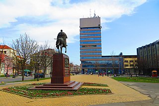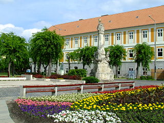
Zrenjanin is a city and the administrative center of the Central Banat District in the autonomous province of Vojvodina, Serbia. The city urban area has a population of 76,511 inhabitants, while the city administrative area has 123,362 inhabitants.

Hévíz Spa and the Szent András Hospital, Hévíz is a spa in Hungary. It is located in Hévíz, on the shores of the lake of the same name.

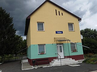
Tállya is a village in Borsod-Abaúj-Zemplén county, Northern Hungary, 45 kilometres from county seat Miskolc, in the famous Tokaj-Hegyalja wine district.

Orăștie is a city in Hunedoara County, south-western Transylvania, Romania.

Zala is an administrative county in south-western Hungary. It is named after the Zala River. It shares borders with Croatia and Slovenia and the Hungarian counties Vas, Veszprém and Somogy. The capital of Zala county is Zalaegerszeg. Its area is 3,784 square kilometres (1,461 sq mi). Lake Balaton lies partly in the county.

Szolnok is the county seat of Jász-Nagykun-Szolnok county in central Hungary. Its location on the banks of the Tisza river, at the heart of the Great Hungarian Plain, has made it an important cultural and economic crossroads for centuries.

Mezőkövesd[ˈmɛzøːkøvɛʒd] is a town in Borsod-Abaúj-Zemplén county, Northern Hungary. It lies 50 km (31 mi) from Miskolc and 15 km (9 mi) from Eger.

Sajószentpéter is a town in Borsod-Abaúj-Zemplén county, Northern Hungary. It lies in the Miskolc–Kazincbarcika agglomeration, 10 kilometres away from the county capital.

Kalocsa is a town in Bács-Kiskun county, Hungary. It lies 142 km (88 mi) south of Budapest. It is situated in a marshy but highly productive district, near the left bank of the Danube River. Historically it had greater political and economic importance than at present.

Szentistván is a village in Northern Hungary, in the Mezőkövesd district of Borsod-Abaúj-Zemplén county.
Bocskaikert is a village situated in the north-east part of Hungary, 15 km (9 mi) away from Debrecen, the country's second largest town. Administratively it belongs to Hajdú-Bihar County.

Vojlovica is a neighborhood of the city of Pančevo, Serbia. Formerly, it was a separate village that was joined with Pančevo in the second half of the 20th century. Vojlovica’s centre is located 3,32 kilometers away from the Pančevo's centre. The geographical latitude of the settlement is 44° 50' 41.48" North, while the longitude is 20° 40' 21.69" East.

Békésszentandrás is a village in Békés county, in the Southern Great Plain region of south-east Hungary.

Körösnagyharsány (Körös-Nagy-Harsány) is a village in Békés County, in the Southern Great Plain region of south-east Hungary.

Hévíz is a spa town in Zala County, Hungary, about 8 kilometres from Keszthely.

Cserszegtomaj is a village in Zala county, Hungary. It is located north of Keszthely, at the south-west foot of the Keszthely Hills.

Gyömrő is a town in Pest county, Budapest metropolitan area, Hungary. The City of Gyömrő is situated in the center of the hilly region of Monor, in the outskirt of the capital city, Budapest. The whole territory of Gyömrő is 26,51 km², its internal area is 6.45 km². The number of inhabitants is about 15,290.

Kozármisleny, is a town in Baranya county, Hungary. It is south-east of the city of Pécs.

Felsőcsatár is a village in Vas County, Hungary.

Zsámbok is a village and commune in the comitatus of Pest County, Hungary.


