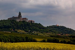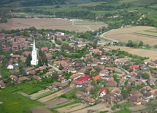
Pest is a county (vármegye) in central Hungary. It covers an area of 6,393.14 square kilometres (2,468.41 sq mi), and has a population of 1,339,090 (2023). It surrounds the national capital Budapest and the majority of the county's population live in the suburbs of Budapest. It shares borders with Slovakia and the Hungarian counties Nógrád, Heves, Jász-Nagykun-Szolnok, Bács-Kiskun, Fejér, and Komárom-Esztergom. The River Danube flows through the county. The capital of Pest County is Budapest, although Budapest is not part of Pest County. Starting 2018, they also constitute different NUTS:HU level 2 regions, as previously Pest County has lost catch-up aids from the European Union because of the high development of Budapest.

Vukovar-Srijem County, Vukovar-Sirmium County or Vukovar-Syrmia County, named after the eponymous town of Vukovar and the region of Syrmia, is the easternmost Croatian county. It includes the eastern parts of the region of Slavonia and the western parts of the region of Syrmia, as well as the lower Sava river basin, Posavina and Danube river basin Podunavlje. Due to the overlapping definitions of geographic regions, division on Slavonia and Syrmia approximately divides the county vertically into north-west and south-east half, while division on Posavina and Podunavlje divides it horizontally on north-east and south-west half.

Fejér is an administrative county in central Hungary. It lies on the west bank of the river Danube and nearly touches the eastern shore of Lake Balaton. It shares borders with the Hungarian counties Veszprém, Komárom-Esztergom County, Pest, Bács-Kiskun County, Tolna and Somogy. The capital of Fejér county is Székesfehérvár.

Vas is an administrative county of Hungary. It was also one of the counties of the former Kingdom of Hungary. It is part of the Centrope Project.

Zala is an administrative county in south-western Hungary. It is named after the Zala River. It shares borders with Croatia and Slovenia and the Hungarian counties Vas, Veszprém and Somogy. The seat of Zala County is Zalaegerszeg Its area is 3,784 square kilometres (1,461 sq mi). Lake Balaton lies partly in the county.

Borsod–Abaúj–Zemplén is an administrative county in north-eastern Hungary, on the border with Slovakia. It shares borders with the Hungarian counties Nógrád, Heves, Hajdú–Bihar and Szabolcs–Szatmár–Bereg. The capital of Borsod–Abaúj–Zemplén county is Miskolc. Of the seven statistical regions of Hungary it belongs to the region Northern Hungary.

Győr–Moson–Sopron is an administrative county in north-western Hungary, on the border with Slovakia and Austria (Burgenland). It shares borders with the Hungarian counties Komárom–Esztergom, Veszprém and Vas. The capital of Győr–Moson–Sopron county is Győr. The county is a part of the Centrope project.

Hajdú–Bihar is an administrative county in eastern Hungary, on the border with Romania. It shares borders with the Hungarian counties Szabolcs-Szatmár-Bereg, Borsod–Abaúj–Zemplén, Jász–Nagykun–Szolnok and Békés. The capital of Hajdú-Bihar county is Debrecen. Together with Bihor County in Romania it constitutes the Biharia Euroregion.

Encs is a small town in Borsod-Abaúj-Zemplén county, Northern Hungary, 30 kilometers from the county capital Miskolc.

Atid is a commune in Harghita County, Romania. It lies in the Székely Land, an ethno-cultural region in eastern Transylvania. The route of the Via Transilvanica long-distance trail passes through the village of Inlăceni, which is administered by Atid commune.

Plăieșii de Jos is a commune in Harghita County, Romania. It lies in the Székely Land, an ethno-cultural region in eastern Transylvania. The commune is composed of five villages: Cașinu Nou (Kászonújfalu), Iacobeni (Kászonjakabfalva), Imper, Plăieșii de Jos, and Plăieșii de Sus (Kászonfeltíz).

Aszaló is a village in Borsod–Abaúj–Zemplén county, Hungary. In 2013, it had 1,860 inhabitants.

Garadna is a village in Borsod-Abaúj-Zemplén county, Hungary, in the Encs District.

Chibed is a commune in Mureș County, Transylvania, Romania, composed of a single village, Chibed. It lies in the Székely Land, an ethno-cultural region in eastern Transylvania. The village is famous for the onion produced in the village and sold in front of the houses along the main road.

Corunca is a commune in Mureș County, Transylvania, Romania. The commune is composed of two villages: Bozeni (Székelybós) and Corunca. It became an independent commune when the component villages split from Livezeni in 2004.

Tornanádaska is a village in the Edelényi kistérség, Borsod-Abaúj-Zemplén County, Hungary.

Győr was the name of a gens in the Kingdom of Hungary. The ancestor of the kindred was a German knight, who arrived to Hungary in the first half of the 11th century. His descendants settled down in Transdanubia. The last scion of the family died in the 17th century.

Nagykanizsa is a district in southern part of Zala County. Nagykanizsa is also the name of the town where the district seat is found. The district is located in the Western Transdanubia Statistical Region.
Pat (I) from the kindred Győr was a Hungarian influential lord at the turn of the 12th and 13th centuries, who served as Palatine of Hungary from 1209 until 1212.


