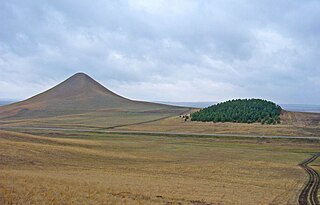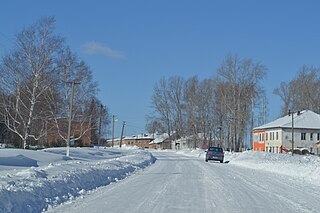
Abzelilovsky District is an administrative and municipal district (raion), one of the fifty-four in the Republic of Bashkortostan, Russia. It is located in the southeast of the republic. The area of the district is 4,288 square kilometers (1,656 sq mi). Its administrative center is the rural locality of Askarovo. As of the 2010 census, the total population of the district was 45,551, with the population of Askarovo accounting for 16.8% of that number.

Alsheyevsky District is an administrative and municipal district (raion), one of the fifty-four in the Republic of Bashkortostan, Russia. It is located in the west of the republic. The area of the district is 2,415 square kilometers (932 sq mi). Its administrative center is the rural locality of Rayevsky. As of the 2010 Census, the total population of the district was 43,647, with the population of Rayevsky accounting for 44.8% of that number.

Bakalinsky District is an administrative and municipal district (raion), one of the fifty-four in the Republic of Bashkortostan, Russia. It is located in the west of the republic and borders with Ilishevsky District in the northeast, Chekmagushevsky District in the east, Sharansky District in the south, and with the Republic of Tatarstan in the west and northwest. The area of the district is 1,951 square kilometers (753 sq mi). Its administrative center is the rural locality of Bakaly. As of the 2010 Census, the total population of the district was 28,776, with the population of Bakaly accounting for 33.3% of that number.

Baltachevsky District is an administrative and municipal district (raion), one of the fifty-four in the Republic of Bashkortostan, Russia. It is located in the north of the republic and borders with Tatyshlinsky District in the north, Askinsky and Karaidelsky Districts in the east, Mishkinsky District in the south, and with Burayevsky District in the west. The area of the district is 1,598 square kilometers (617 sq mi). Its administrative center is the rural locality of Starobaltachevo. As of the 2010 Census, the total population of the district was 21,623, with the population of Starobaltachevo accounting for 25.9% of that number.

Chekmagushevsky District is an administrative and municipal district (raion), one of the fifty-four in the Republic of Bashkortostan, Russia. It is located in the west of the republic and borders with Dyurtyulinsky District in the north, Kushnarenkovsky District in the east, Blagovarsky District in the southeast, Buzdyaksky District in the south, Sharansky District in the southwest, Bakalinsky District in the west, and with Ilishevsky District in the northwest. The area of the district is 1,692 square kilometers (653 sq mi). Its administrative center is the rural locality of Chekmagush. As of the 2010 Census, the total population of the district was 30,780, with the population of Chekmagush accounting for 37.0% of that number.

Duvansky District is an administrative and municipal district (raion), one of the fifty-four in the Republic of Bashkortostan, Russia. It is located in the north of the republic and borders with Perm Krai in the north, Mechetlinsky District in the northeast and east, Kiginsky District in the southeast, Salavatsky District in the south, Nurimanovsky District in the southwest, Karaidelsky District in the west, and with Askinsky District in the northwest. The area of the district is 3,243 square kilometers (1,252 sq mi). Its administrative center is the rural locality of Mesyagutovo. As of the 2010 Census, the total population of the district was 31,068, with the population of Mesyagutovo accounting for 35.0% of that number.

Dyurtyulinsky District is an administrative and municipal district (raion), one of the fifty-four in the Republic of Bashkortostan, Russia. It is located in the northwest of the republic and borders with Kaltasinsky District in the north, Burayevsky District in the northeast and east, Birsky District in the east and southeast, Kushnarenkovsky and Chekmagushevsky Districts in the south, Ilishevsky District in the west, and with Krasnokamsky District in the northwest. The area of the district is 1,670 square kilometers (640 sq mi). Its administrative center is the town of Dyurtyuli. As of the 2010 Census, the total population of the district was 32,701.

Iglinsky District is an administrative and municipal district (raion), one of the fifty-four in the Republic of Bashkortostan, Russia. It is located in the east of the republic and borders with Nurimanovsky District in the north, Chelyabinsk Oblast in the east, Arkhangelsky District in the south, Karmaskalinsky District in the southwest, Ufimsky District in the west, and with Blagoveshchensky District in the northwest. The area of the district is 2,450 square kilometers (950 sq mi). Its administrative center is the rural locality of Iglino. As of the 2010 Census, the total population of the district was 49,675, with the population of Iglino accounting for 33.8% of that number.

Karmaskalinsky District is an administrative and municipal district (raion), one of the fifty-four in the Republic of Bashkortostan, Russia. It is located in the center of the republic and borders with Ufimsky and Iglinsky Districts in the north, Arkhangelsky District in the east, Gafuriysky District in the southeast, Aurgazinsky District in the south, Alsheyevsky District in the southwest, and with Chishminsky District in the west. The area of the district is 1,750 square kilometers (680 sq mi). Its administrative center is the rural locality of Karmaskaly. As of the 2010 Census, the total population of the district was 51,504, with the population of Karmaskaly accounting for 16.6% of that number.

Krasnokamsky District is an administrative and municipal district (raion), one of the fifty-four in the Republic of Bashkortostan, Russia. It is located in the northwest of the republic and borders with the territory of the city of republic significance of Neftekamsk in the north, Yanaulsky District in the northeast, Kaltasinsky District in the east, Ilishevsky District in the south, the Republic of Tatarstan in the south and southwest, and with the Udmurt Republic in the west and northwest. The area of the district is 1,594.92 square kilometers (615.80 sq mi). Its administrative center is the rural locality of Nikolo-Beryozovka. As of the 2010 Census, the total population of the district was 27,986, with the population of Nikolo-Beryozovka accounting for 21.8% of that number.

Kugarchinsky District is an administrative and municipal district (raion), one of the fifty-four in the Republic of Bashkortostan, Russia. It is located in the southwest of the republic and borders Meleuzovsky District in the north, Burzyansky District in the northeast, Zilairsky District in the east, Zianchurinsky District in the south, Orenburg Oblast in the southwest, and Kuyurgazinsky District in the west. The area of the district is 3,371 square kilometers (1,302 sq mi). Its administrative center is the rural locality of Mrakovo. As of the 2010 Census, the total population of the district was 31,444, with the population of Mrakovo accounting for 27.6% of that number.

Kuyurgazinsky District is an administrative and municipal district (raion), one of the fifty-four in the Republic of Bashkortostan, Russia. It is located in the southwest of the republic and borders with Fyodorovsky and Meleuzovsky Districts in the north, Kugarchinsky District in the east, and with Orenburg Oblast in the east, south, and west. The area of the district is 2,235 square kilometers (863 sq mi). Its administrative center is the rural locality of Yermolayevo. As of the 2010 Census, the total population of the district was 25,125, with the population of Yermolayevo accounting for 25.5% of that number.

Salavatsky District is an administrative and municipal district (raion), one of the fifty-four in the Republic of Bashkortostan, Russia. It is located in the northeast of the republic and borders Duvansky District in the north, Kiginsky District in the northeast, Chelyabinsk Oblast in the east, south, and west, and Nurimanovsky District in the west. The area of the district is 2,182 square kilometers (842 sq mi). Its administrative center is the rural locality of Maloyaz. As of the 2010 Census, the total population of the district was 26,566, with the population of Maloyaz accounting for 18.5% of that number.

Tatyshlinsky District is an administrative and municipal district (raion), one of the fifty-four in the Republic of Bashkortostan, Russia. It is located in the north of the republic and borders Perm Krai to the north, Askinsky District to the east, Baltachevsky District to the southeast and south, Burayevsky District to the south and Yanaulsky District to the southwest and west. The area of the district is 1,376.16 square kilometers (531.34 sq mi). Its administrative center is the rural locality of Verkhniye Tatyshly. As of the 2010 Census, the total population of the district was 25,159, with the population of Verkhniye Tatyshly accounting for 26.4% of that number.

Yanaulsky District is an administrative and municipal district (raion), one of the fifty-four in the Republic of Bashkortostan, Russia. It is located in the northwest of the republic and borders Perm Krai to the north, Tatyshlinsky District to the east, Burayevsky District to the southeast, Kaltasinsky District to the south, Krasnokamsky District to the southwest and Udmurt Republic to the west. The area of the district is 2,094 square kilometers (808 sq mi). Its administrative center is the town of Yanaul. As of the 2010 Census, the total population of the district was 21,210.

Yermekeyevsky District is an administrative and municipal district (raion), one of the fifty-four in the Republic of Bashkortostan, Russia. It is located in the west of the republic and borders with Tuymazinsky District in the north, Belebeyevsky District in the east, Bizhbulyaksky District in the southeast, and with Orenburg Oblast and the Republic of Tatarstan in the west. The area of the district is 1,437 square kilometers (555 sq mi). Its administrative center is the rural locality of Yermekeyevo. As of the 2010 Census, the total population of the district was 17,162, with the population of Yermekeyevo accounting for 22.9% of that number.

Zianchurinsky District is an administrative and municipal district (raion), one of the fifty-four in the Republic of Bashkortostan, Russia. It is located in the south of the republic and borders with Kugarchinsky District in the north, Zilairsky District in the northeast and east, Khaybullinsky District in the east, and with Orenburg Oblast in the south and west. The area of the district is 3,342.35 square kilometers (1,290.49 sq mi). Its administrative center is the rural locality of Isyangulovo. As of the 2010 Census, the total population of the district was 27,626, with the population of Isyangulovo accounting for 26.9% of that number.

Zilairsky District is an administrative and municipal district (raion), one of the fifty-four in the Republic of Bashkortostan, Russia. It is located in the south of the republic and borders with Burzyansky District in the north, Baymaksky District in the east, Khaybullinsky District in the southeast and south, Zianchurinsky District in the southwest and west, and with Kugarchinsky District in the west and northwest. The area of the district is 5,773.99 square kilometers (2,229.35 sq mi). Its administrative center is the rural locality of Zilair. As of the 2010 Census, the total population of the district was 16,590, with the population of Zilair accounting for 33.7% of that number.
Verkhneyarkeyevo is a rural locality and the administrative center of Ilishevsky District in the Republic of Bashkortostan, Russia. Population: 9,710 (2010 Census); 9,339 (2002 Census); 8,001 (1989 Soviet census).
Priyutovo is an urban locality in Belebeyevsky District of the Republic of Bashkortostan, Russia. As of the 2010 Census, its population was 20,891.


