Related Research Articles

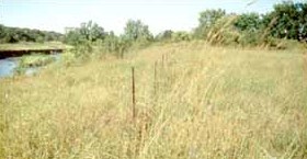
The Jeffers Petroglyphs site is an outcrop in southwestern Minnesota with pre-contact Native American petroglyphs. The petroglyphs are pecked into rock of the Red Rock Ridge, a 23-mile (37 km)-long Sioux quartzite outcrop that extends from Watonwan County, Minnesota to Brown County, Minnesota. The exposed surface is approximately 150 by 650 feet and surrounded by virgin prairie. "The site lies in an area inhabited in the early historic period by the Dakota Indians, and both the style and form of some of the carvings are identical with motifs that appear on Dakota hide paintings and their quill designs and beadwork. Others are foreign to this Plains Indian tradition and seem to be much earlier in origin." Several old wagon trail ruts traverse the site, one of which is believed to be the old stage coach route from New Ulm, Minnesota to Sioux Falls, South Dakota.
Indian Village State Preserve, or the Wittrock Indian Village State Preserve, is a state archaeological preserve near Sutherland, Iowa. The 6-acre (2.4 ha) property preserves the Indian Village Site (13OB4), a prehistoric fortified village of the Mill Creek culture. It was declared a National Historic Landmark in 1964, and made a state preserve in 1968. It is located east of Sutherland, south of 455th Street and west of Yellow Avenue. Access to the preserve requires crossing private land.

The Paisley Caves complex is a system of four caves in an arid, desolate region of south-central Oregon, United States north of the present-day city of Paisley, Oregon. The caves are located in the Summer Lake basin at 4,520 feet (1,380 m) elevation and face to the west in a ridge of Miocene and Pliocene era basalts mixed with soft volcanic tuffs and breccias, from which the caves were carved by Pleistocene-era waves from Summer Lake. One of the caves may contain archaeological evidence of the oldest definitively-dated human presence in North America. The site was first studied by Luther Cressman in the 1930s.

Burro Flats Painted Cave (BFPC) is located near Burro Flats, in the Simi Hills of eastern Ventura County, California, United States. The Chumash-style "main panel" and the surrounding 25-acres were listed on the National Register of Historic Places in 1976, with a boundary decrease in 2020. The main panel includes dozens of pictographs in a variety of colors. The cave is in the mountains, near the bi-lingual Chumash/Fernandeno village of Huwam/Jucjauynga. Burro Flats Painted Cave and the rest of the former Santa Susana Field Laboratory are not accessible to the public.
American Indian Rock Art in Minnesota MPS is a Multiple Property Submission (MPS) of the eligibility of many rock art properties for listing on the National Register of Historic Places. The listing is to protect and preserve Native American petroglyphs, pictographs and petroform rock art sites in the present day U.S. state of Minnesota.

The Greaser Petroglyph Site is located on land managed by the Bureau of Land Management in eastern Lake County, Oregon. The designs were scraped into a basalt boulder by Native Americans perhaps 12,000 years ago. No one knows the meaning of the designs. Because of its unique archaeological and cultural significance, the Greaser Petroglyph Site was listed on the National Register of Historic Places in 1974.

The Barnesville Petroglyph petroglyph site in the eastern part of the U.S. state of Ohio. Located approximately 3 miles (4.8 km) southwest of the village of Barnesville in Belmont County, the petroglyphs have been known both by archaeologists and the general public since the 1850s or earlier. Although the site was significantly damaged during the twentieth century, it is still a significant archaeological site, and has been named a historic site.

Indian God Rock is a large boulder in the northwestern part of the U.S. state of Pennsylvania. Located near the unincorporated community of Brandon, it lies along the Allegheny River in Venango County's Rockland Township. It is significant for the large petroglyph on one of its sides. Because of the petroglyph, the rock has been an explorers' landmark, a tourist attraction, and an object of scholarly investigation.

The Sommerheim Park Archaeological District includes a group of six archaeological sites west of Erie, Pennsylvania in the United States. The sites are in Sommerheim Park, one of the few undeveloped areas of the Lake Erie shoreline, in Millcreek Township. This district has been listed on the National Register of Historic Places. This is one of the leading archaeological sites in the Erie area and along the southern shoreline of Lake Erie, due to the amount of artifacts and the lack of disturbance on the site.

The Francis Farm Petroglyphs are a group of petroglyphs in the southwestern part of the U.S. state of Pennsylvania. Located on a boulder in Jefferson Township in the northwestern portion of Fayette County, it has been known to archaeologists since at least the middle of the nineteenth century. Despite damage in the 1930s, it remains an important archaeological site, and accordingly, it has been designated a historic site.

The Sugar Grove Petroglyphs are a group of petroglyphs in the southwestern part of the U.S. state of Pennsylvania. Located on an outcrop of sandstone in Monongahela Township near the eastern edge of Greene County, the petroglyphs have been known since at least the 1930s. Due to their value as an archaeological site, the petroglyphs have been named a historic site.

The LoDaisKa Site is a prominent archaeological site in the U.S. state of Colorado, located within a rockshelter near Morrison. The rockshelter was first inhabited by people of the Archaic through the Middle Ceramic period, generally spanning 3000 BC to 1000 AD.

Hamilton Farm Petroglyphs, also known as Pictured Rocks and Indian Picture Rocks, are a series of ancient petroglyphs located on U.S. Route 119 southeast of Ringgold, in Monongalia County of northern West Virginia. The rock art designs were carved by early Native Americans on sandstone.

The Rockhouse Cliffs Rockshelters are a pair of rockshelters in the far southern region of the U.S. state of Indiana. Located amid broken terrain in the Hoosier National Forest, the shelters may have been inhabited for more than ten thousand years by peoples ranging from the Early Archaic period until the twentieth century. As a result of their extensive occupation and their remote location, they are important and well-preserved archaeological sites and have been named a historic site.

Grimes Point, in Churchill County, Nevada near Fallon, is a 720-acre (290 ha) archeological site that was listed on the U.S. National Register of Historic Places in 1972. It was listed for its potential to yield future information.

The Picture Rock Pass Petroglyphs Site is in northern Lake County, Oregon, United States. The site is located near the summit of Picture Rock Pass on land administered by the Bureau of Land Management. The designs were scraped into a basalt boulder by ancient Native Americans, probably between 7,500 and 12,000 years ago. No one knows the meaning of the petroglyph designs. Because of its unique archaeological and cultural significance, the Picture Rock Pass Petroglyph Site was listed on the National Register of Historic Places in 1975.

The Hidden Valley Rockshelter (44-BA-31) is a significant archaeological site located near the community of Warm Springs in Bath County, Virginia, United States. A large rockshelter located near the Jackson River, it has been occupied by humans for thousands of years, and it has been named a historic site.
The eastern part of the United States state of Maine is known to have historically significant examples of prehistoric and historic rock art. The easternmost shore, particularly the shores and islands of Machias Bay, contain one of the greatest concentrations of rock art on the east coast of North America, with creation dates estimated to range from c. 1000 BCE to beyond the European contact period. Many of these sites are listed on the United States National Register of Historic Places.
Tainter Cave, also known as Tombstone Cave, is a dry sandstone cave in Crawford County, Wisconsin, in which prehistoric Native Americans carved petroglyphs and drew pictographs, including birds, men, deer, and abstract designs. With over 100 pictographs, the cave holds more than any other known site in Wisconsin. It is also notable as the first archaeological site recorded in the dark zone of a cave in the Upper Midwest.
References
- 1 2 "National Register Information System". National Register of Historic Places . National Park Service. July 9, 2010.
- ↑ Joan K. Pitts (October 1975). "National Register of Historic Places Inventory Nomination Form: Indian Cave Petroglyphs" (PDF). State of West Virginia, West Virginia Division of Culture and History, Historic Preservation. Retrieved 2011-08-05.