Ingoda

Last updated

Ingoda
village
India Maharashtra location map.svg
Red pog.svg
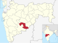
Ingoda
Location in Maharashtra, India
India location map.svg
Red pog.svg
Ingoda
Ingoda (India)
Coordinates: 18°25′15″N75°24′19″E / 18.42083°N 75.40528°E / 18.42083; 75.40528
CountryFlag of India.svg India
State Maharashtra
District Osmanabad
Tahsil Paranda
Population
 (2011)
  Total
1,725
Languages
  Official Marathi
Time zone UTC+5:30 (IST)
PIN
413505 [1]
Telephone code912477 [2]
Vehicle registration MH25
Lok Sabha constituency Osmanabad
Vidhan Sabha constituency Paranda [3]

Ingoda is a village with a Gram panchayat in the Paranda Tehsil of Osmanabad district, Maharashtra state in India. [4] [5]

Contents

Demographics

In the 2011 Indian census, Ingoda had population of 1725, with 906 (52.52%) males and 819 (47.47%) females, for a gender ratio of 904 females per thousand males. [6]

Transportation

Rail: The nearest railway station is Kurduvadi Junction on the Mumbai-Solapur route, 45 kilometers from Ingoda. Barshi, on the Kurduwadi-Latur route of the Central Railway, is another station near to Ingoda. The distance between Barshi and Ingoda is 47 kilometers.

Road: Ingoda, Paranda, Barshi, Kurduvadi, and Karmala are connected by state highways. The Maharashtra State Transport bus services are available to Ingoda from Barshi, Kurduwadi, Osmanabad, Bhoom, Karmala, Kharda, Pune and Pimpri-Chinchwad.

Air: Solapur, which is located 123 kilometers from Ingoda, is the nearest airport.

See also

References

  1. "Ingoda PinCode". pincodeofindia.in.
  2. "Paranda STD Code". pincodeofindia.in.
  3. "Assembly Constituencies-Post delimitation: Maharashtra: Osmanabad District" (PDF). National Informatics Centre, Government of India. Archived from the original (PDF) on 5 May 2013.
  4. "Village List". vlist.in.
  5. "Villages in Paranda Taluka". indiagrowing.com. Archived from the original on 9 December 2023. Retrieved 4 November 2015.
  6. "Ingoda village census 2011". census2011.co.in.