The 2000–2006 municipal reorganization in Quebec resulted in large-scale amalgamation of smaller municipalities in Quebec into larger cities. It was undertaken by one administration, and modified and partially undone by its successor.
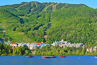
Mont-Tremblant is a city in the Laurentian Mountains of Quebec, Canada, approximately 130 kilometres (81 mi) northwest of Montreal and 140 kilometres (87 mi) northeast of Ottawa, Ontario. The current municipality with city status was formed in 2000. Mont-Tremblant is most famous for its ski resort, the Mont-Tremblant Ski Resort, which is seven kilometres from the village proper, at the foot of a mountain called Mont Tremblant.

Saint-Donat is a township municipality in the Canadian province of Quebec, part of the Regional County Municipality of Matawinie, within the larger administrative region of Lanaudière. The main town within the township is also identified as Saint-Donat-de-Montcalm to distinguish it from a parish municipality with the same name in La Mitis RCM. It is located approximately 135 kilometres (84 mi) northwest of Montreal. The town is surrounded by mountains and numerous water basins of the Laurentian Mountains. The nearest natural landmark is the Mont-Tremblant National Park.

Sainte-Agathe-des-Monts is a town in the province of Quebec, Canada, in the regional county municipality of Les Laurentides in the administrative region of Laurentides, also known as the "Laurentians" or the Laurentian Mountains. Sainte-Agathe-des-Monts borders on a lake called Lac des Sables, and is located approximately 100 kilometres (62 mi) northwest of Montreal.

Brébeuf is a parish municipality in the Laurentides region of Quebec, Canada, part of Les Laurentides Regional County Municipality. It is located along the Rouge River, near Mont-Tremblant.

Lac-Supérieur is a municipality in the Laurentides region of Quebec, Canada, part of the Les Laurentides Regional County Municipality. It is named after Lake Superior which is located in the Laurentian Mountains, due east of Mont Tremblant Resort. The community of Lac-Supérieur is just south of the lake, which itself is ringed with cottages. The entire northern portion of the municipality is mostly undeveloped and part of the Mont-Tremblant National Park.

Barkmere is a ville in the Canadian province of Quebec, located in Les Laurentides Regional County Municipality.

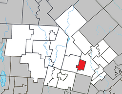
Amherst is a township municipality in the Canadian province of Quebec, located within Les Laurentides Regional County Municipality.

Saint-Placide is a municipality in the Laurentides region of Quebec, Canada, part of the Deux-Montagnes Regional County Municipality, along the north shore of the Ottawa River.

Saint-Joseph-du-Lac is a municipality in the Laurentides region of Quebec, Canada, part of the Deux-Montagnes Regional County Municipality.

Val-Morin is a municipality in the Laurentides region of Quebec, Canada, part of the Les Laurentides Regional County Municipality.

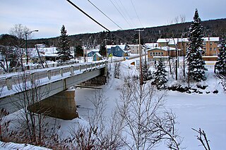
Huberdeau is a village and municipality in the Laurentides region of Quebec, Canada, part of the Les Laurentides Regional County Municipality. It is located along the western banks of the Rouge River.

Saint-Faustin–Lac-Carré is a municipality in the Laurentides region of Quebec, Canada, part of the Les Laurentides Regional County Municipality.

La Conception is a village and municipality in the Laurentides region of Quebec, Canada, part of the Les Laurentides Regional County Municipality.

Labelle is a village and municipality in the Laurentides region of Quebec, Canada, part of the Les Laurentides Regional County Municipality. Its large "L"-shaped territory surrounds Lake Labelle, and the village is located along the Rouge River and Route 117.

La Minerve is a village and municipality in the Laurentides region of Quebec, Canada, part of the Les Laurentides Regional County Municipality.

Val-des-Lacs is a municipality in the Laurentides region of Quebec, Canada, part of the Les Laurentides Regional County Municipality.

Lantier is a village and municipality in the Laurentides region of Quebec, Canada, part of the Les Laurentides Regional County Municipality.

Sainte-Lucie-des-Laurentides is a municipality in the Laurentides region of Quebec, Canada, part of the Les Laurentides Regional County Municipality.
L'Ascension is a municipality in the Laurentides region of Quebec, Canada, part of the Antoine-Labelle Regional County Municipality. The area is known as La Vallée de la Rouge.