Burlington is a census-designated place (CDP) in Mineral County, West Virginia, United States, located along U.S. Route 50 where it crosses Pattersons Creek. As of the 2020 census, its population was 131. It is part of the Cumberland, MD-WV Metropolitan Statistical Area. The ZIP code for Burlington is 26710.

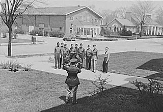
Arthurdale is an unincorporated community in Preston County, West Virginia, United States. It was built in 1933 at the height of the Great Depression as a social experiment to provide opportunities for unemployed local miners and farmers. Arthurdale was undertaken by the short-lived Subsistence Homesteads Division and with the personal involvement of First Lady Eleanor Roosevelt, who used her influence to win government approval for the scheme.

Fort Benjamin Harrison was a U.S. Army post located in suburban Lawrence Township, Marion County, Indiana, northeast of Indianapolis, between 1906 and 1991. It is named for the 23rd United States president, Benjamin Harrison.

Park Place is a neighborhood in the western half of Norfolk, Virginia. Its boundaries are roughly Granby Street on the east, Colley Avenue on the west, 23rd Street on the south and up to 38th Street to the north. Within these boundaries Park Place is made up of 4 historic subdivisions; Virginia Place, East Kensington, Park Place, and East Old Dominion Place.

Lake of the Ozarks State Park is a Missouri state park on the Grand Glaize Arm of the Lake of the Ozarks and is the largest state park in the state. This is also the most popular state park in Missouri, with over 2.5 million visitations in 2017.

Westmoreland State Park lies within Westmoreland County, Virginia. The park extends about one and a half miles along the Potomac River and covers 1,321 acres. The Horsehead Cliffs provide visitors with a panoramic view of the Potomac River, and lower levels feature fossils and beach access. The park offers hiking, camping, cabins, fishing, boating and swimming, although mechanical issues have kept the swimming pool closed since 2021. Located on the Northern Neck Peninsula, the park is close to historical sites featuring earlier eras: George Washington's birthplace and Stratford Hall, the birthplace of Robert E. Lee.

Advance Mills, also known as Fray's Mill, is an unincorporated community in Albemarle County, Virginia.

Camp Pendleton is a 325-acre (1.32 km2) state military reservation in Virginia Beach, Virginia, named after Confederate Brigadier General William N. Pendleton, who served as Robert E. Lee's chief of artillery during the American Civil War. It lies on the Atlantic coast slightly east of Naval Air Station Oceana. It is one of the U.S. Army installations named for Confederate soldiers to be renamed by the Commission on the Naming of Items of the Department of Defense that Commemorate the Confederate States of America or Any Person Who Served Voluntarily with the Confederate States of America. Since Camp Pendleton is owned by the State of Virginia and not the federal government, the facility was not covered by The Naming Commission's mandate. However Governor Ralph Northam "directed his administration to review and recommend a replacement name for Camp Pendleton" in January 2021.

The historical buildings and structures of Grand Teton National Park include a variety of buildings and built remains that pre-date the establishment of Grand Teton National Park, together with facilities built by the National Park Service to serve park visitors. Many of these places and structures have been placed on the National Register of Historic Places. The pre-Park Service structures include homestead cabins from the earliest settlement of Jackson Hole, working ranches that once covered the valley floor, and dude ranches or guest ranches that catered to the tourist trade that grew up in the 1920s and 1930s, before the park was expanded to encompass nearly all of Jackson Hole. Many of these were incorporated into the park to serve as Park Service personnel housing, or were razed to restore the landscape to a natural appearance. Others continued to function as inholdings under a life estate in which their former owners could continue to use and occupy the property until their death. Other buildings, built in the mountains after the initial establishment of the park in 1929, or in the valley after the park was expanded in 1950, were built by the Park Service to serve park visitors, frequently employing the National Park Service Rustic style of design.

Mill Creek Historic District is a national historic district located at Bunker Hill, Berkeley County, West Virginia. It encompasses nine contributing buildings, eight contributing sites, and three contributing objects that relate to an early industrial-commercial center in the county. They include: the Mill Creek Bridge, Henry Sherrard Mill, Robert Daniels House, John Gray House, Henshaw Log House, "Springhill", Henshaw Miller's House, "Springfield", Holliday Mill Sites, Bunker Hill Cumberland Valley Railroad Bridge, Stephenson's Tavern, Morgan Park including two State markers and monument (1924) to Morgan Morgan, Elisha Boyd Mill Sites, Joel Ward Mill ruins, Bunker Hill Mill Complex, and Joel Ward House.

Tuscarora Creek Historic District is a national historic district located near Martinsburg and Nollville, Berkeley County, West Virginia. It encompasses 31 contributing buildings and three contributing sites, related to the early settlement and economic development along the Tuscarora Creek. Notable buildings in the district include: Patterson's Mill (1765) and the miller's house, "Elm Dale," the Silber-Walters House, Huxley Hall, site of Patterson's New Mill and miller's house, Hibbard Mill, Tuscarora School, Providence Cemetery, the Mong House, Tuscarora Church (1802), James Noll Shop, Rumsey Mill site, and the poor house or "Mansion House" (1788).

Spring Mills Historic District is a national historic district located near Martinsburg, Berkeley County, West Virginia. It encompasses five contributing buildings, constructed between about 1790 and 1922, and two contributing sites. They include the Falling Waters Presbyterian Church (1834) and Manse (1922) and Stephen Hammond Mill, Miller's House, and Spring House. The buildings are of masonry construction. The sites are the Falling Waters Presbyterian Church Cemetery and the site of Dr. Allen Hammonds House.

Camp Caesar, also known as the Webster County 4-H Camp, is a historic campsite located at Cowen, Webster County, West Virginia. It has 20 contributing buildings, 5 contributing sites, 13 contributing structures, and 3 contributing objects. The camp was established in 1922 by local members of the Farm Bureau and the Webster County extension agent, Julius A. Wolfram. During the 1920s, an octagonal assembly hall now known as Gregory Hall, a council circle, a dining hall, and a home for the camp caretaker were constructed. After the onset of the Great Depression, the Works Progress Administration built several stone cottages, a pool and poolhouse, dining hall expansion, stone walks, retaining walls, and other features.

Camp Washington-Carver Complex, formerly known as West Virginia 4-H Camp for Negroes, is a historic camp and national historic district located near Clifftop, Fayette County, West Virginia. The district encompasses four contributing buildings and two contributing structures, the most notable being the Great Chestnut Lodge, a log building of unusual size and structural character. It is the largest log structure built entirely of chestnut in West Virginia. It was built in 1941–1942, and is a 1 1/2 story building in the form of a modified Latin cross with a gabled block and a gabled wing or ell. Also on the property are a log cottage (1940), two frame dormitories (1942), a water tower (1940), and a small pond (1940). The camp was established by an act of the West Virginia legislature in 1937, and developed as a project of the Works Progress Administration starting in 1939.
Nickell Homestead and Mill, also known as Mont Glenn Farm, is a historic home, grist mill, and national historic district located at Secondcreek, near Ronceverte, Monroe County, West Virginia. The district includes seven contributing buildings. The original section of the main house was built about 1820, with additions made in 1858, and about 1900. It is a 2+1⁄2-story, six bay brick and frame Federal style dwelling. The 1900 addition has some Colonial Revival style details. Also on the property is a two-story mill built in 1814, a barn, machine shed, hog shed, garage, and house by the mill. The Nickell mill closed in 1949. The property upon which the mill stood was sold in 2014 or 2015. The new owner tore down the mill. The only thing remaining is the stone foundation. The new owner is not maintaining the property and the house is also falling into disrepair. One wonders why this person bought an historic property only to destroy it.
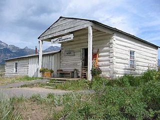
The Camp Bartow Historic District — centered on the historic inn called "Traveller's Repose" and the site of the Battle of Greenbrier River (1861) — is a national historic district located at Bartow, Pocahontas County, West Virginia, United States. It is situated at the foot of Burner Mountain, at a bend in the East Fork Greenbrier River, where U.S. Route 28 intersects U.S. Route 250.

Tygart Valley Homesteads Historic District is a national historic district located near Dailey, Randolph County, West Virginia. It encompasses 337 contributing buildings, three contributing sites, and three contributing structures, associated with a resettlement community established during the Great Depression by the Roosevelt administration. It was the largest of the three resettlement communities in West Virginia, the others being Arthurdale and Eleanor. The first dwellings were constructed in 1934, and the Civilian Conservation Corps built the public water system, draining systems, and culverts. The houses have modest Colonial Revival architecture details and have either a side gable or gambrel roof, referred to as either an "A-Frame" or "Barn House." Other notable buildings include the Dailey Community Center (1937), gas station (1940), The Homestead School (1939), The East Dailey Bridge (1938), Community Farm, The Warehouse, The Woodworking Shop, and The Weaving Shop.

Franklin Historic District is a national historic district located at Franklin, Virginia. The district includes 226 contributing buildings and 1 contributing site in the city of Franklin. It includes residential and commercial buildings that were primarily built during the late 19th- and early 20th-century. Notable resources include the Poplar Springs Cemetery, Camp Family Homestead, the former W.T. Pace Hardware Store, former U.S. Post Office (1916), Franklin Professional Building (1920s), Lyons State Theatre (1930s), Pretlow Peanut Company Warehouses, High Street Methodist Church (1890s), Emmanuel Episcopal / Grace Lutheran Church, and Franklin Elementary School (1922). Located in the district is the separately listed The Elms.
The Civil War Trust's Civil War Discovery Trail is a heritage tourism program that links more than 600 U.S. Civil War sites in more than 30 states. The program is one of the White House Millennium Council's sixteen flagship National Millennium Trails. Sites on the trail include battlefields, museums, historic sites, forts and cemeteries.


