Jalapa, Indiana

Last updated

Jalapa, Indiana
Frances Slocum Trail at Jalapa.jpg
Houses on the Frances Slocum Trail at Jalapa
Grant County Indiana Incorporated and Unincorporated areas Jalapa Highlighted 1837674.svg
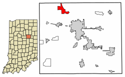
Location of Jalapa in Grant County, Indiana.
USA Indiana location map.svg
Red pog.svg
Jalapa
Usa edcp location map.svg
Red pog.svg
Jalapa
Coordinates: 40°37′40″N85°44′44″W / 40.62778°N 85.74556°W / 40.62778; -85.74556
Country United States
State Indiana
County Grant
Township Pleasant
Area
[1]
  Total0.57 sq mi (1.48 km2)
  Land0.57 sq mi (1.48 km2)
  Water0.00 sq mi (0.00 km2)
Elevation
[2]
820 ft (250 m)
Population
 (2020)
  Total182
  Density318.18/sq mi (122.79/km2)
ZIP code
46952
FIPS code 18-37674 [3]
GNIS feature ID2583457 [2]

Jalapa is an unincorporated community and census-designated place (CDP) in Pleasant Township, Grant County, Indiana, United States. As of the 2010 census it had a population of 171. [4] The site of the Battle of the Mississinewa, fought during the War of 1812, is nearby. [5]

Contents

History

The first post office in Jalapa, called "Dallas", operated from 1848 until 1849. [6] The post office was renamed "Jalapa" in 1849, and remained in operation until it was discontinued in 1900. [7] The community was named after Jalapa, in Mexico. [6]

Geography

Jalapa is located in northwestern Grant County on high ground just southwest of the Mississinewa River, a northwest-flowing tributary of the Wabash River. Jalapa is 7 miles (11 km) northwest of Marion, the Grant County seat.

According to the U.S. Census Bureau, the Jalapa CDP has an area of 3.2 square miles (8.2 km2), all of it land. [4]

Demographics

Historical population
CensusPop.Note
2020 182
U.S. Decennial Census [8]

Related Research Articles

<span class="mw-page-title-main">Grant County, Indiana</span> County in Indiana, United States

Grant County is a county in central Indiana in the United States Midwest. At the time of the 2020 census, the population was 66,674. The county seat is Marion. Important paleontological discoveries, dating from the Pliocene epoch, have been made at the Pipe Creek Sinkhole in Grant County.

<span class="mw-page-title-main">Mexico, Indiana</span> Census-designated place in Indiana, United States

Mexico is an unincorporated community and census-designated place (CDP) in Jefferson Township, Miami County, in the U.S. state of Indiana. The population was 915 at the 2020 census.

<span class="mw-page-title-main">Rapid City, Michigan</span> Census-designated place & unincorporated community in Michigan, United States

Rapid City is an unincorporated community and census-designated place (CDP) in Kalkaska County in the U.S. state of Michigan. At the 2020 census, the CDP had a population of 1,357. Rapid City is located within Clearwater Township, and is about 8 miles (13 km) northwest of Kalkaska.

<span class="mw-page-title-main">Raglesville, Indiana</span> Census-designated place in Indiana, United States

Raglesville is an unincorporated community and census-designated place (CDP) in Van Buren Township, Daviess County, Indiana, United States. As of the 2010 census it had a population of 141.

<span class="mw-page-title-main">Point Isabel, Indiana</span> Census-designated place in Indiana, United States

Point Isabel is an unincorporated community and census-designated place (CDP) in central Green Township, Grant County, Indiana, United States. It lies at the intersection of State Roads 13 and 26. As of the 2010 census it had a population of 91.

<span class="mw-page-title-main">New Trenton, Indiana</span> Census-designated place in Indiana, United States

New Trenton is an unincorporated community and census-designated place (CDP) in Whitewater Township, Franklin County, Indiana. As of the 2010 census it had a population of 252. It has a ZIP code 47035.

<span class="mw-page-title-main">Herbst, Indiana</span> Census-designated place in Indiana, United States

Herbst is an unincorporated census-designated place in Franklin Township, Grant County, Indiana, in the United States. As of the 2010 census, the population was 112.

<span class="mw-page-title-main">Sims, Indiana</span> Census-designated place in Indiana, United States

Sims is an unincorporated community and census-designated place (CDP) in Sims Township, Grant County, Indiana. In 2010 it had a population of 156.

<span class="mw-page-title-main">Vallonia, Indiana</span> Census-designated place in Indiana, United States

Vallonia is an unincorporated community and census-designated place (CDP) in Driftwood and Brownstown townships, Jackson County, Indiana, United States. It was an 18th-century French settlement and 19th-century American frontier fortification known as Fort Vallonia. As of the 2010 census, Vallonia had a population of 336.

Kent is an unincorporated community and census-designated place (CDP) in Republican Township, Jefferson County, Indiana, United States. As of the 2010 census it had a population of 70.

<span class="mw-page-title-main">Avoca, Indiana</span> Census-designated place in Indiana, United States

Avoca is an unincorporated community and census-designated place in Marshall Township, Lawrence County, Indiana, United States. As of the 2010 census the population was 583.

<span class="mw-page-title-main">Burns City, Indiana</span> Census-designated place in Indiana, United States

Burns City is an unincorporated community and census-designated place (CDP) in Perry Township, Martin County, in the U.S. state of Indiana. The population was 114 at the 2020 census.

North Grove is an unincorporated community and census-designated place (CDP) in Harrison Township, Miami County, in the U.S. state of Indiana.

Mace is an unincorporated community and census-designated place (CDP) in Walnut Township, Montgomery County, in the U.S. state of Indiana.

<span class="mw-page-title-main">Eminence, Indiana</span> Census-designated place in Indiana, United States

Eminence is an unincorporated community and census-designated place (CDP) in Adams Township, Morgan County, in the U.S. state of Indiana.

<span class="mw-page-title-main">Bennetts Switch, Indiana</span> Census-designated place in Indiana, United States

Bennetts Switch is an unincorporated community and census-designated place (CDP) in Deer Creek Township, Miami County, in the U.S. state of Indiana.

<span class="mw-page-title-main">Landess, Indiana</span> Census-designated place in Indiana, United States

Landess is an unincorporated community and census-designated place (CDP) in Washington and Van Buren townships, Grant County, Indiana, in the United States. As of the 2010 census it had a population of 188.

<span class="mw-page-title-main">Mier, Indiana</span> Census-designated place in Indiana, United States

Mier is an unincorporated community and census-designated place (CDP) in Richland Township, Grant County, Indiana, in the United States. As of the 2010 census it had a population of 78.

<span class="mw-page-title-main">Painted Hills, Indiana</span> Census-designated place in Indiana, United States

Painted Hills is an unincorporated community and census-designated place (CDP) in Jackson Township, Morgan County, in the U.S. state of Indiana. Its population was 766 as of the 2020 census, up from 677 in 2010. The community is located on the shores of Lake Holiday and Lake Nebo southeast of Martinsville, the Morgan county seat. The two lakes are a combined 196 acres (79 ha) in size.

Linwood is a hamlet and census-designated place (CDP) in the town of York, Livingston County, New York, United States. Its population was 74 as of the 2010 census. Linwood had a post office until February 6, 1993; it still has its own ZIP code, 14486.

References

  1. "2020 U.S. Gazetteer Files". United States Census Bureau. Retrieved March 16, 2022.
  2. 1 2 U.S. Geological Survey Geographic Names Information System: Jalapa, Indiana
  3. "U.S. Census website". United States Census Bureau . Retrieved January 31, 2008.
  4. 1 2 "Geographic Identifiers: 2010 Demographic Profile Data (G001): Jalapa CDP, Indiana". American Factfinder. U.S. Census Bureau. Retrieved December 5, 2016.[ dead link ]
  5. Edward E. Moore (1910). A Century of Indiana. American Book Company. p.  108.
  6. 1 2 Baker, Ronald L. (October 1995). From Needmore to Prosperity: Hoosier Place Names in Folklore and History . Indiana University Press. p.  178. ISBN   978-0-253-32866-3. A post office established as Dallas...
  7. "Grant County". Jim Forte Postal History. Retrieved September 12, 2014.
  8. "Census of Population and Housing". Census.gov. Retrieved June 4, 2016.