
Indiana County is a county in the Commonwealth of Pennsylvania. It is located in the west central part of Pennsylvania. As of the 2020 census, the population was 83,246. Its county seat is Indiana. Indiana County comprises the Indiana, PA Micropolitan Statistical Area, which is also included in the Pittsburgh-New Castle-Weirton, PA-WV-OH Combined Statistical Area.
Douglas County is one of the 36 counties in the U.S. state of Oregon. As of the 2020 census, the population was 111,201. The county seat is Roseburg. The county is named after Stephen A. Douglas, an American politician who supported Oregon statehood. Douglas County comprises the Roseburg, OR Micropolitan Statistical Area. In regards to area, Douglas County is the largest county west of the Oregon Cascades.
Whitley County is a rural county in the U.S. state of Indiana. As of the 2020 United States census, the population was 34,191. Whitley County is the 49th largest county in Indiana. The county seat is Columbia City. The county has the highest county number (92) on Indiana license plates, as it is alphabetically the last in the state's list of counties. It is part of the Fort Wayne Metropolitan Statistical Area and the Fort Wayne–Huntington–Auburn Combined Statistical Area.

Union County is a county in the U.S. state of Indiana. As of the 2020 United States census, the population was 7,087. The county seat is Liberty.

Rush County is a county in the U.S. state of Indiana. In the 2020 United States Census, the population was 16,752. The county seat is Rushville.

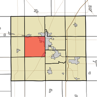
Newton County is a county located near the northwestern corner of the U.S. state of Indiana. As of 2020, the population was 13,830. This county is part of Northwest Indiana as well as the Chicago metropolitan area. The county seat is Kentland. The county is divided into 10 townships which provide local services.

Madison County is a county in the U.S. state of Indiana. The 2020 census states the population is standing at 130,129. The county seat since 1836 has been Anderson, one of three incorporated cities within the county.

Greene County is a county in the U.S. state of Indiana. As of 2020, the population was 30,803. The county seat is Bloomfield. The county was determined by the US Census Bureau to include the mean center of U.S. population in 1930.
Grant County is a county in central Indiana in the United States Midwest. At the time of the 2020 census, the population was 66,674. The county seat is Marion. Important paleontological discoveries, dating from the Pliocene epoch, have been made at the Pipe Creek Sinkhole in Grant County.

Roseburg is a city in the U.S. state of Oregon. It is in the Umpqua River Valley in southern Oregon and is the county seat and most populous city of Douglas County. Founded in 1851, the population was 23,683 at the 2020 census, making it the principal city of the Roseburg, Oregon Micropolitan Statistical Area. The community developed along both sides of the South Umpqua River and is traversed by Interstate 5. Traditionally a lumber industry town, Roseburg was the original home of Roseburg Forest Products, which is now based in nearby Springfield.

Roseburg North is a census-designated place (CDP) in Douglas County, Oregon, United States. The population was 5,912 at the 2010 census. Winchester, Oregon is included as part of Roseburg North.
Roseburg is the name of two places in the State of Indiana in the United States of America:

Joseph Lane was an American politician and soldier. He was a state legislator representing Evansville, Indiana, and then served in the Mexican–American War, becoming a general. President James K. Polk appointed Lane as the first Governor of Oregon Territory. When Oregon was admitted as a state in 1859, Lane was elected one of Oregon's first two U.S. Senators.

Indiana's 5th congressional district is a congressional district in the U.S. state of Indiana comprising Hamilton, Madison, Delaware, Grant, and Tipton counties, as well as the large majority of Howard County. Much of its population is located in the northern suburbs of Indianapolis, including the cities of Carmel, Noblesville, and Fishers, while other population centers include Muncie, Kokomo, Anderson, and Marion. The district is predominantly white and is the wealthiest congressional district in Indiana, as measured by median income.
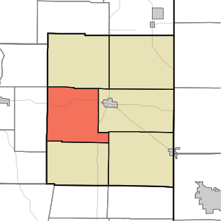
Liberty Township is one of six townships in Union County, Indiana, United States. As of the 2010 census, its population was 1,042 and it contained 447 housing units.
Franklin Township is one of thirteen townships in Grant County, Indiana, United States. As of the 2010 census, its population was 7,211 and it contained 3,553 housing units.

Lookingglass is an unincorporated community and census-designated place in the Lookingglass Valley of Douglas County, Oregon, United States, about 9 miles (14 km) southwest of Roseburg. As of the 2010 census it had a population of 855. Lookingglass is considered a suburb of Roseburg.
Roseburg is an unincorporated community in Liberty Township, Union County, in the U.S. state of Indiana.


