Sims, Indiana

Last updated

Sims, Indiana
Grant County Indiana Incorporated and Unincorporated areas Sims Highlighted 1869894.svg
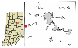
Location of Sims in Grant County, Indiana.
USA Indiana location map.svg
Red pog.svg
Sims
Usa edcp location map.svg
Red pog.svg
Sims
Coordinates: 40°29′58″N85°51′24″W / 40.49944°N 85.85667°W / 40.49944; -85.85667
Country United States
State Indiana
County Grant
Township Sims
Area
[1]
  Total1.00 sq mi (2.58 km2)
  Land1.00 sq mi (2.58 km2)
  Water0.00 sq mi (0.00 km2)
Elevation
[2]
860 ft (260 m)
Population
 (2020)
  Total164
  Density164.33/sq mi (63.46/km2)
ZIP code
46986
FIPS code 18-69894 [3]
GNIS feature ID2583470 [2]

Sims is an unincorporated community and census-designated place (CDP) in Sims Township, Grant County, Indiana. In 2010 it had a population of 156. [4]

Contents

History

The community took its name from Sims Township. [5] A post office was established at Sims in 1881, and remained in operation until it was discontinued in 1992. [6]

Geography

Sims is located near the western border of Grant County. It is 2 miles (3 km) west of Swayzee and 13 miles (21 km) southwest of Marion, the county seat. A rail line operated by the Central Railroad Company of Indianapolis passes along the north side of town.

According to the U.S. Census Bureau, the Sims CDP has a total area of 1.0 square mile (2.6 km2), all of it land. [4]

Demographics

Historical population
CensusPop.Note
2020 164
U.S. Decennial Census [7]

Related Research Articles

<span class="mw-page-title-main">Carp Lake, Michigan</span> Census-designated place & unincorporated community in Michigan, United States

Carp Lake is an unincorporated community and census-designated place (CDP) in Emmet County in the U.S. state of Michigan. As of the 2010 census, the CDP had a population of 357. It is located within Carp Lake Township.

<span class="mw-page-title-main">Coalmont, Indiana</span> Census-designated place in Indiana, United States

Coalmont is an unincorporated community and census-designated place in Lewis Township, Clay County, Indiana, United States. It is part of the Terre Haute Metropolitan Statistical Area. As of the 2010 census it had a population of 402.

<span class="mw-page-title-main">Raglesville, Indiana</span> Census-designated place in Indiana, United States

Raglesville is an unincorporated community and census-designated place (CDP) in Van Buren Township, Daviess County, Indiana, United States. As of the 2010 census it had a population of 141.

<span class="mw-page-title-main">Dubois, Indiana</span> Census-designated place in Indiana, United States

Dubois is an unincorporated community and census-designated place (CDP) in Dubois County, Indiana, United States. Its population at the 2010 census was 488.

<span class="mw-page-title-main">Point Isabel, Indiana</span> Census-designated place in Indiana, United States

Point Isabel is an unincorporated community and census-designated place (CDP) in central Green Township, Grant County, Indiana, United States. It lies at the intersection of State Roads 13 and 26. As of the 2010 census it had a population of 91.

<span class="mw-page-title-main">New Trenton, Indiana</span> Census-designated place in Indiana, United States

New Trenton is an unincorporated community and census-designated place (CDP) in Whitewater Township, Franklin County, Indiana. As of the 2010 census it had a population of 252. It has a ZIP code 47035.

<span class="mw-page-title-main">Herbst, Indiana</span> Census-designated place in Indiana, United States

Herbst is an unincorporated census-designated place in Franklin Township, Grant County, Indiana, in the United States. As of the 2010 census, the population was 112.

<span class="mw-page-title-main">Jalapa, Indiana</span> Census-designated place in Indiana, United States

Jalapa is an unincorporated community and census-designated place (CDP) in Pleasant Township, Grant County, Indiana, United States. As of the 2010 census it had a population of 171. The site of the Battle of the Mississinewa, fought during the War of 1812, is nearby.

<span class="mw-page-title-main">Owensburg, Indiana</span> Census-designated place in Indiana, United States

Owensburg is an unincorporated community and census-designated place (CDP) in Jackson Township, Greene County, Indiana, United States. It was named in honor of the Owens family of early settlers. As of the 2010 census it had a population of 406.

<span class="mw-page-title-main">Scotland, Indiana</span> Census-designated place in Indiana, United States

Scotland is an unincorporated community and census-designated place (CDP) in Taylor Township, Greene County, Indiana, United States. As of the 2010 census it had a population of 134.

<span class="mw-page-title-main">Freetown, Indiana</span> Census-designated place in Indiana, United States

Freetown is an unincorporated community and census-designated place in Pershing Township, Jackson County, Indiana, United States. As of the 2010 census the population was 385.

Kent is an unincorporated community and census-designated place (CDP) in Republican Township, Jefferson County, Indiana, United States. As of the 2010 census it had a population of 70.

<span class="mw-page-title-main">Scipio, Indiana</span> Census-designated place in Indiana, United States

Scipio is an unincorporated community and census-designated place (CDP) in Geneva Township, Jennings County, Indiana, United States. As of the 2010 census it had a population of 153.

<span class="mw-page-title-main">Emison, Indiana</span> Census-designated place in Indiana, United States

Emison is an unincorporated community and census-designated place (CDP) in Busseron Township, Knox County, Indiana. Its population was 154 at the 2010 census.

<span class="mw-page-title-main">Hanna, Indiana</span> Census-designated place in Indiana, United States

Hanna is an unincorporated community and census-designated place in Hanna Township, LaPorte County, Indiana, United States. It had a population of 463 at the 2010 census.

<span class="mw-page-title-main">Hudson Lake, Indiana</span> Census-designated place in Indiana, United States

Hudson Lake is an unincorporated community and census-designated place (CDP) in Hudson Township, LaPorte County, Indiana, United States. The town sits on the dividing line between Central and Eastern time zones. It is the site of the Hudson Lake station stop of the South Shore Line. As of the 2010 census, the population of the CDP was 1,297.

<span class="mw-page-title-main">Rolling Prairie, Indiana</span> Census-designated place in Indiana, United States

Rolling Prairie is an unincorporated community and census-designated place (CDP) in Kankakee Township, LaPorte County, Indiana, United States. As of the 2010 census, it had a population of 582.

<span class="mw-page-title-main">Avoca, Indiana</span> Census-designated place in Indiana, United States

Avoca is an unincorporated community and census-designated place in Marshall Township, Lawrence County, Indiana, United States. As of the 2010 census the population was 583.

<span class="mw-page-title-main">Landess, Indiana</span> Census-designated place in Indiana, United States

Landess is an unincorporated community and census-designated place (CDP) in Washington and Van Buren townships, Grant County, Indiana, in the United States. As of the 2010 census it had a population of 188.

<span class="mw-page-title-main">Mier, Indiana</span> Census-designated place in Indiana, United States

Mier is an unincorporated community and census-designated place (CDP) in Richland Township, Grant County, Indiana, in the United States. As of the 2010 census it had a population of 78.

References

  1. "2020 U.S. Gazetteer Files". United States Census Bureau. Retrieved March 16, 2022.
  2. 1 2 U.S. Geological Survey Geographic Names Information System: Sims, Indiana
  3. "U.S. Census website". United States Census Bureau . Retrieved January 31, 2008.
  4. 1 2 "Geographic Identifiers: 2010 Demographic Profile Data (G001): Sims CDP, Indiana". American Factfinder. U.S. Census Bureau. Retrieved December 5, 2016.[ dead link ]
  5. Baker, Ronald L. (October 1995). From Needmore to Prosperity: Hoosier Place Names in Folklore and History. Indiana University Press. p. 302. ISBN   978-0-253-32866-3. ...named for Sims Township, in which it is located...
  6. "Grant County". Jim Forte Postal History. Retrieved September 12, 2014.
  7. "Census of Population and Housing". Census.gov. Retrieved June 4, 2016.