Jefferson, Kansas | |
|---|---|
 | |
 Jefferson  Jefferson | |
| Coordinates: 37°06′44″N95°45′41″W / 37.11222°N 95.76139°W [1] | |
| Country | United States |
| State | Kansas |
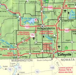
| County | Montgomery |
| Founded | 1886 |
| Platted | 1886 |
| Named after | Albert Jefferson Broadbent |
| Elevation | 807 ft (246 m) |
| Time zone | UTC-6 (CST) |
| • Summer (DST) | UTC-5 (CDT) |
| Area code | 620 |
| FIPS code | 20-35275 |
| GNIS ID | 469241 [1] |
Jefferson is an unincorporated community in Montgomery County, Kansas, United States. [1]
