Jeziórko, Pomeranian Voivodeship

Last updated
Jeziórko
Settlement
Country Flag of Poland.svg Poland
Voivodeship Pomeranian
County Chojnice
Gmina Czersk
Population 4

Jeziórko [jɛˈʑurkɔ] (German : Jeserich) is a settlement in the administrative district of Gmina Czersk, within Chojnice County, Pomeranian Voivodeship, in northern Poland. [1]

German language West Germanic language

German is a West Germanic language that is mainly spoken in Central Europe. It is the most widely spoken and official or co-official language in Germany, Austria, Switzerland, South Tyrol (Italy), the German-speaking Community of Belgium, and Liechtenstein. It is also one of the three official languages of Luxembourg and a co-official language in the Opole Voivodeship in Poland. The languages which are most similar to German are the other members of the West Germanic language branch: Afrikaans, Dutch, English, the Frisian languages, Low German/Low Saxon, Luxembourgish, and Yiddish. There are also strong similarities in vocabulary with Danish, Norwegian and Swedish, although those belong to the North Germanic group. German is the second most widely spoken Germanic language, after English.

Human settlement Community of any size, in which people live

In geography, statistics and archaeology, a settlement, locality or populated place is a community in which people live. The complexity of a settlement can range from a small number of dwellings grouped together to the largest of cities with surrounding urbanized areas. Settlements may include hamlets, villages, towns and cities. A settlement may have known historical properties such as the date or era in which it was first settled, or first settled by particular people.

Gmina Czersk is an urban-rural gmina in Chojnice County, Pomeranian Voivodeship, in northern Poland. Its seat is the town of Czersk, which lies approximately 30 kilometres (19 mi) east of Chojnice and 77 km (48 mi) south-west of the regional capital Gdańsk.

For details of the history of the region, see History of Pomerania .

History of Pomerania aspect of history

The history of Pomerania starts shortly before 1000 AD with ongoing conquests by newly arrived Polans rulers. Before that the area was recorded nearly 2000 years ago as Germania, and in modern-day times Pomerania is split between Germany and Poland. The name Pomerania comes from the Slavic po more, which means Land at the Sea.

The settlement has a population of 4.

Related Research Articles

Banjole Village in Istria County, Croatia

Banjole is a village in the municipality of Medulin, in southern Istria in Croatia. In 2011 it had a population of 983.

Saxton, North Yorkshire village in North Yorkshire

Saxton is a small, affluent village in North Yorkshire, England, about 15 miles southwest from York and about 12 miles east from Leeds. The resident population is about 250. It is close to the battlefield of Towton. The closest town is Tadcaster.

Agawam River river in the United States of America

The Agawam River is a 10.7-mile-long (17.2 km) stream in southeastern Massachusetts, USA, that is part of the Wareham River estuary watershed. The Agawam River is named in honor of the peaceful Native Americans that helped the Massachusetts Bay Colony establish its first Connecticut River Valley settlement at Springfield, Massachusetts in 1636, and helped it to flourish while many of the Connecticut Colony settlements south of Springfield were attacked or destroyed by more war-like Native American tribes.

Valverde de Llerena Place in Extremadura, Spain

Valverde de Llerena is a municipality in the province of Badajoz, Extremadura, Spain. It has a population of 763 and an area of 41 km².

Dwór is a settlement in the administrative district of Gmina Bielsk Podlaski, within Bielsk County, Podlaskie Voivodeship, in north-eastern Poland. The etymology of its name means manor house.

Cisów, Świętokrzyskie Voivodeship Village in Świętokrzyskie, Poland

Cisów is a village in the administrative district of Gmina Daleszyce, within Kielce County, Świętokrzyskie Voivodeship, in south-central Poland. It lies approximately 9 kilometres (6 mi) south-east of Daleszyce and 25 km (16 mi) south-east of the regional capital Kielce.

Wincentów, Włoszczowa County Settlement in Świętokrzyskie, Poland

Wincentów is a settlement in the administrative district of Gmina Secemin, within Włoszczowa County, Świętokrzyskie Voivodeship, in south-central Poland. It lies approximately 7 kilometres (4 mi) north of Secemin, 10 km (6 mi) west of Włoszczowa, and 55 km (34 mi) west of the regional capital Kielce.

Folusz is a settlement in the administrative district of Gmina Trzemeszno, within Gniezno County, Greater Poland Voivodeship, in west-central Poland.

Głąby Settlement in Silesian, Poland

Głąby is a settlement in the administrative district of Gmina Herby, within Lubliniec County, Silesian Voivodeship, in southern Poland. It lies approximately 5 kilometres (3 mi) west of Herby, 13 km (8 mi) north-east of Lubliniec, and 58 km (36 mi) north of the regional capital Katowice.

Jastrzębie, Pomeranian Voivodeship Village in Pomeranian, Poland

Jastrzębie is a village in the administrative district of Gmina Osieczna, within Starogard County, Pomeranian Voivodeship, in northern Poland. It lies approximately 8 kilometres (5 mi) north-west of Osieczna, 31 km (19 mi) south-west of Starogard Gdański, and 69 km (43 mi) south-west of the regional capital Gdańsk.

Sasino Village in Pomeranian, Poland

Sasino is a village in the administrative district of Gmina Choczewo, within Wejherowo County, Pomeranian Voivodeship, in northern Poland. Its population is 474.

Janiki Wielkie is a village in the administrative district of Gmina Zalewo, within Iława County, Warmian-Masurian Voivodeship, in northern Poland.

Ininka Settlement in West Pomeranian, Poland

Ininka is a settlement in the administrative district of Gmina Goleniów, within Goleniów County, West Pomeranian Voivodeship, in north-western Poland. It lies approximately 4 kilometres (2 mi) west of Goleniów and 20 km (12 mi) north-east of the regional capital Szczecin.

Brzozowo, Gmina Przybiernów Village in West Pomeranian, Poland

Brzozowo is a village in the administrative district of Gmina Przybiernów, within Goleniów County, West Pomeranian Voivodeship, in north-western Poland. It lies approximately 5 kilometres (3 mi) north of Przybiernów, 28 km (17 mi) north of Goleniów, and 44 km (27 mi) north of the regional capital Szczecin.

Łąkie is a settlement in the administrative district of Gmina Polanów, within Koszalin County, West Pomeranian Voivodeship, in northwestern Poland.

Bezmoście Settlement in West Pomeranian, Poland

Bezmoście is a settlement in the administrative district of Gmina Resko, within Łobez County, West Pomeranian Voivodeship, in north-western Poland. It lies approximately 7 kilometres (4 mi) south-east of Resko, 17 km (11 mi) north-west of Łobez, and 71 km (44 mi) north-east of the regional capital Szczecin.

Bugar is a village in the municipality of Bihać, Bosnia and Herzegovina.

Rašljani Village in Brčko, Bosnia and Herzegovina

Rašljani is a village in the municipality of Brčko, Bosnia and Herzegovina.

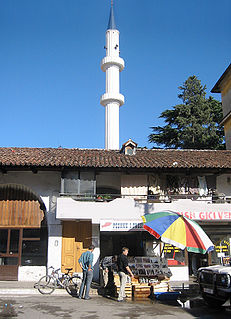
Kokonozi Mosque

The Mosque of Mahmud Agha Kokonozi or New Bazaar Mosque is an Ottoman-era mosque built in 1750 and one of the few mosques that survived the communist dictatorship under the Hoxhaist regime.

References


Coordinates: 53°45′33″N17°49′30″E / 53.75917°N 17.82500°E / 53.75917; 17.82500

Geographic coordinate system Coordinate system

A geographic coordinate system is a coordinate system that enables every location on Earth to be specified by a set of numbers, letters or symbols. The coordinates are often chosen such that one of the numbers represents a vertical position and two or three of the numbers represent a horizontal position; alternatively, a geographic position may be expressed in a combined three-dimensional Cartesian vector. A common choice of coordinates is latitude, longitude and elevation. To specify a location on a plane requires a map projection.