Uboga

Last updated
Uboga
Settlement
Country Flag of Poland.svg Poland
Voivodeship Pomeranian
County Chojnice
Gmina Czersk
Population 6

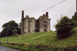
Uboga [uˈbɔɡa] (German : Wörth) is a settlement in the administrative district of Gmina Czersk, within Chojnice County, Pomeranian Voivodeship, in northern Poland. [1]

German language West Germanic language

German is a West Germanic language that is mainly spoken in Central Europe. It is the most widely spoken and official or co-official language in Germany, Austria, Switzerland, South Tyrol (Italy), the German-speaking Community of Belgium, and Liechtenstein. It is also one of the three official languages of Luxembourg and a co-official language in the Opole Voivodeship in Poland. The languages which are most similar to German are the other members of the West Germanic language branch: Afrikaans, Dutch, English, the Frisian languages, Low German/Low Saxon, Luxembourgish, and Yiddish. There are also strong similarities in vocabulary with Danish, Norwegian and Swedish, although those belong to the North Germanic group. German is the second most widely spoken Germanic language, after English.

Human settlement Community of any size, in which people live

In geography, statistics and archaeology, a settlement, locality or populated place is a community in which people live. The complexity of a settlement can range from a small number of dwellings grouped together to the largest of cities with surrounding urbanized areas. Settlements may include hamlets, villages, towns and cities. A settlement may have known historical properties such as the date or era in which it was first settled, or first settled by particular people.

Gmina Czersk is an urban-rural gmina in Chojnice County, Pomeranian Voivodeship, in northern Poland. Its seat is the town of Czersk, which lies approximately 30 kilometres (19 mi) east of Chojnice and 77 km (48 mi) south-west of the regional capital Gdańsk.

For details of the history of the region, see History of Pomerania .

History of Pomerania aspect of history

The history of Pomerania starts shortly before 1000 AD with ongoing conquests by newly arrived Polans rulers. Before that the area was recorded nearly 2000 years ago as Germania, and in modern-day times Pomerania is split between Germany and Poland. The name Pomerania comes from the Slavic po more, which means Land at the Sea.

The settlement has a population of 6.

Related Research Articles

Star, Alberta

Star is a hamlet in central Alberta, Canada within Lamont County. It is located on Highway 831, approximately 5 kilometres (3.1 mi) north of Lamont and 8 kilometres (5.0 mi) south of Highway 45.

Glinsk, County Galway

Glinsk is a small village in County Galway, Ireland, between Creggs and Ballymoe. Glinsk is located approximately 68 km from Galway city and approximately 30 km from Roscommon. It is located in valley of the River Suck, which has a 60-mile hiking trail. Nearby is the Glinsk Castle ruin, built by Ulick Burke in the early 17th century. Also in the area is the ruins of Ballynakill Abbey, which dates from the early 13th century. See Burke Baronets.

Grochowiska Szlacheckie Village in Kuyavian-Pomeranian, Poland

Grochowiska Szlacheckie is a village in the administrative district of Gmina Rogowo, within Żnin County, Kuyavian-Pomeranian Voivodeship, in north-central Poland.

Stelmachowo-Kolonia is a village in the administrative district of Gmina Tykocin, within Białystok County, Podlaskie Voivodeship, in north-eastern Poland.

Brzezinka is a village in the administrative district of Gmina Krotoszyn, within Krotoszyn County, Greater Poland Voivodeship, in west-central Poland.

Czartołomie Village in Pomeranian, Poland

Czartołomie is a village in the administrative district of Gmina Chojnice, within Chojnice County, Pomeranian Voivodeship, in northern Poland. It lies approximately 5 kilometres (3 mi) north of Chojnice and 99 km (62 mi) south-west of the regional capital Gdańsk.

Cewice Village in Pomeranian, Poland

Cewice is a village in Lębork County, Pomeranian Voivodeship, in northern Poland. It is the seat of the gmina called Gmina Cewice. It lies approximately 13 kilometres (8 mi) south of Lębork and 59 km (37 mi) west of the regional capital Gdańsk.

Parcele, Pomeranian Voivodeship Settlement in Pomeranian, Poland

Parcele is a settlement in the administrative district of Gmina Osieczna, within Starogard County, Pomeranian Voivodeship, in northern Poland. It lies approximately 6 kilometres (4 mi) north of Osieczna, 29 km (18 mi) south-west of Starogard Gdański, and 68 km (42 mi) south-west of the regional capital Gdańsk.

Olszówka, Tczew County Village in Pomeranian, Poland

Olszówka is a village in the administrative district of Gmina Morzeszczyn, within Tczew County, Pomeranian Voivodeship, in northern Poland. It lies approximately 4 kilometres (2 mi) south-west of Morzeszczyn, 32 km (20 mi) south of Tczew, and 61 km (38 mi) south of the regional capital Gdańsk.

Pustki, Tczew County Settlement in Pomeranian, Poland

Pustki is a settlement in the administrative district of Gmina Pelplin, within Tczew County, Pomeranian Voivodeship, in northern Poland. It lies approximately 6 kilometres (4 mi) south-east of Pelplin, 25 km (16 mi) south of Tczew, and 55 km (34 mi) south of the regional capital Gdańsk.

Gardyny is a settlement in the administrative district of Gmina Młynary, within Elbląg County, Warmian-Masurian Voivodeship, in northern Poland.

Wilkasy, Giżycko County Village in Warmian-Masurian, Poland

Wilkasy is a village in the administrative district of Gmina Giżycko, within Giżycko County, Warmian-Masurian Voivodeship, in northern Poland. It lies approximately 4 kilometres (2 mi) south-west of Giżycko and 85 km (53 mi) east of the regional capital Olsztyn.

Żarnowo, Goleniów County Village in West Pomeranian, Poland

Żarnowo is a village in the administrative district of Gmina Stepnica, within Goleniów County, West Pomeranian Voivodeship, in north-western Poland. It lies approximately 10 kilometres (6 mi) north of Stepnica, 23 km (14 mi) north-west of Goleniów, and 36 km (22 mi) north of the regional capital Szczecin.

Dębina is a village in the administrative district of Gmina Stare Czarnowo, within Gryfino County, West Pomeranian Voivodeship, in north-western Poland.

Tarnowo is a village in the administrative district of Gmina Myślibórz, within Myślibórz County, West Pomeranian Voivodeship, in north-western Poland.

Śmilcz Village in West Pomeranian, Poland

Śmilcz is a village in the administrative district of Gmina Barwice, within Szczecinek County, West Pomeranian Voivodeship, in north-western Poland. It lies approximately 4 kilometres (2 mi) east of Barwice, 19 km (12 mi) west of Szczecinek, and 126 km (78 mi) east of the regional capital Szczecin.

Amiret El Hojjaj is a town and commune in the Monastir Governorate, Tunisia.

Bukovik (Sokolac) Village in Republika Srpska, Bosnia and Herzegovina

Bukovik is a village in the municipality of Sokolac, Bosnia and Herzegovina.

Rushing is an unincorporated community in Stone County, Arkansas, United States.

Long Mỹ (town) Town in Mekong Delta, Vietnam

Long Mỹ is a district-level town in the Mekong Delta of Vietnam. Until May 2015 is a part of Long Mỹ District.

References


Coordinates: 53°44′7″N17°49′11″E / 53.73528°N 17.81972°E / 53.73528; 17.81972

Geographic coordinate system Coordinate system

A geographic coordinate system is a coordinate system that enables every location on Earth to be specified by a set of numbers, letters or symbols. The coordinates are often chosen such that one of the numbers represents a vertical position and two or three of the numbers represent a horizontal position; alternatively, a geographic position may be expressed in a combined three-dimensional Cartesian vector. A common choice of coordinates is latitude, longitude and elevation. To specify a location on a plane requires a map projection.