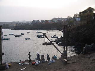
Mindelo is a port city in the northern part of the island of São Vicente in Cape Verde. Mindelo is also the seat of the parish of Nossa Senhora da Luz, and the municipality of São Vicente. The city is home to 93% of the entire island's population. Mindelo is known for its colourful and animated carnival celebrations, with roots in Portuguese traditions.

Brava is an island in Cape Verde, in the Sotavento group. At 62.5 km2 (24.1 sq mi), it is the smallest inhabited island of the Cape Verde archipelago, but at the same time the greenest. First settled in the early 16th century, its population grew after Mount Fogo on neighbouring Fogo erupted in 1680. For more than a century, its main industry was whaling, but the island economy is now primarily agricultural.

Santa Catarina is a concelho (municipality) of Cape Verde. It is situated in the western part of the island of Santiago. Its seat is the city of Assomada. Its population was 45,920 in 2017 (estimate). Its area is 242.6 km2.

São Lourenço dos Órgãos is a concelho (municipality) of Cape Verde. It is situated in the mountainous central part of the island of Santiago. Its seat is the city João Teves. Its population was 7,388 at the 2010 census, and its area is 36.9 km2. The municipality is bordered by Santa Cruz to the northeast, São Domingos to the south, Ribeira Grande de Santiago to the southwest and São Salvador do Mundo to the northwest. Pico de Antónia, the island's highest mountain, straddles the borders of São Lourenço dos Órgãos, São Salvador do Mundo and Ribeira Grande de Santiago.

Tarrafal de São Nicolau is a city in the western part of the island of São Nicolau, Cape Verde. With a population of 3,733, it is the most populous settlement of the island. It is the seat of the Tarrafal de São Nicolau Municipality, and the main port of the island. It is situated on the west coast, 9 km southwest of Ribeira Brava.

Pedra Badejo is a city in the eastern part of the island of Santiago, Cape Verde. It is situated on the east coast, 25 km north of the island capital Praia, 8 km southeast of Calheta de São Miguel and 15 km east of Assomada. It is the seat of Santa Cruz municipality. At the 2010 census, the town had 9,859 inhabitants.

Furna is a seaside community in the northeastern part of the island of Brava, Cape Verde. It lies 2.5 km northeast of the island capital of Nova Sintra. At the 2010 census its population was 612.

Atalaia is a settlement in the northern part of the island of Fogo, Cape Verde. Its population was 700 in 2010. It is situated near the coast, 6 km west of Mosteiros and 19 km northeast of the island capital São Filipe. The municipal boundary with São Filipe is to the west. Nearby settlements area Ribeira Ilhéu to the east and Campanas Baixo to the west. The festival of Saint John is celebrated every June 24.

Ribeira do Ilhéu is a settlement in the northern part of the island of Fogo, Cape Verde. It is situated 6 km west of Mosteiros and 20 km northeast of the island capital São Filipe. The nearest village is Atalaia, 1.5 km to the southwest. The village's main festival is the festival of Saint Joseph that takes place on March 19.

João Varela is a settlement in the southern part of the island of Santiago, Cape Verde. It is situated 5 km northeast of Cidade Velha and 9 km northwest of the capital Praia. It is part of the municipality of Ribeira Grande de Santiago.

São João Baptista is a freguesia of Cape Verde. It covers the eastern part of the island of Boa Vista. It is named after the church located in Fundo das Figueiras.

Fajã de Baixo is a town in the northern part of the island of São Nicolau, Cape Verde. It is situated 2 km south of Estância de Brás and 5 km northwest of Ribeira Brava.

Bofarreira is a village in the northern part of the island of Boa Vista in the Cape Verde archipelago. The village is around 10 km east of the island capital of Sal Rei.

Ribeira Dom João is a settlement in the southeast of the island of Maio in Cape Verde. It lies near the coast, 4 km east of Barreiro and 10 km east of Porto Inglês. As of the 2010 census, its population was 203.

São Jorge is a settlement in the central part of the island of Santiago, Cape Verde. It is part of the São Lourenço dos Órgãos municipality. In 2010 its population was 6. It is situated 2.5 km southwest of João Teves and 4 km southeast of Picos. Its elevation is 319 meters.

Montanha is a settlement in the central part of the island of Santiago, Cape Verde. It is situated 2 km north of João Teves and 8 km southwest of Pedra Badejo. The area is intensively farmed; mainly maize, beans and sugar-cane.

Levada is a village in the interior of the island of Santiago, Cape Verde. It is part of the municipality of São Lourenço dos Órgãos. It is situated 3 km east of João Teves, 5 km north of São Domingos and 18 km north of the capital Praia. In 2010 its population was 234. The village is on the upper course of the river Ribeira Seca, west of the Poilão Reservoir.

Longueira is a village in the southcentral part of the island of Santiago, Cape Verde. In 2010 its population was 326. Longueira is located 4 km southwest of João Teves and 1.5 km west of São Jorge. Monte Tchota, the highest point of the mountains of Rui Vaz, lies to the south.

Lombo de Figueira is a settlement in the eastcentral part of the island of Santo Antão, Cape Verde, part of the municipality of Porto Novo and the parish of São João Baptista. In 2010 its population was 281. It is situated about 9 km north of the island capital Porto Novo, on the national road from Porto Novo to Ribeira Grande (EN1-SA01). Subdivisions include Água das Caldeiras and Chã de Tampa. An endemic species of butterflies, Leptotes pirithous capverti, has been found in the area.


