Otero County is a county located in the U.S. state of Colorado. As of the 2020 census, the population was 18,690. The county seat is La Junta. The county was named for Miguel Antonio Otero, one of the founders of the town of La Junta and a member of a prominent Hispanic family.

La Junta is a home rule municipality in, the county seat of, and the most populous municipality of Otero County, Colorado, United States. The city population was 7,322 at the 2020 United States Census. La Junta is located on the Arkansas River in southeastern Colorado 68 miles (109 km) east of Pueblo. The city is home to Otero College.

West Virginia University (WVU) is a public land-grant research university with its main campus in Morgantown, West Virginia, United States. Its other campuses are those of the West Virginia University Institute of Technology in Beckley, Potomac State College of West Virginia University in Keyser, and clinical campuses for the university's medical school at Charleston Area Medical Center in Charleston, and the Eastern Division at the WVU Medicine Berkeley and Jefferson Medical Centers. WVU Extension Service provides outreach with offices in all 55 West Virginia counties.

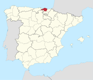
Biscay or Bizkaia, is a province of the Basque Autonomous Community, heir of the ancient Lordship of Biscay, lying on the south shore of the eponymous bay. The capital and largest city is Bilbao.

The Greek junta or Regime of the Colonels was a right-wing military junta that ruled Greece from 1967 to 1974. On 21 April 1967, a group of colonels overthrew the caretaker government a month before scheduled elections which Georgios Papandreou's Centre Union was favoured to win.

Odd is an unincorporated place in Raleigh County, West Virginia, United States. It is located along Tommy Creek. Only a post office is located there, with small residences spread along the nearby roads.
Western District may refer to:
The Huntington–Ashland metropolitan area is a metropolitan area in the Appalachian Plateau region of the United States. Referred to locally as the "Tri-State area," and colloquially as "Kyova", the region spans seven counties in the three states of Kentucky, Ohio, and West Virginia. With a population of 361,580, the Tri-State area is nestled along the banks of the Ohio River. The region offers a diverse range of outdoor activities.
Belva is an unincorporated community and census-designated place in west Nicholas County and north Fayette County, West Virginia, United States; while the CDP only includes the Nicholas County portion, the Fayette County portion is considered part of the community. The town is situated at the bottomland surrounding the convergence of Bells Creek with Twentymile Creek and, subsequently, Twenty Mile Creek with the Gauley River. Belva is also the location of the convergence of two state highways: West Virginia Route 16 and West Virginia Route 39.

The following outline is provided as an overview of and topical guide to the U.S. state of West Virginia:
Pueblo de las Juntas is a former settlement in Fresno County, California situated at the confluence of the San Joaquin River and Fresno Slough, 2 miles (3.2 km) north of Mendota.

Chelyan is a census-designated place (CDP) in Kanawha County, West Virginia, United States. Chelyan is located on the south bank of the Kanawha River, southeast of Chesapeake. It is served by Exit 85 of the West Virginia Turnpike. As of the 2010 census, its population was 776.
Patterson Creek is a 51.2-mile-long (82.4 km) tributary of the North Branch Potomac River in West Virginia's Eastern Panhandle, in the United States. It enters the North Branch east of Cumberland, Maryland, with its headwaters located in Grant County, West Virginia. Patterson Creek is the watershed for two-thirds of Mineral County, West Virginia. The creek passes through Lahmansville, Forman, Medley, Williamsport, Burlington, Headsville, Reeses Mill, Champwood, and Fort Ashby.
Peapatch is an unincorporated community in Buchanan County, Virginia and McDowell County, West Virginia, United States, straddling the Virginia–West Virginia border.
Beury is an unincorporated community and coal town in Fayette County, West Virginia, United States.
Rush Run was an unincorporated community and coal town in Fayette County, West Virginia, United States.
Dimmock is an unincorporated community and coal town in Fayette County, West Virginia, United States.
Milburn is an unincorporated community and coal town in Fayette County, West Virginia, United States.


