
Orma is an unincorporated community in Calhoun County, West Virginia, United States. It lies along West Virginia Route 16 and the West Fork Little Kanawha River, to the south of the town of Grantsville, the county seat of Calhoun County. Its elevation is 738 feet. Although it is unincorporated, it has a post office, with the ZIP code of 25268.
Chloe is an unincorporated community in Calhoun County, West Virginia, United States. It lies along West Virginia Route 16 and the West Fork Little Kanawha River, to the south of the towns of Grantsville and Arnoldsburg. Its elevation is 794 feet (242 m). Although it is unincorporated, it has a post office, with the ZIP code of 25235.
Arnoldsburg is an unincorporated community in Calhoun County, West Virginia, United States. It lies along U.S. Route 33 at the point where West Virginia Route 16 heads southward; it is several miles south of the county seat of Grantsville. Its elevation is 738 feet. The West Fork Little Kanawha River flows through the community. Although it is unincorporated, it has a post office, with the ZIP code of 25234.
Millstone is an unincorporated community in Calhoun County, West Virginia, United States. It lies along U.S. Route 33 at the point where West Virginia Route 16 heads northward, to the south of the town of Grantsville, the county seat of Calhoun County. Its elevation is 810 feet. Although it is unincorporated, it has a post office, with the ZIP code of 25261.
Big Bend is an unincorporated community in Calhoun County, West Virginia, United States. It lies along West Virginia Route 5 northwest of the town of Grantsville, the county seat of Calhoun County, along the Little Kanawha River. Its elevation is 682 feet. Although it is unincorporated, it has a post office, with the ZIP code of 26136.
Big Springs is an unincorporated community in Calhoun County, West Virginia, United States. It lies along West Virginia Route 16 to the north of the town of Grantsville, the county seat of Calhoun County. Its elevation is 771 feet. Although it is unincorporated, it has a post office, with the ZIP code of 26137.
Elton is an unincorporated community in Summers County, West Virginia, United States. It lies to the northeast of the city of Hinton, the county seat of Summers County. Its elevation is 1,749 feet. Elton had a post office, with the ZIP code of 25965, until it closed on July 11, 2009.
Forest Hill is an unincorporated community in Summers County, West Virginia, United States. It lies along West Virginia Route 12 to the southeast of the city of Hinton, the county seat of Summers County. Its elevation is 1,926 feet. Although it is unincorporated, it has a post office, with the ZIP code of 24935.
Green Sulphur Springs is an unincorporated community in Summers County, West Virginia, United States. It lies near Interstate 64 to the northeast of the city of Hinton, the county seat of Summers County. Its elevation is 1,552 feet. Green Sulphur Springs had a post office, with the ZIP code of 25966, until it closed on February 29, 1992.
Nimitz is an unincorporated community in Summers County, West Virginia, United States. It lies along West Virginia Route 3 to the west of the city of Hinton, the county seat of Summers County. Its elevation is 2,523 feet. Although it is unincorporated, it has a post office, with the ZIP code of 25978.
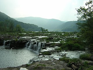
Sandstone is an unincorporated community in Summers County, West Virginia, United States. It lies along West Virginia Route 20 and the New River to the north of the city of Hinton, the county seat of Summers County. Its elevation is 1,352 feet. Although it is unincorporated, it has a post office, with the ZIP code of 25985.
Griffithsville is an unincorporated community in eastern Lincoln County, West Virginia, United States. It lies along West Virginia Route 3 southeast of the town of Hamlin, the county seat of Lincoln County. Its elevation is 659 feet (201 m). Although it is unincorporated, it has a post office, with the ZIP code of 25521.
Galloway is a census-designated place (CDP) and coal town in northwestern Barbour County, West Virginia, USA. It lies along West Virginia Route 76 northwest of the city of Philippi, the county seat of Barbour County. Its elevation is 1,073 feet (327 m). Although it is unincorporated, it has a post office, with the ZIP code of 26349. As of the 2010 census, its population is 143.
Smithville is an unincorporated community in southern Ritchie County, West Virginia, USA. It lies along West Virginia Route 47 south of the town of Harrisville, the county seat of Ritchie County. Its elevation is 686 feet (209 m). Although it is unincorporated, it has a post office, with the ZIP code of 26178.
Macfarlan is an unincorporated community in southwestern Ritchie County, West Virginia, United States. It lies along West Virginia Route 47 southwest of the town of Harrisville, the county seat of Ritchie County. Its elevation is 653 feet (199 m). Although it is unincorporated, it has a post office, with the ZIP code of 26148.
Waverly is a census-designated place (CDP) in northeastern Wood County, West Virginia, United States. As of the 2010 census, its population was 395. It lies along the Ohio River on West Virginia Route 2, northeast of the city of Parkersburg, the county seat of Wood County. Its elevation is 620 feet (189 m). Although it is unincorporated, it has a post office, with the ZIP code of 26184 and a school.
Creston is an unincorporated community in southeastern Wirt County, West Virginia, United States. It lies at the confluence of the Little Kanawha River and the West Fork Little Kanawha River on West Virginia Route 5, southeast of the town of Elizabeth, the county seat of Wirt County. Its elevation is 653 feet (199 m). Creston had a post office, which closed on June 25, 2011. The community was named for a drainage divide near the town site.
Dallas is an unincorporated community in northeastern Marshall County, West Virginia, United States. It lies along local roads northeast of the city of Moundsville, the county seat of Marshall County, and almost in Pennsylvania. Its elevation is 1,388 feet (423 m). Although it is unincorporated, it has a post office, with the ZIP code of 26036.
Glen Easton is an unincorporated community in southern Marshall County, West Virginia, United States. It lies along local roads southeast of the city of Moundsville, the county seat of Marshall County. Its elevation is 945 feet (288 m). Although it is unincorporated, it has a post office, with the ZIP code of 26039.
Proctor is an unincorporated community in northwestern Wetzel County, West Virginia, United States. It lies on West Virginia Route 2 along the Ohio River, north of the city of New Martinsville, the county seat of Wetzel County. Its elevation is 630 feet (192 m). Because the community has borne multiple names, the Board on Geographic Names officially designated it "Proctor" in 1980. Although it is unincorporated, it has a post office, with the ZIP code of 26055.


