
Mercer County is a county in Southern West Virginia on the southeastern border of the U.S. state of West Virginia. At the 2020 census, the population was 59,664. Its county seat is Princeton. The county was originally established in the State of Virginia by act of its General Assembly on March 17, 1837, using lands taken from Giles and Tazewell counties.
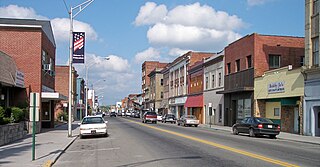
Princeton is a city in and the county seat of Mercer County, West Virginia, United States. The population was 5,872 at the 2020 census. It is part of the Bluefield micropolitan area. The city hosts the Princeton WhistlePigs baseball club of the Appalachian League.

Saltville is a town in Smyth and Washington counties in the U.S. state of Virginia. The population was 1,824 at the 2020 census. It is part of the Kingsport–Bristol (TN)–Bristol (VA) Metropolitan Statistical Area, which is a component of the Johnson City–Kingsport–Bristol, TN-VA Combined Statistical Area – commonly known as the "Tri-Cities" region.

The Ohio Company, formally known as the Ohio Company of Virginia, was a land speculation company organized for the settlement by Virginians of the Ohio Country and to trade with the Native Americans. The company had a land grant from Britain and a treaty with Indians, but France also claimed the area, and the conflict helped provoke the outbreak of the French and Indian War.
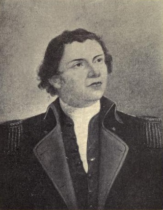
Hugh Mercer was a Scottish brigadier general in the Continental Army during the American Revolutionary War. He fought in the New York and New Jersey campaign and was mortally wounded at the Battle of Princeton.
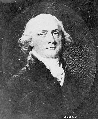
John Francis Mercer was a Founding Father of the United States, politician, lawyer, planter, and slave owner from Virginia and Maryland. An officer during the Revolutionary War, Mercer initially served in the Virginia House of Delegates and then the Maryland State Assembly. As a member of the assembly, he was appointed a delegate from Maryland to the Philadelphia Convention of 1787, where he was a framer of the U.S. Constitution though he left the convention before signing. Mercer was later elected to the U.S. House of Representatives from two different districts in Maryland. In 1801—1803, he served as Maryland's 10th governor.

Thomas Jefferson Lilly represented West Virginia in the Sixty-eighth United States Congress. He was the son of Joseph L Lilly and Martha Jane Cox.
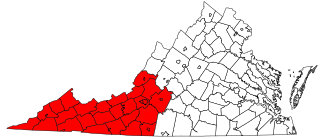
Southwest Virginia, often abbreviated as SWVA, is a mountainous region of Virginia in the westernmost part of the commonwealth. Located within the broader region of western Virginia, Southwest Virginia has been defined alternatively as all Virginia counties on the Appalachian Plateau, all Virginia counties west of the Eastern Continental Divide, or at its greatest expanse, as far east as Blacksburg and Roanoke. Another geographic categorization of the region places it as those counties within the Tennessee River watershed. Regardless of how borders are drawn, Southwest Virginia differs from the rest of the commonwealth in that its culture is more closely associated with Appalachia than the other regions of Virginia. Historically, the region has been and remains a rural area, but in the 20th century, coal mining became an important part of its economy. With the decline in the number of coal jobs and the decline of tobacco as a cash crop, Southwest Virginia is increasingly turning to tourism as a source of economic development. Collectively, Southwest Virginia's craft, music, agritourism and outdoor recreation are referred to as the region's "creative economy."

George Rogers Clark Floyd was an American politician and businessman. He served as the Secretary of the Wisconsin Territory from 1843 to 1846, and served in the West Virginia House of Delegates from 1872 to 1873.

Arc-et-Senans is a commune in the Doubs department in the Bourgogne-Franche-Comté region of eastern France.
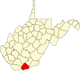
This is a list of the National Register of Historic Places listings in Mercer County, West Virginia.
The 36th Virginia Infantry Regiment was an infantry regiment mostly raised in the Kanawha Valley for service in the Confederate States Army during the American Civil War. It fought mostly in western Virginia, Tennessee, and Kentucky.
Gardner is an unincorporated community in Mercer County, West Virginia, United States. Gardner is located along Interstate 77, 4 miles (6.4 km) north of Princeton. The Gardner Area was home of the Bluestone Land and Lumber Company, the Mercer County Poor Farm, and the Forestry Sciences Laboratory. Organizations that still exist in the Gardner Area include the Mercer County Gardner Center, U.S. Forest Service, West Virginia Forest Products Center, West Virginia Division of Highways, Pikeview Middle School and Pikeview High School.
Mercers Bottom is an unincorporated community in Mason County, West Virginia, United States. It is situated on the east bank of the Ohio River along West Virginia Route 2, some 13.5 miles (21.7 km) south of Point Pleasant.

Brush Fork is a census-designated place (CDP) in Mercer County, West Virginia, United States. Brush Fork is 2 miles (3.2 km) northwest of Bluefield. As of the 2010 census, its population was 1,197.
Green Valley is an unincorporated community in Mercer County, West Virginia, United States. Green Valley is located along West Virginia Route 123, 4.5 miles (7.2 km) north-northeast of Bluefield.
Midway is an unincorporated community in Mercer County, West Virginia, United States. Midway is located on County Route 11 near the northwest border of Bluefield.
New Hope is an unincorporated community in Mercer County, West Virginia, United States. New Hope is located on West Virginia Route 20, 4 miles (6.4 km) west-southwest of Princeton.
Weyanoke is an unincorporated community in Mercer County, West Virginia, United States. Weyanoke is located on County Route 11, 1 mile (1.6 km) west of Matoaka.


