Kalam, Swat

Last updated

Kalam
Valley
کالام
Kalam, Swat (Pakistan).jpg
Kalam Valley
Country Flag of Pakistan.svg  Pakistan
Province Khyber Pakhtunkhwa
District Swat
Elevation 2,001 m (6,565 ft)
Time zone PST (UTC+5)

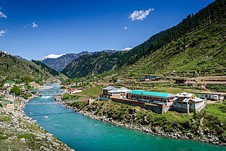
Kalam (Kalami/Pashto/Urdu : کالام) is a valley located at distance of 99 km from Mingora in the northern upper reaches of Swat valley along the bank of Swat River in Khyber Pakhtunkhwa province of Pakistan. Kalam is surrounded by lush green hills, thick forests and bestowed with mesmeric lakes, meadows and waterfalls which are worth seen features of the landscape. It is the birthplace of Swat river which forms with confluence of two major tributaries of Gabral river & Ushu river.

Kalami (کالامي), also known as Gawri (ګاوری), Garwi, or Bashkarik, is a Dardic language spoken in Swat Kohistan region in the upper Swat District and in the upper Panjkora river valley of Upper Dir District, Khyber Pakhtunkhwa, Pakistan.

Pashto Indo-Iranian language spoken in Afghanistan

Pashto, sometimes spelled Pukhto, is the language of the Pashtuns. It is known in Persian literature as Afghāni (افغانی) and in Hindustani literature as Paṭhānī. Speakers of the language are called Pashtuns/Pakhtuns/Pathans and sometimes Afghans. It is an Eastern Iranian language, belonging to the Indo-European family. Pashto is one of the two official languages of Afghanistan and it is the second-largest regional language of Pakistan, mainly spoken in the west and northwest of the country. In Pakistan, it is the majority language of the province of Khyber Pakhtunkhwa and the northern districts of Balochistan. Along with Dari Persian, Pashto is the main language among the Pashtun diaspora around the world. The total number of Pashto-speakers is estimated to be 45–60 million people worldwide.

Mingora City in Khyber Pakhtunkhwa, Pakistan

Mingora is a commercial city in the Swat District of Khyber Pakhtunkhwa, Pakistan, located at an altitude of 984 metres (3,228 ft), 2 km (1.2 mi) away from the town of Saidu Sharif. Mingora is the largest city in Malakand Division, and also the largest in the northern part of Khyber Pakhtunkhwa. Mingora is a major tourist destination, with a large number of hotels.

Contents

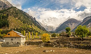
It is a spacious sub-valley of Swat, at an elevation of about 2,000 meters (6,600 feet) above sea level, and providing rooms for a small but fertile plateau above the river for farming. [1] Here, the metaled road ends and shingle road leads to the Usho and Utror valleys. From Matiltan some snow-capped mountains are visible including Mount Falaksar 5,918 meters (19,416 feet), and another unnamed peak 6,096 meters (20,000 feet) high. [2]

There are grand hotels in Kalam for tourists to rest and enjoy the cool breeze of Swat river. [3]

Climate

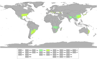
With a mild and generally warm and temperate climate, Kalam features a humid subtropical climate (Cfa) under the Köppen climate classification. The average temperature in Kalam is 13.4 °C, while the annual precipitation averages 639 mm. Even in the driest months, there is a lot of precipitation. November is the driest month with 15 mm of precipitation, while April, the wettest month, has an average precipitation of 93 mm.

Humid subtropical climate category in the Köppen climate classification system

A humid subtropical climate is a zone of climate characterized by hot and humid summers, and mild winters. These climates normally lie on the southeast side of all continents, generally between latitudes 25° and 40° and are located poleward from adjacent tropical climates. While many subtropical climates tend to be located at or near coastal locations, in some cases they extend inland, most notably in China and the United States, where they exhibit more pronounced seasonal variations and sharper contrasts between summer and winter, as part of a gradient between the more tropical climates of the southern coasts of these countries and the more continental climates of China and the United States’ northern and central regions.

Köppen climate classification widely used climate classification system

The Köppen climate classification is one of the most widely used climate classification systems. It was first published by the Russian climatologist Wladimir Köppen (1846–1940) in 1884, with several later modifications by Köppen, notably in 1918 and 1936. Later, the climatologist Rudolf Geiger introduced some changes to the classification system, which is thus sometimes called the Köppen–Geiger climate classification system.

July is the hottest month of the year with an average temperature of 24.1 °C. The coldest month January has an average temperature of 1.5 °C.

Climate data for Kalam
MonthJanFebMarAprMayJunJulAugSepOctNovDecYear
Average high °C (°F) 5.3
(41.5)
6.9
(44.4)
12.3
(54.1)
18.2
(64.8)
23.1
(73.6)
29.5
(85.1)
30.5
(86.9)
29.4
(84.9)
26.0
(78.8)
21.2
(70.2)
15.0
(59)
8.1
(46.6)
18.8
(65.8)
Daily mean °C (°F) 1.5
(34.7)
2.8
(37)
7.6
(45.7)
13.0
(55.4)
17.3
(63.1)
23.0
(73.4)
24.1
(75.4)
23.4
(74.1)
19.8
(67.6)
15.1
(59.2)
9.5
(49.1)
4.0
(39.2)
13.4
(56.2)
Average low °C (°F) −2.2
(28)
−1.3
(29.7)
3.0
(37.4)
7.9
(46.2)
11.6
(52.9)
16.6
(61.9)
17.8
(64)
17.5
(63.5)
13.7
(56.7)
9.0
(48.2)
4.1
(39.4)
0.0
(32)
8.1
(46.7)
Source: Climate-Data.org [4]

Tourist Spots

Usho (also spelled Ushu) is a hill station in the north east of Kalam valley. It is situated at a distance of 8 kilometers (5.0 mi) from Kalam and 123 kilometers (76 mi) km from Saidu Sharif at the height of 2,300 metres (7,550 feet). It is accessible through a non metalled road from Kalam by jeeps only.

Usho Place in Khyber Pakhtunkhwa, Pakistan

Usho is a village in Usho Valley, Khyber Pakhtunkhwa province of Pakistan. It is situated 8 kilometers (5.0 mi) from Kalam and 123 kilometers (76 mi) km from Mingora, at the height of 2,300 metres. It is accessible through a non metalled road from Kalam by jeeps only.

Saidu Sharif City in Khyber Pakhtunkhwa, Pakistan

Saidū Sharīf is the Capital City of Swat District in the Khyber Pakhtunkhwa province of Pakistan. The city also serves as the capital city of Malakand division. Named after Saidu Baba, a prominent leader of the former Yusufzai State of Swat, Saidu Sharif is the third-largest city in Swat District after the city of Mingora and Kabal.

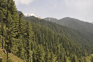
Usho Forest in Kalam Kalaam Forest.JPG
Usho Forest in Kalam

Matiltan

Matiltan is a picturesque spot comes after Usho and located at about 11 km away from Kalam. It is famous for huge glaciers, thick forests and lofty moauntain peaks. The tallest peak of Falaksair mountain can be seen from here clearly.

Matiltan

Matiltan is a picturesque spot comes after Usho and located at a distance of about 11 km away from Kalam. It is famous for huge glaciers, thick forests and lofty moauntain peaks. The tallest peak of Falak Sar mountain can be seen from here clearly. It is accessible through a non metalled road from Kalam by a four-wheel drive vehicle and the charming lake of Mahodand comes after this village of Kalam.

Utror

Utror hill station is another scenic place in Kalam valley which is located 16 km away from Kalam. It is one of the beautiful valley in the region, surrounded by snow clad mountains and beautiful Kundol lake of the area is worth seen.

Gabral

Gabral is a charming hill station, comes at a distance of 20 km away from Kalam. It is famous for brown swati trout fish, thick lush green forests, medicinal springs, lofty snow clad peaks and beautiful lakes, among them Shahi Bagh lake located to north west of Sazgul region at about three hours of trekking is worth seen.

Lakes

Kundol lake, Utror Kalam Swat Kundol lake, Utror kalam swat.jpg
Kundol lake, Utror Kalam Swat

Kalam has large number of alpine glacial lakes, among them Mahodand lake and Kundol lake are very popular due to ease of accessibility. But others like Izmis lake, which is located in close proximity with Kundol lake is one of the spectacular one in the region. Most of these lakes are accessible through tedious trekking over lush green trails across the way.

Mahodand Lake is one of the largest & scenic lake in the Swat valley, located at a distance of about 40 km from Kalam, in the Usho Sub-valley of Kalam which is laid out in the foothills of Hindu Kush mountains. It is accessible with a four-wheel drive vehicle, and is a good resort for fishing, boating and camping. It is surrounded by snow clad mountains, lush green meadows and thick forests which hypontise one to its center.

Kundol Lake is another charming lake in Kalam valley which is located in the north of Utror region at a distance of 19 km away from kalam. It also lies in the foothills of Hindu Kush mountains and accessible via the mesmeric valley of Ladu through a trek of 4–6 hours. [5]

See also

Related Research Articles

Swat River river in Pakistan

The Swat River is a perennial river in the northern region of Khyber-Pakhtunkhwa Province, Pakistan. The river commences in the Kalam Valley of Swat Kohistan with the confluence of two main tributaries Ushu and Utrar and runs downstream in a narrow gorge up to Baghdheri.
Miandam Place in Khyber Pakhtunkhwa, Pakistan

Miandam is a hill station in Khyber Pakhtunkhwa, Pakistan, in the foothills of Hindu Kush mountains. It is located at a distance of 55 km away from Mingora the capital of Swat Valley, and 56 kilometers (35 mi) from Saidu Sharif.

Marghuzar

Marghuzar, or Marghazar is a hill station located in the Swat District of the Khyber Pakhtunkhwa province of Pakistan, and is 13 kilometers away from Saidu Sharif. Marghuzar, translated as "green land", contains green valleys, cold springs, and mountains, including the Elum Ghar mountain. In 1940, the then Wali of Swat, Miangul Abdul Wadud, decided to build a summer residence there for himself which became the summer capital of Swat. The palace was named Sufed Mahal, translated as The White Palace. The palace has since been converted into a hotel. Marghuzar has a 200-year-old colossal chinar tree, which serves as a canopy for visitors. There is also a middle school and one primary school for boys and girls each, but there aren't any hospitals or clinics.

Utror Place in Khyber Pakhtunkhwa, Pakistan

Utror, also spelt Atror, is a valley which is located in the Dir District of Khyber Pakhtunkhwa, Pakistan. It is surrounded by snow clad mountains, green pastures and waterfalls. The area of the valley is about 47,400 hectares. Utror is 16 km (9.9 mi) away from Kalam Valley and 116 km (72 mi) from Saidu Sharif.
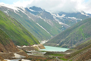
Lulusar lake in Pakistan

Lulusar is group of mountain peaks and a lake in the Kaghan Valley in the Khyber-Pakhtunkhwa province of Pakistan. The highest peak has a height of 11,200 ft (3,410 m) above sea level.
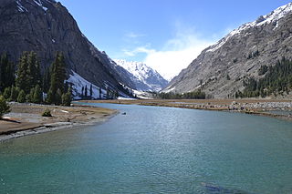
Mahodand Lake lake in Pakistan

Mahodand Lake is a lake located in the upper Usho Valley at a distance of about 40 km from Kalam, Swat District, Khyber Pakhtunkhwa province of Pakistan. The lake is accessible by a four-wheel drive vehicle, and is often utilized for fishing and boating.

Kundol Lake

Kundol Lake also known as Kundol Dand, is a lake in Swat Valley, Khyber Pakhtunkhwa, Pakistan, which is located in the north of Utror valley at a distance of 20.8 kilometres (12.9 mi) away from kalam. Similarly, there is a well known story about the lake which is that every night in a month, a golden bowl appears in the center of the lake and glistens like moon but no one has ever touched that bowl due to magical powers inside it.

Tourism in Khyber Pakhtunkhwa

Khyber Pakhtunkhwa is located in the north-west region of Pakistan. It is known as the tourist hotspot for adventurers and explorers. The province has a varied landscape ranging from rugged mountains, valleys, hills and dense agricultural farms. The region is well known for its ancestral roots. There are a number of Buddhist archaeological sites from the Gandhara civilisation such as Takht Bhai and Pushkalavati. There are a number of other Buddhist and Hindu archaeological sites including Bala Hisar Fort, Butkara Stupa, Kanishka stupa, Chakdara, Panjkora Valley and Sehri Bahlol.

Bahrain, Swat Town in Khyber Pakhtunkhwa, Pakistan

Bahrain is a town located in Swat District of Khyber Pakhtunkhwa, Pakistan, 60 km North of Mingora at an elevation of 4700 ft on the right bank of the Swat river. It is named Bahrain due to its location at the confluence of the Daral and Swat rivers. It is known for its riverside tourist resorts, local handicrafts, and its view of the merging of the Daral and Swat Rivers. It also serves as a base camp for the trail that leads to the Daral & Saidgai lakes.
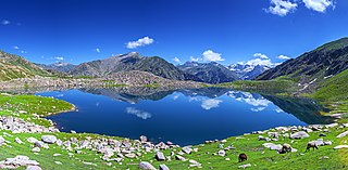
Daral Lake

Daral Lake also known Daral Dand is an alpine scenic lake in the hill top of Bahrain a region of Swat Valley in Khyber Pakhtunkhwa the Province of Pakistan. It is situated to the northeast of Saidgai Lake. The lake appears as giant amoeba like in shape and stretched over a huge area.Near the lake, there is an ancient mosque where shepherds and visitors offer their prayers and use it as a resting place for night.

Gabin Jabba

Gabin Jabba which means in Pashto honey marshes, is located approximately 65 km from Mingora on Matta sakhra road Swat valley, Khyber Pakhtunkhwa the province of Pakistan. It is an area in Swat valley, with green meadows, thick forests, snow clad mountains, mineral springs and high peaks.

Jabba Zomalu Lake

Jabba Zomalu Lake is an alpine glacial lake located in the Ushu valley of Kalam Upper Swat, Khyber Pakhtunkhwa.

Katora Lake

Katora Lake is an alpine glacial lake located in the upper reaches of Jahaz Banda, Kumrat valley in Upper Dir District of Khyber Pakhtunkhwa the Province of Pakistan. The lake is fed by the surrounding melting glacier waters. The word Katora means "bowl" in Pashto. It was named after the lakes resemblance to a bowl shape.

Saidgai Lake

Saidgai Lake also known as Saidgai Dand is a lake in the upper reaches of Ushirai Dara close to the Dir mountains, between the border of Swat District and Dir District of Khyber Pakhtunkhwa the Province of Pakistan. It is located at an elevation of 11,500 feet (3,500 m) above the sea level. It is located to the northwest of Gabin Jabba. The temperature is normally about 5 °C to 10 °C during hot months. Mostly this lake catches tourist form Dir and Swat and other parts of the country as well in the month of June, July and August, while the remaining months this lake is covered by snow and impossible for the tourist to stay there. Saidgai lake is the boundary between Swat valley and Dir Upper.

Bashigram Lake

Bashigram Lake also known as Bashigram Danda in Pashto is an alpine glacial lake located to the eastern side of Madyan in Swat District of Khyber Pakhtunkhwa province of Pakistan.

Pari Lake Lake in Pakistan

Pari Lake is located at the highest altitude approx: 14,442 feet (4,402 m) above sea level, in the mountain ranges of Utror Valley, Kalam, Swat Valley, Khyber Pakhtunkhwa, Pakistan. It is comparatively greater in size and depth than the other lake situated in its vicinity and remains open in the months of July till September. The western face of the lake is open and its water flows down to the gigantic Kundol Lake which is situated in the foothills. There are in fact two lakes that share the common name and are sometimes referred to as lake 1 and lake 2.

Kharkhari is a small lake in the Gabral Valley, Pakistan, about 400 m long and 250 m wide. It is traversed by the Gabral river, a tributary of the Utrar River. It is located about 41 km by road from the town of Kalam, 16 km north of the town of Gabrāl and 9 km north of the Gul Bandaj bridge, at an altitude of 5160 meters. The name has also been spelled Karkaray

Gabral Valley

The Gabral Valley is a valley in the Kohistan District of Khyber Pakhtunkhwa province, Pakistan. It is located in the south slopes of the westernmost end of the Himalayas. Its lower end is at the town of Gabral, about 20 km north from Kalam and 120 km north of Islamabad, at an altitude of 2290 m. The name is also spelled as Gabrāl or Ghabral.

References

Coordinates: 35°28′48″N72°35′15″E / 35.4801°N 72.5874°E / 35.4801; 72.5874