Kalamnuri

Last updated

Kalamnuri
city
India Maharashtra location map.svg
Red pog.svg
Kalamnuri
Location in Maharashtra, India
Coordinates: 19°40′N77°20′E / 19.67°N 77.33°E / 19.67; 77.33 Coordinates: 19°40′N77°20′E / 19.67°N 77.33°E / 19.67; 77.33
CountryFlag of India.svg  India
State Maharashtra
District Hingoli
Government
  Body Municipal council
Elevation
480 m (1,570 ft)
Population
 (2011 [1] )
  Total24,784
Demonym(s) Kalamnurikar
Languages
  Official Marathi
Time zone UTC+5:30 (IST)
Vehicle registration MH-38

Kalamnuri is a city and a municipal council in Hingoli district in the Indian state of Maharashtra.

A municipal council is the legislative body of a municipality such as a city council or a town council.

Hingoli district District of Maharashtra in India

Hingoli district is an administrative district in the state of Maharashtra in India. The district is headquartered at Hingoli. The district occupies an area of 4,526 km2 and has a population of 11,77,345 of which 15.60% were urban. Hingoli was actually known as the Nizams military base as it was bordered with Vidharbha. In that era military troops, hospitals, veterinary hospital were in operation from Hingoli. Being a military base the city was one of the important and famous places of the Hyderabad state.One of the twelve Jyotirlinga shrines, the Aundha Nagnath is located in Hingoli district about 25 km south-west from district headquarter.

India Country in South Asia

India is a country in South Asia. It is the seventh-largest country by area, the second-most populous country, and the most populous democracy in the world. Bounded by the Indian Ocean on the south, the Arabian Sea on the southwest, and the Bay of Bengal on the southeast, it shares land borders with Pakistan to the west; China, Nepal, and Bhutan to the north; and Bangladesh and Myanmar to the east. In the Indian Ocean, India is in the vicinity of Sri Lanka and the Maldives; its Andaman and Nicobar Islands share a maritime border with Thailand and Indonesia.

Contents

Geography

Kalamnuri is located at 19°40′N77°20′E / 19.67°N 77.33°E / 19.67; 77.33 . [2] It has an average elevation of 480 metres (1574 feet).

Demography

Maharashtra State in western India

Maharashtra is a state in the western peninsular region of India occupying a substantial portion of the Deccan Plateau. It is the second-most populous state and third-largest state by area in India. Spread over 307,713 km2 (118,809 sq mi), it is bordered by the Arabian Sea to the west, the Indian states of Karnataka and Goa to the south, Telangana to the southeast and Chhattisgarh to the east, Gujarat and Madhya Pradesh to the north, and the Indian union territory of Dadra and Nagar Haveli to the north west. It is also the world's second-most populous subnational entity.

Government and Administration

Kalanuri is one of the 288 constituencies of Maharashtra Vidhan Sabha and one of the three located in the Hingoli district.

Indian National Congress Major political party in India

The Indian National Congress(pronunciation ) is a political party in India with widespread roots. Founded in 1885, it was the first modern nationalist movement to emerge in the British Empire in Asia and Africa. From the late 19th century, and especially after 1920, under the leadership of Mahatma Gandhi, Congress became the principal leader of the Indian independence movement. Congress led India to independence from Great Britain, and powerfully influenced other anti-colonial nationalist movements in the British Empire.

Shiv Sena Political party in India

Shiv Sena, is a far-right based Marathi regional and Hindu nationalist political organisation in India founded on 19 June 1966 by political cartoonist Bal Thackeray. The party originally emerged from a movement in Mumbai demanding preferential treatment for Maharashtrians over migrants to the city. It is currently headed by Thackeray's son, Uddhav Thackeray. Members of Shiv Sena are referred to as Shivsainiks.

See also

Related Research Articles

Muktainagar Town in Maharashtra, India

Muktainagar is a small town situated near the National Highway 53, in Jalgaon district near the northern border of Maharashtra State, India. Muktainagar is located in the Khandesh region of North Maharashtra.

Pathri Town in Maharashtra, India

Pathri is a town and a municipal council in Parbhani district in the Indian state of Maharashtra. Sri Sai Janmasthan Temple, Pathri attracts thousands of tourists each year. Pathri Premier League (PPL) is a popular annual cricket tournament organised in the city to boost local cricketing talent.

Sonpeth Town Municipality in Maharashtra, India

Sonpeth is a city and a municipal council in Parbhani district in the Indian state of Maharashtra.

Aundha Nagnath town in Maharashtra, India

Aundha Naganath is a town and a tehsil in Basmat Subdivision of Hingoli district in Marathwada region of the Indian state of Maharashtra.

Vasmat Vidhan Sabha constituency is one of the 288 Vidhan Sabha constituencies of Maharashtra state in western India.

Rajeev Shankarrao Satav is the Former Member of Parliament from Hingoli in Maharashtra. He defeated Subhash Wankhede, Shiv Sena MP and a three time MLA. He has the distinction of wresting the Kalamnuri Assembly seat in Marathwada region from the Shiv Sena after 20 years in the 2009 elections. He is the All India Congress Committee (AICC) Incharge for the State of Gujarat & Permanent Invitee to Congress Working Committee which is the highest decision making body of Indian National Congress. Before his appointment as In Charge of Gujarat he was also the AICC Secretary in charge for Saurashtra region during the Gujarat Vidhan Sabha Elections 2017, where Congress won the maximum seats. Rajeev Satav was also a member of the Screening Committee for the Punjab Vidhan Sabha Elections 2017. He was President of the Indian Youth Congress from February 2010 to December 2014. Before occupying the prestigious position of President, Indian Youth Congress, he was President of Maharashtra Pradesh Youth Congress from May 2008 to February 2010.

Sonkhed Village in Maharashtra, India

Sonkhed is a village in Loha taluka of Nanded district in Maharashtra state of India.

Ashti, Jalna Village in Maharashtra, India

Ashti is a major village in Partur taluka of Jalna district in Maharashtra state of India.

Bori, Parbhani Village in Maharashtra, India

Bori is a village in Jintur taluka of Parbhani district in Maharashtra state of India.

Zari, Parbhani Village in Maharashtra, India

Zari is a major village in Parbhani taluka of Parbhani district of Maharashtra state in India.

Charthana Village in Maharashtra, India

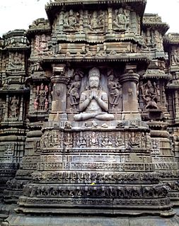
Charthana is a major village in Jintur taluka of Parbhani district in Maharashtra state of India. It used to be known as Charukshetra Nagari in the name of king Charudatta. There are near about 360 temples of Mahadeva, some of which are under the ground. The Archaeological Survey of India (ASI) has acquired the remaining temples for conservation. Gokuleshwar mandir, Barav, Dwipmal, and Nartirtha are places of interest among many others.

Palam, Parbhani Town in Maharashtra, India

Palam is a town and a headquarter of Palam taluka. It's located in Parbhani district which is part of State of Maharashtra in India.

Walur Village in Maharashtra, India

Walur is a major village in Sailu taluka of Parbhani district in Maharashtra state of India.

Bhogaon, Jintur Village in Maharashtra, India

Bhogaon is a major village in Jintur taluka of Parbhani district in Maharashtra state of India.

Akhada Balapur Village in Maharashtra, India

Akhada Balapur is a major village in Kalamnuri tehsil of Hingoli district in Maharashtra state of India.

Daithana Village in Maharashtra, India

Daithana is a major village in Parbhani taluka of Parbhani district in Indian state of Maharashtra. Village is located on Parbhani-Gangakhed state highway, 24 km away from Parbhani city.

Vishnupuri, Nanded Village in Maharashtra, India

Vishunupuri is a village in Nanded taluka of Nanded district in the Indian state of Maharashtra. It is 10 kilometres (6.2 mi) from Nanded city on the Nanded-Latur highway. Though it is a village, it is now a suburb of the city due its close proximity and rapid urbanisation. Swami Ramanand Teerth Marathwada University, Shri Guru Gobind Singhji Institute of Engineering and Technology and Government Medical College, Nanded are located there.

Satona Village/Railway Station in Maharashtra, India

Satona also known as Satona (Kh) or Satuna, is a major village and railway station in Partur taluka of Jalna district of Indian state of Maharashtra.

References

  1. 1 2 3 "Kalamnuri City Population Census 2011 - Maharashtra". Census2011.co.in. Retrieved 30 August 2015.
  2. Falling Rain Genomics, Inc - Kalamnuri
  3. "Kalamnuri (Maharashtra) Election Results 2014, Current and Previous MLA". Elections.in. 17 February 2015. Retrieved 30 August 2015.
  4. "Hingoli(Maharashtra) Lok Sabha Election Results 2014 with Sitting MP and Party Name". Elections.in. Retrieved 30 August 2015.