Kamarajugadda

Last updated

Kamarajugadda
Village
Location map India Andhra Pradesh EN.svg
Red pog.svg
Kamarajugadda
Location in Andhra Pradesh, India
Coordinates: 16°18′53″N80°10′37″E / 16.314853°N 80.177044°E / 16.314853; 80.177044 Coordinates: 16°18′53″N80°10′37″E / 16.314853°N 80.177044°E / 16.314853; 80.177044
Country India
State Andhra Pradesh
District Guntur
Mandal Repalle
Government
[1]
  Type Panchayati raj
  BodyKamarajugadda gram panchayat
Area
[2]
  Total693 ha (1,712 acres)
Population
 (2011) [3]
  Total1,985
  Density290/km2 (740/sq mi)
Languages
  Official Telugu
Time zone UTC+5:30 (IST)
PIN
522xxx
Area code(s) +91–
Vehicle registration AP

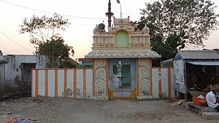
Kamarajugadda is a village in Guntur district of the Indian state of Andhra Pradesh. It is located in Repalle mandal of Tenali revenue division. [2]

Guntur district District of Andhra Pradesh in India

Guntur district is an administrative district in the Coastal Andhra region of the Indian state of Andhra Pradesh. The administrative seat of the district is located at Guntur, the largest city of the district in terms of area and population. It has a coastline of approximately 100 km and is situated on the right bank of Krishna River, that separates it from Krishna district and extends till it empties into the Bay of Bengal. It is bounded on the south by Prakasam district and on the west by the state of Telangana. It has an area of 11,391 km2 (4,398 sq mi) and is the 2nd most populous district in the state, with a population of 4,889,230 as per 2011 census of India.

Andhra Pradesh State in southern India

Andhra Pradesh is one of the 29 states of India. Situated in the south-east of the country, it is the seventh-largest state in India, covering an area of 160,205 km2 (61,855 sq mi). As per the 2011 census, it is the tenth-most populous state, with 49,386,799 inhabitants. The largest city in Andhra Pradesh is Visakhapatnam. Telugu, one of the classical languages of India, is the major and official language of Andhra Pradesh.

Repalle mandal Mandal in Andhra Pradesh, India

Repalle mandal is one of the 57 mandals in Guntur district of the state of Andhra Pradesh, India. It is under the administration of Tenali Revenue Division and the headquarters are located at Repalle. The mandal is situated on the banks of Krishna River of Velanadu region and is bounded by Bhattiprolu, Nagaram and Nizampatnam mandals.

Contents

Governance

Kamarajugadda gram panchayat is the local self-government of the village. [1] It is divided into wards and each ward is represented by a ward member. [4] The elected members of the gram panchayat is headed by a sarpanch. [5]

A gram panchayat or village panchayat is the only grassroots-level of panchayati raj formalised local self-governance system in India at the village or small-town level, and has a sarpanch as its elected head.

Local self-government in India refers to governmental jurisdictions below the level of the state. India is a federal republic with three spheres of government: central (union), state and local. The 73rd and 74th constitutional amendments give recognition and protection to local governments and in addition each state has its own local government legislation. Since 1993, local government in India takes place in two very distinct forms. Urban localities, covered in the 74th amendment to the Constitution, have Nagar Palika but derive their powers from the individual state governments, while the powers of rural localities have been formalized under the panchayati raj system, under the 73rd amendment to the Constitution. For the history of traditional local government in India and South Asia, see panchayati raj.

A sarpanch is a decision-maker, elected by the village-level constitutional body of local self-government called the Gram Sabha in India. The sarpanch, together with other elected pancha , constitute the gram panchayat. The sarpanch is the focal point of contact between government officers and the village community and retains power for five years.

See also

Related Research Articles

Bhrugubanda Village in Andhra Pradesh, India

Bhrugubanda is a village in Guntur district of Indian state of Andhra Pradesh. It is located in Sattenapalle mandal of Guntur revenue division. It forms a part of Andhra Pradesh Capital Region.

Rompicherla, Guntur district Village in Andhra Pradesh, India

Rompicherla is a village in Guntur district of the Indian state of Andhra Pradesh. It is the headquarters of Repalle mandal in Tenali revenue division.

Khajipalem Village in Andhra Pradesh, India

Khajipalem is a village in Guntur district of the Indian state of Andhra Pradesh. It is located in Pittalavanipalem mandal of Guntur revenue division.

Ravela Village in Andhra Pradesh, India

Ravela is a village in Guntur district of the Indian state of Andhra Pradesh. It is located in Tadikonda mandal of Guntur revenue division. It forms a part of Andhra Pradesh Capital Region.

Nekarikallu Village in Andhra Pradesh, India

Nekarikallu is a village in Guntur district of the Indian state of Andhra Pradesh. It is the headquarters of Nekarikallu mandal in Narasaraopet revenue division.

Rajupalem, Guntur district Village in Andhra Pradesh, India

Rajupalem is a village in Guntur district of the Indian state of Andhra Pradesh. It is located in Rajupalem mandal of Guntur revenue division.

Peteru Village in Andhra Pradesh, India

Peteru is a village in Guntur district of the Indian state of Andhra Pradesh. It is located in Repalle mandal of Tenali revenue division.

Ponnekallu Village in Andhra Pradesh, India

Ponnekallu is a village in Guntur district of the Indian state of Andhra Pradesh. It is located in Tadikonda mandal of Guntur revenue division. It forms a part of Andhra Pradesh Capital Region.

Thumrukota Village in Andhra Pradesh, India

Thumrukota is a village in Guntur district of the Indian state of Andhra Pradesh. It is located in Rentachintala mandal of Gurazala revenue division.

Bethapudi Village in Andhra Pradesh, India

Bethapudi is a village in Guntur district of the Indian state of Andhra Pradesh. It is located in Repalle mandal of Tenali revenue division.

Palaparru Village in Andhra Pradesh, India

Palaparru is a village in Guntur district of the Indian state of Andhra Pradesh. It is located in Pedanandipadu mandal of Guntur revenue division.

Kothalur Village in Andhra Pradesh, India

Kothaluru is a village in Guntur district of the Indian state of Andhra Pradesh. It is located in Savalyapuram mandal of Guntur revenue division.

Singupalem Village in Andhra Pradesh, India

Singupalem is a village in Guntur district of the Indian state of Andhra Pradesh. It is located in Repalle mandal of Tenali revenue division.

Lakkarajugarlapadu Village in Andhra Pradesh, India

Lakkaraju Garlapadu is a village in Guntur district of the Indian state of Andhra Pradesh. It is located in Sattenapalle mandal of Guntur revenue division.

Chirumamilla Village in Andhra Pradesh, India

Chirumamilla is a village in Guntur district of the Indian state of Andhra Pradesh. It is located in Nadendla mandal of Narasaraopet revenue division.

Abburu, Andhra Pradesh Village in Andhra Pradesh, India

Abburu is a village in Guntur district of the Indian state of Andhra Pradesh. It is located in Sattenapalle mandal of Guntur revenue division.

Sangupalem Kodur Village in Andhra Pradesh, India

Sangupalem Kodur is a village in Guntur district of the Indian state of Andhra Pradesh. It is located in Pittalavanipalem mandal of Guntur revenue division.

Manchikallu Village in Andhra Pradesh, India

Manchikallu is a village in Guntur district of the Indian state of Andhra Pradesh. It is located in Rentachintala mandal of Gurazala revenue division.

Nalluru Village in Andhra Pradesh, India

Nalluru is a village in Guntur district of the Indian state of Andhra Pradesh. It is located in Repalle mandal of Tenali revenue division.

Penumudi Village in Andhra Pradesh, India

Penumudi is a village in Guntur district of the Indian state of Andhra Pradesh. It is located on the banks of Krishna river, in Repalle mandal of Tenali revenue division.

References

  1. 1 2 "Gram Panchayat Identification Codes" (PDF). Saakshar Bharat Mission. National Informatics Centre. p. 117. Archived from the original (PDF) on 18 August 2017. Retrieved 7 May 2019.
  2. 1 2 "District Census Hand Book – Guntur" (PDF). Census of India . Registrar General and Census Commissioner of India. pp. 14, 516. Retrieved 7 May 2019.
  3. "Population". Census of India . Registrar General and Census Commissioner of India . Retrieved 8 May 2019.
  4. Seetharam, Mukkavilli (1 January 1990). Citizen Participation in Rural Development. Mittal Publications. p. 34. ISBN   9788170992271.
  5. Seetharam, Mukkavilli (1 January 1990). Citizen Participation in Rural Development. Mittal Publications. ISBN   9788170992271.