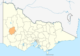
The Rural City of Horsham is a local government area in Victoria, Australia, located in the western part of the state. It covers an area of 4,267 square kilometres (1,647 sq mi) and in June 2018, had a population of 19,875. It includes the towns of Brimpaen, Dadswells Bridge, Dooen, Haven, Horsham, Laharum, Natimuk, Noradjuha and Pimpinio. It was formed in 1995 by the amalgamation of the City of Horsham, most of the Shire of Wimmera and Shire of Arapiles, and part of the Shire of Kowree.

Stawell ( "stall"), is an Australian town in the Wimmera region of Victoria 237 kilometres (147 mi) west-north-west of the state capital, Melbourne. Located within the Shire of Northern Grampians local government area, it is a seat of local government for the shire and its main administrative centre. At the 2021 census, Stawell had a population of 6,220.

Crib Point is a town on the Mornington Peninsula in Melbourne, Victoria, Australia, 64 km (40 mi) south-east of Melbourne's Central Business District, located within the Shire of Mornington Peninsula local government area. Crib Point recorded a population of 3,343 at the 2021 census.

The Victorian government's Wimmera Southern Mallee subregion is part of the Grampians region in western Victoria. It includes most of what is considered the Wimmera, and part of the southern Mallee region. The subregion is based on the social catchment of Horsham, its main settlement.

Ceduna is a town in South Australia located on the shores of Murat Bay on the coast, west of the Eyre Peninsula. It lies west of the junction of the Flinders and Eyre Highways around 786 km northwest of Adelaide. The nearby port of Thevenard lies 3 km to the west on Cape Thevenard. It is in the District Council of Ceduna, the federal electoral Division of Grey, and the state electoral district of Flinders.

Arkaroola is the common name for the Arkaroola Wilderness Sanctuary, a wildlife sanctuary situated on 610 square kilometres of freehold and pastoral lease land in South Australia. It is located 700 kilometres north of the Adelaide city centre in the Northern Flinders Ranges, adjacent to the Vulkathunha-Gammon Ranges National Park and the Mawson Plateau. The most common way to get there is by car, but air travel can be chartered from Parafield Airport, Adelaide Airport or Aldinga Airfield. It was used as a location set for the 2002 film The Tracker.

Thevenard is a port town in the far west of Eyre Peninsula, South Australia. It is contiguous with the larger town of Ceduna. Its name derives from nearby Cape Thevenard, which in turn was named after Antoine-Jean-Marie Thévenard, a French admiral. In the 2021 census, Thevenard had a population of 563.
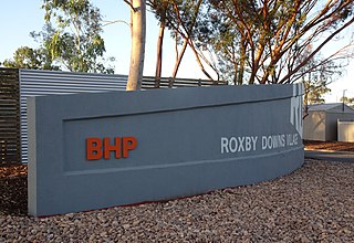
Roxby Downs is a town and locality in the Australian state of South Australia about 511 kilometres (318 mi) north of the state capital of Adelaide. The town has a highly transient population of around 4,000 people.

Innamincka, formerly Hopetoun, is a township and locality in north-east South Australia. By air it is 820 kilometres north-east of the state capital, Adelaide, and 365 kilometres north-east of the closest town, Lyndhurst. It is 66 kilometres north-east of the Moomba Gas Refinery. The town lies within the Innamincka Regional Reserve and is surrounded by the Strzelecki Desert to the south and the Sturt Stony Desert to the north. It is linked by road to Lyndhurst via the Strzelecki Track, to the Birdsville Developmental Road via Cordillo Downs Road and Arrabury Road, and the Walkers Crossing Track to the Birdsville Track. The Walkers Crossing Track is closed in summer and only traversable in dry weather. The township is situated along the Cooper Creek, a part of the Lake Eyre basin.

Millicent is a town in the Australian state of South Australia located about 399 kilometres (248 mi) south-east of the state capital of Adelaide and about 50 kilometres (31 mi) north of the regional centre of Mount Gambier. In the 2011 census, the population was 5,024.

Woombah is a small but growing bushland village in Clarence Valley, New South Wales, Australia. This hamlet is located to the south of the World Heritage-listed Bundjalung National Park, near the Port of Yamba on Goodwood Island, and 15 minutes from the fishing village of Iluka, New South Wales.
Israelite Bay is a bay and locality on the south coast of Western Australia.

Balmoral is a township in the Shire of Southern Grampians in the Western District of Victoria, Australia. At the 2016 census, Balmoral and the surrounding area had a population of 294.
Yellabinna is a locality in the Australian state of South Australia located to the north of the town of Ceduna in the western part of the state.

Inneston is a locality in the Australian state of South Australia located on the south-western end of Yorke Peninsula about 155 kilometres west of the state capital of Adelaide. Historically, it is notable as a site for the mining of gypsum and since 1970, the majority of the land within the current extent of the locality is within the protected area called the Dhilba Guuranda–Innes National Park.

Lake Gilles is a locality in the Australian state of South Australia located on the Eyre Peninsula about 278 kilometres north west of the state capital of Adelaide and about 35 kilometres to the north-east of the town of Kimba.
Etadunna is a locality in the Australian state of South Australia located about 684 kilometres north of the capital city of Adelaide and about 108 kilometres north-east of the town of Marree.
Pureba is a locality in the Australian state of South Australia located on the west coast of Eyre Peninsula and on land to the immediate north of the peninsula about 528 kilometres north-west of the state capital of Adelaide and about 52 kilometres north-east and 90 kilometres north respectively of the municipal seats of Ceduna and Streaky Bay.
Kyeema is a locality in the Australian state of South Australia located about 39 kilometres (24 mi) south of the state capital of Adelaide and about and 27 kilometres (17 mi) north-west of the municipal seat of Goolwa.
'The Douglas Mine' also known as the 'Douglas and Echo Mine' is a mineral sands mine near the small Western-Victorian town of Balmoral. It was established in 2006 to mine rutile and zircon, and then closed in 2012. Watpac, the construction company responsible for mine operations, estimated that it extracted 7.5 million tonnes of mineral sands from the mine.


