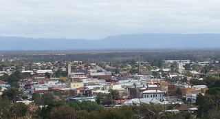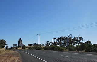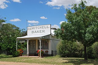
Stawell, is an Australian town in the Wimmera region of Victoria 237 kilometres (147 mi) west-north-west of the state capital, Melbourne. Located within the Shire of Northern Grampians local government area, it is a seat of local government for the shire and its main administrative centre. At the 2016 census, Stawell had a population of 6,032.

Nhill is a town in the Wimmera, in western Victoria, Australia. Nhill is located on the Western Highway, halfway between Adelaide and Melbourne. At the 2016 census, Nhill had a population of 1,749. "Nhill" is believed to be a Wergaia word meaning "early morning mist rising over water" or "white mist rising from the water".

Jeparit is a town on the Wimmera River in Western Victoria, Australia, 370 kilometres (230 mi) north west of Melbourne. At the 2016 census Jeparit had a population of 342, down from 394 five years earlier.

Dimboola is a town in the Shire of Hindmarsh in the Wimmera region of western Victoria, Australia, 334 kilometres north-west of Melbourne.

Ararat is a city in south-west Victoria, Australia, about 198 kilometres (120 mi) west of Melbourne, on the Western Highway on the eastern slopes of the Ararat Hills and Cemetery Creek valley between Victoria's Western District and the Wimmera. Its urban population according to 2016 census is 8,297 and services the region of 11,752 residents across the Rural City's boundaries. It is also the home of the 2018/19 GMGA Golf Championship Final.

Natimuk is a town in Western Victoria, Australia. It is located about 300 kilometres (190 mi) northwest of Melbourne. A further 10 km (6.2 mi) west of Natimuk is one of Australia's best climbing areas, Mount Arapiles. At the 2016 census, Natimuk had a population of 514, up from 449 in 2006.

Murtoa is a wheat district town in Victoria, Australia, situated around Lake Marma on the Wimmera Highway, 305 kilometres (190 mi) north-west of the state capital, Melbourne. The town is in the Shire of Yarriambiack local government area. At the 2016 census, Murtoa had a population of 865 and is located around 30 kilometres from Horsham, a major city in the Wimmera region.

Warracknabeal is a wheatbelt town in the Australian state of Victoria. Situated on the banks of the Yarriambiack Creek, 330 km north-west of Melbourne, it is the business and services centre of the northern Wimmera and southern Mallee districts, and hosts local government offices of the Shire of Yarriambiack. At the 2011 census Warracknabeal district had a population of 2,745, of which 2,340 lived in the town.

Edenhope is a town in Victoria, Australia. It is located on the Wimmera Highway, 30 kilometres from the South Australian border, in the Shire of West Wimmera local government area. At the 2016 census Edenhope had a population of 946.

St Arnaud is a town in the Wimmera region of Victoria, Australia, 244 kilometres north west of the capital Melbourne. It is in the Shire of Northern Grampians local government area. At the 2016 census, St Arnaud had a population of 2,193.

Horsham is a regional city in the Wimmera region of western Victoria, Australia. Located on a bend in the Wimmera River, Horsham is approximately 300 kilometres (190 mi) northwest of the state capital Melbourne. As of the 2021 Census, Horsham had a population of 20,429. It is the most populous city in Wimmera, and the main administrative centre for the Rural City of Horsham local government area. It is the eleventh largest city in Victoria after Melbourne, Geelong, Ballarat, Bendigo, Wodonga, Mildura, Shepparton, Warrnambool, Traralgon, and Wangaratta.

Antwerp is a locality in Victoria, Australia on the Dimboola – Rainbow Road, in the Shire of Hindmarsh, 14 kilometres (8.7 mi) north of Dimboola and 356 kilometres (221 mi) north-west of Melbourne. The Wimmera River passes 500 metres (550 yd) west of the locality. The population at the 2016 census was 63.
Apsley is a small town in Victoria, Australia. It is on the Wimmera Highway, in the Shire of West Wimmera, 420 kilometres north-west of Melbourne, and 7 kilometres east of the South Australian border. The town is named after Apsley House in London. It was surveyed in 1851 and proclaimed in 1852, a Post Office opening on 1 January 1854 replacing that of Lake Wallace nearer what is now Edenhope serving the grazing population.

Minyip is a town in the Wimmera region of Victoria, Australia, 320 kilometres (199 mi) north west of Melbourne. It is in the Shire of Yarriambiack local government area. At the 2016 census, Minyip had a population of 524.

Harrow is a town in the Wimmera region of western Victoria, Australia. The town is located in the Shire of West Wimmera local government area, 391 kilometres north west of the state capital Melbourne, overlooking the Glenelg River valley. At the 2016 census, Harrow and the surrounding area had a population of 200.

Goroke is a town in the Wimmera region of Victoria. The town is located in the Shire of West Wimmera local government area, 370 kilometres (230 mi) north west of the state capital, Melbourne. At the 2016 census, Goroke recorded a population of 299.

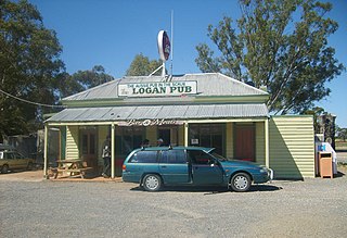
Logan is a locality in Victoria, Australia. It is located at the intersection of Bendigo-St Arnaud Road and Logan-Wedderburn Road in the Loddon Shire. The Australian Bureau of Statistics does not calculate its population, although the town is estimated to have approximately 15 people. According to the Victorian Electoral Commission the locality has 45 registered voters.

Minimay is a small town located in Victoria, Australia. The town is in the Shire of West Wimmera 25 kilometres (25,000 m) from the South Australian border, about halfway between Melbourne and Adelaide. At the 2016 census, Minimay and the surrounding area recorded a population of 84. A signpost outside the town lists the town's population at 9.

Glenorchy is a town in the Wimmera district of the Australian state of Victoria. The town in located in the Northern Grampians Shire and on the Wimmera River, 257 kilometres (160 mi) north-west of the state capital, Melbourne. At the 2016 census, Glenorchy had a population of 125.

Navarre is a town in the Wimmera region of the Australian state of Victoria. The town is in the Shire of Northern Grampians and Shire of Pyrenees local government areas, 227 kilometres (141 mi) north west of the state capital, Melbourne and 37 kilometres (23 mi) north east of the regional centre of Stawell. At the 2011 census, Navarre and the surrounding area had a population of 241.


