The Victorian government's Wimmera Southern Mallee subregion is part of the Grampians region in western Victoria. It includes most of what is considered the Wimmera, and part of the southern Mallee region. The subregion is based on the social catchment of Horsham, its main settlement.
Rainbow is a town in the Shire of Hindmarsh in northwest Victoria, Australia, 400 kilometres (250 mi) from Melbourne. The nearest large towns are Warracknabeal, Dimboola and Nhill, all to the south. At the 2021 census, Rainbow had a population of 672.

Hopetoun is a town which serves as the major service centre for the Southern Mallee area of Victoria, Australia. Hopetoun is situated 400 km (249 mi) north-west of Melbourne on the Henty Highway in the Shire of Yarriambiack. In the 2021 census, Hopetoun had a population of 694.

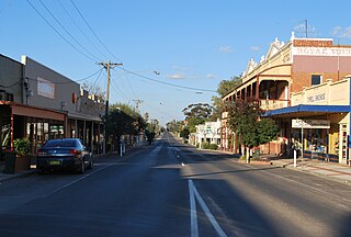
Murtoa is a town in Victoria, Australia, situated around Lake Marma on the Wimmera Highway, 305 kilometres (190 mi) north-west of the state capital, Melbourne. The town is in the Shire of Yarriambiack local government area. At the 2016 census, Murtoa had a population of 865 and is located around 30 kilometres from Horsham, a major city in the Wimmera region.
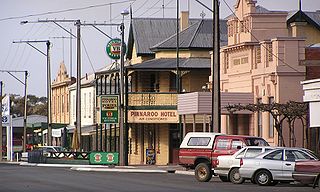
Pinnaroo is a town in the Murray Mallee region of South Australia, near the border with Victoria, 243 km east of Adelaide. Pinnaroo is on the north side of the Mallee Highway, and on the railway line between Tailem Bend and Ouyen. The roadhouse on the highway at Pinnaroo is the first "food and leg-stretch" stop on the bus route from Adelaide to Sydney.

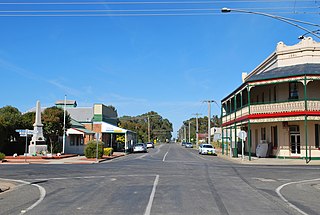
Grenfell is a town in Weddin Shire in the Central West of New South Wales, Australia. It is 370 km (230 mi) west of Sydney. It is close to Forbes, Cowra and Young. At the 2011 census, Grenfell had a population of 1,996. The town is served daily by connecting NSW TrainLink services from Sydney via Bathurst and Lithgow. Grenfell is approximately 4+3⁄4 hours from Sydney and 2+1⁄2 hours from Canberra.

The Mallee is a sub-region of Loddon Mallee covering the most north-westerly part of Victoria, Australia and is bounded by the South Australian and New South Wales borders. Definitions of the south-eastern boundary vary, however, all are based on the historic Victorian distribution of mallee eucalypts. These trees dominate the surviving native vegetation through most of Mallee,. Its biggest settlements are Mildura and Swan Hill.

Ouyen is a town in Victoria, Australia, located in the Rural City of Mildura at the junction of the Calder Highway and Mallee Highway, 105 kilometres (65 mi) south of Mildura, and 441 km (274 mi) northwest of Melbourne. At the 2016 census, the town had a population of 1,045.

Minyip is a town in the Wimmera region of Victoria, Australia, 320 kilometres (199 mi) north west of Melbourne. It is in the Shire of Yarriambiack local government area. At the 2016 census, Minyip had a population of 524.
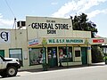
Berriwillock is a town in the Mallee region in the north-west of the Australian state of Victoria. Berriwillock is 332 kilometres (206 mi) north-west of the state capital, Melbourne. Nearby towns include Boigbeat (about 11 kilometres north west and Culgoa 11 kilometres south east.
Sea Lake is a town in the Mallee district of north-west Victoria, Australia and is situated on the southern shores of Lake Tyrrell. The town is located on the Calder Highway, 351 kilometres (218 mi) north-west of Melbourne, and 73 kilometres (45 mi) west of Swan Hill. Sea Lake is in the heart of Australia's wheat belt, and is the main township for a number of wheat farms in the region. At the 2021 census, Sea Lake had a population of 619.
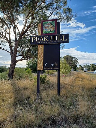
Peak Hill is a town in Parkes Shire in the Central West of New South Wales, Australia. At the 2021 census, Peak Hill had a population of 768. It is located on the Newell Highway and the Parkes to Narromine railway line.

Woomelang is a town in the Mallee region of Victoria, Australia. The town is in the Shire of Yarriambiack local government area and on the Sunraysia Highway, 359 kilometres (223 mi) north-west of the state capital, Melbourne, 183 kilometres (114 mi) south-east of Mildura and 154 kilometres (96 mi) north of Horsham. At the 2011 census, Woomelang and the surrounding area had a population of 191.
Tungamah is a town in the Goulburn Valley region of northern Victoria, Australia. The town is located in the Shire of Moira local government area, 259 kilometres (161 mi) from the state capital, Melbourne. Tungamah is situated on the banks of Boosey Creek and at the 2006 census, Tungamah had a population of 355.

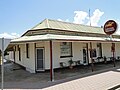
Rupanyup is a town in rural Victoria, Australia. As of the 2016 census, it had a population of 536. The name Rupanyup is an Aboriginal word meaning 'branch hanging over water'.

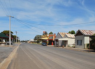
Beulah is a town in the southern Mallee region of Victoria, Australia. The town is in the Shire of Yarriambiack local government area, 395 kilometres north-west of the state capital, Melbourne. At the 2016 census, Beulah had a population of 329.

Walpeup is a town in the Mallee region of north west Victoria. The town is in the Rural City of Mildura local government area and on the Mallee Highway and Pinnaroo railway line between Ouyen and the South Australian border, 458 kilometres (285 mi) north west of the state capital, Melbourne and 130 kilometres (81 mi) south west of the regional centre of Mildura. At the 2016 census, Walpeup had a population of 158.
The Katamatite railway line is a disused railway located in northern Victoria, Australia. It was built as a tramway, running from Dookie to Katamatite, and opened on 11 August 1890. Two years later it was taken over by the Victorian Railways (VR) and sections of the track were upgraded allowing its reclassification as a railway. The line was formally closed on 13 January 1987.

Guido van Helten is an Australian artist, known for his photorealistic murals.
Lubeck is a town in the Shire of Northern Grampians and the Shire of Yarriambiack, Victoria, Australia. At the 2021 census, Lubeck had a population of 40.