
Bajhang District (Nepali: बझाङ जिल्ला Listen , a part of Sudurpashchim Pradesh, is one of the seventy-seven districts of Nepal. The district, with Chainpur, that is part of Jaya Prithvi Municipality, as its district headquarters, covers an area of 3,422 km2 and has a population of 195,159. The headquarter Chainpur is situated at the bank of Seti River and Bauli Gaad. Bitthad Bazar is bordered with Baitadi District which is the place of Bitthad Kalika and Kedar. This place was famous for fresh milk and yogurt.

Bajura District, a part of Sudurpashchim Pradesh, is one of the seventy-seven districts of Nepal. The district, with Martadi as its district headquarters, covers an area of 2,188 km2 (845 sq mi) and had a population of 108,781 in 2001 and 134,912 in 2011. The district has nine municipalities, 9 Ilakas and 1 constituency areas. The district is situated in Longitude between 81° 10′ 20″ to 81° 48′ 27″ East and Latitude 29° 16′ 21″ to 29° 56′ 56″ North. Geographically the district is divided in three distinct regions from north to south viz. Higher Himalayan Region, Higher Mountain and mid – Mountains. The Higher Himalayan region comprises Saipal Himalayan range; High Mountain region comprises Doha Lekh and Ghori Lekh. Similarly, Mid-Mountain range comprises different ranges of mountains e.g. Badimalika Temple. The District has started from 300m to 6400m in height. The annual rainfall is about 13,433 mm and temperatures vary from 0 °C to 40 °C. The livelihood of more than 80% of the district population depends on agriculture farming, mainly small scale livestock. Due to low level of agricultural production, the majority of the households face acute food shortages for a large part of the year. According to the National Census 2011, the total population of the district is 134,912 comprising 69,106 female (51%) and 65,806 male (49%) residing in 24,908 households. Bajura district has an average population density of around 62 people per square km. The average family size is 5.4. Life expectancy of the people is 58 years. The average literacy rate is about 32%. Bajura district has a multi ethnic composition with Chhetri, Kami, Thakuri, Brahman, Damai, SarkI and Sanyashi. The common language is Nepali (96%) followed by Bhote Sherpa (0.46%) and Tamang (0.42%). Although accessibility to Bajura is very poor, this is improving rapidly. The Government strategy is mainly focused on the connection of VDC headquarters with all-weather motor able roads to SRN or District headquarters. Moreover, the DDC body of Bajura district has given higher priority on rural roads.
Bhagyeshwar is a business center in Sanphebagar Municipality in Achham District in the Seti Zone of western Nepal. It was annexed to form the new municipality since 18 May 2014. According to the 1991 Nepal census, the village had a population of 1158 living in 257 houses. At the time of the 2001 Nepal census, the population was 1321, of which 62% was literate.
Nandegata is a village in Achham District in the Seti Zone of western Nepal. At the time of the 1991 Nepal census, the village had a population of 2881 living in 542 houses. At the time of the 2001 Nepal census, the population was 3356, of which 33% was literate.
Kot Bhairab is a village in Bajhang District in the Seti Zone of north-western Nepal. At the time of the 1991 Nepal census it had a population of 2,734 and had 506 houses in the village.
Majhigaun is a village in Bajhang District in the Seti Zone of north-western Nepal. At the time of the 1991 Nepal census it had a population of 3,309 and had 622 houses in the village.

Atichaur is a village in Bajura District in the Seti Zone of north-western Nepal. At the time of the 1991 Nepal census it had a population of 2,968 and had 546 houses in the village.
Bichhiya is a village in Bajura District in the Seti Zone of north-western Nepal. At the time of the 1991 Nepal census it had a population of 1,904 and had 352 houses in the village.
Gotri is a village in Bajura District in the Seti Zone of north-western Nepal. It was founded in 1954. At the time of the 1991 Nepal census it had a population of 3,545 and had 584 houses in the village.
Jagannath, Nepal is a village in Bajura District in the Seti Zone of north-western Nepal. At the time of the 1991 Nepal census it had a population of 2,612 and had 538 houses in the village.
Jayabageshwari is a village in Bajura District in the Seti Zone of north-western Nepal. At the time of the 1991 Nepal census it had a population of 1,782 and had 332 houses in the village.
Kuldeumandau is a village in Bajura District in the Seti Zone of north-western Nepal. At the time of the 1991 Nepal census it had a population of 4,776 and had 969 houses in the village.
Jugada is a village in Bajura District in the Seti Zone of north-western Nepal. At the time of the 1991 Nepal census it had a population of 3,802 and had 709 houses in the village.
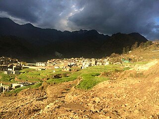
Martadi is a town and seat of Bajura District in the Seti Zone of north-western Nepal. At the time of the 1991 Nepal census it had a population of 4,618 and had 942 houses in the town but now it has increased by growth rate of 2.62.
Tolidewal is a village in Bajura District in the Seti Zone of north-western Nepal. At the time of the 1991 Nepal census it had a population of 2,991 and had 599 houses in the village.
Sappata is a village in Bajura District in the Seti Zone of north-western Nepal. At the time of the 1991 Nepal census it had a population of 3,788 and had 662 houses in the village.
Manakot is a village in Bajura District in the Seti Zone of north-western Nepal. At the time of the 1991 Nepal census it had a population of 1,849 and had 376 houses in the village.
Mahamadpur is a Village Development Committee in Bardiya District in Province No. 5 of south-western Nepal. At the time of the 1991 Nepal census it had a population of 8,191 and had 1152 houses in the town.
Sanesri is a village development committee in Bardiya District in Province No. 5 of south-western Nepal. At the time of the 1991 Nepal census it had a population of 12,542 and had 2266 houses in the town.
Lihi is a village development committee in Jumla District in the Karnali Zone of north-western Nepal. At the time of the 1991 Nepal census it had a population of 2397.

