Bhojpur is one of the two urban municipalities of Bhojpur District of Province No. 1 of Nepal.
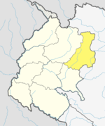
Bajura District, a part of Sudurpashchim Province, is one of the seventy-seven districts of Nepal. The district, with Martadi as its district headquarters, covers an area of 2,188 km2 (845 sq mi) and had a population of 108,781 in 2001 and 134,912 in 2011.
Kohalpur is a municipality in Banke District of Lumbini province of Nepal. The municipality was established on 18 May 2014 merging the existing two Village Development Committees i.e. Rajhena and Kohalpur. The town is in East-West highway and one of the fastest developing places in Nepal. A neighboring city Nepalgunj is on South (16 km), with Ghorahi city (135 km) to west in Dang District and further 6 km is the Indian border. In fact it is a growing city in the western region of Nepal. It has a junction to diverse the roadway transport to east, west, north and south from the city.
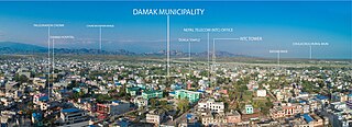
Damak, a city in eastern Nepal is one of the oldest municipalities in Jhapa District in Province No. 1 of Nepal. It is situated between the Ratuwa River in the east and the Maawa River in the west. It has Sivalik Hills in its north and ends with the intersection of Ratuwa River and Maawa River in the south. Mahendra Highway crosses this municipality nearly bisecting it. It is the largest city in Jhapa District as well as in Province No. 1 with a population of 75,743 in 2011 A.D
Juropani (जुरोपानी) is a village development committee of the Jhapa district of Nepal.
Siraha is the headquarters and municipality of Siraha District, a part of Madhesh Province, Nepal. Siraha had a population of 28,442 according to the census of 2011. and a population of 82,531 as of 2015. The mayor is Asheswor Yadav and the deputy mayor is Dr. Namita Yadav. Both assumed office on 25 September 2017. The town is at 80 metres (260 ft) altitude, 29 kilometres (18 mi) ESE of Janakpur.
Budhiganga Municipality is the newly formed municipality in Bajura District in the Sudurpashchim Province of Nepal. It was formed in March, 2017 as decided by the Cabinet in line with the Constitution of Nepal 2015, recommended by the Local Bodies Restructuring Commission (LBRC).

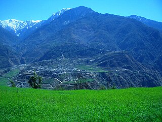
Duradanda is one of the mid-hills in Lamjung District. Lamjung is one of districts in Gandaki in central Nepal. Duradanda used to have former six village development committees (VDCs) namely Chandreshwor, Duradanda, Dhuseni, Ishaneshwor, Neta, and Purankot. The new constitution has restructured the local bodies and these VDCs are formally non-existent. The name 'Duradanda' is composed of two terms: Dura= historical Dura tribes + danda= hill in Nepali. Duras inhabited this place from the historical times and were important political game players in the past, especially when Nepal was fragmented into 22–24 Kingdoms, known as Bayise Chaubisi rajyas. Duradanda is considered to be the place of origin of the 'Dura' tribe. Duras have their own language and culture but are being forgotten because of an increasing influence from other cultures. Dura language, in fact, is no longer in use as the tribe uses the Nepali language. Only old generations knows the language, and not many people of this generation are alive at this time. Thus, Dura language is in danger of being lost completely. Apart from Duras, Duradanda is also known for famous historical movements called 'Halo Kranti ' and 'Siksha Kranti '. Sarvodaya High School was one of the oldest school in the entire region of Central Nepal. Thus, people from very far places used to come to Duradanda for formal school education from Sarvodaya High School. At that time, young people who wanted to come here seeking school education from far villages used to say: "Duradanda kei chhaina tadha, janchhu ma ta sikshya ko khojima" meaning that "Duradanda is no longer far and I want to go there seeking my education". There were no hostels, so the youngesters used to live as guests in locals' houses, preferably relatives. In return, they had to bring commodities or to provide labor services for household and/or farm works.

Dudhauli is a municipality of the Sindhuli District in the Janakpur Zone of south-eastern Nepal.

Pakhribas is an urban municipality out of three urban municipalities located in Dhankuta District of Province No. 1 of Nepal. Pakhribas municipality established on 2 December 2014 merging following VDCs: Pakhribas, Sanne, Phalate, Ghorlikharka and Muga.

Katahariya is a municipality in Rautahat District in the Narayani Zone of south-eastern Nepal. Before September 2017, Katahariya was one of the Village Development Committees with 8 wards. At the time of the 1991 Nepal census, it had a population of 4,619 people living in 835 individual households. Katahariya is famous for its vegetables and cattle market. It has a well-maintained Farmers' market (vegetable) and Cattle (domestic-animal) market. Katahariya is a fast-growing VDC, with the main occupations of local people being business and farming.

Padampur is a municipality in Chitwan District in the Narayani Zone of southern Nepal. At the time of the 1991 Nepal census it had a population of 8,884 people living in 1,559 individual households. It was transferred in new location named Saguntol by Government of Nepal and completed with in 8 years i.e. from 2050 BS to 2058 BS. Previously it was at the lap of Rapati river and inside the Chitwan National Park. Flood of Rapati river in monsoon season destroy farmers crops. Wild animals also harmed their crops. Transportation, electricity, road and educational facilities were beyond people's access. It was known as one of the remote areas of the Chitwan district. In a view of agriculture, It was the best place for farmers. After the new dawn of democracy in 2046, New government was asked to shift this village for peoples safety and conservation of forest and wild animal. The cabinet of Girija Prasad Koirala was assured to shift in a convenience place soon and started the task immediately. This task was successfully done by the politician Baburam Puri of the Nepali Congress. The late Sailaja Acharya visited the people and understood their griefs and proposed to shift it next to Sagoontol near Jutpani VDC. This was a very difficult task to accomplish successfully. People from the Western Chitwan were stood against it but government took bold decision in favour of people of Padampur. Now it is about 2.5 km (1.6 mi) east to Bharatpur, district headquarters of Chitwan. Electricity, roads and transportation facility are comparatively better here. 2,800 households were there now. According to the 2001 census, the total population of the VDC was 11,336 with total households 2,137. Tharus are the dominant ethnic group with 45.89% of the total VDC population. Brahman, Kshetri, Tamang, Gurung and Newar are other castes here. Mainly banana, maize and oil are farmed here. Except ward no 1 there are deep tubewells to Irrigate farmlands. Poultry, dairy, epiculture, mushroom farming and goat keeping have great potentials here. A campus, A higher secondary school, a secondary boarding school and other 7 primary and lower secondary schools are providing education here. Health post, and Post office are too doing their best for providing services to locals. Drinking water is provided in better and modern way. Pipelines of drinking water are available within all roads (113 km) of Padampur. An NGO veterinary office is also serving and helping farmers. Since last 5 years this VDC is starting to be known as one of pocket areas of commercial banana farming of the nation. Nobody is landless here and this is the special feature here. Padampur is very attractive location for migratory view and daily people are migrating here. It is like a colonial place for settlement of people. Government has sifted it in a well planned way and that is why it is the second model VDC of Nepal. Now this village has merged in Kalika Municipality and shares 4 wards in it i.e. Kalika -9, Kalika-10, Kalika-11 and Kalika-12.
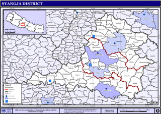
Pindikhola was a village development committee in Syangja District in the Gandaki Zone of central Nepal. At the time of the 2011 Nepal census it had a population of 4,956 people living in 1,119 individual households.
Bardaghat [नेपाली: बर्दघाट] is a Municipality in Parasi District in Lumbini Province, Nepal. It is situated in the lap of Chure range. This municipality was established on 18 May 2014 by merging existing Makar and Panchanagar VDCs. Again during the local election, the neighbouring VDC Dawanne devi and some part of Dhurkot, Jamuniya, Rupauliya were merged in it. It has a population of 55,382 with the area of 162.05 km2. It is an emerging town of Parasi District that is developing rapidly.
Shivasatakshi is a municipality in the southeastern part of Jhapa District in the Mechi Zone of eastern Nepal. The new municipality was formed by merging three existing villages—Shivaganj, Satasidham and Dharampur —on 2 Dec 2014. The office of the municipality is that of the former Satasidham village development committee (VDC).

Dakneshwori Municipality is located in Saptari District in Madhesh Province of Nepal. It was formed in 2016 occupying current 10 sections (wards) merging previous Kabilasha, Hariraha, Tarhi, Bhuthi, Pato, Aurahi, Brahampur, Gamahariya Parwaha, Patthargada and Banaula VDCs. It occupies an area of 69.11 km2 with a total population of 44,782. Dakneshwori Municipality is named after the famous temple Dakneshwori Bhagwati located at ward no. 5, Pato.
Pacharauta is a municipality in Bara District in Province No. 2 of South-Eastern Nepal. It was formed in 2016 occupying current 9 sections (wards) from previous 9 former VDCs. It occupies an area of 44.01 km2 with a total population of 34,175.
Tolidewal was a VDC in Bajura District. Now this VDC is the part of Triveni Municipality of Sudurpashchim Province. At the time of 1991 Nepal census it had a population of 2,991 and had 599 houses in the village. Triveni Municipality office is also located here.
Badimalika Municipality is a newly formed municipality in Bajura District in the Sudurpashchim Province of Nepal. It was formed in March, 2017 as decided by the Cabinet in line with the Constitution of Nepal 2015
Triveni is a municipality in Bajura district in the Sudurpashchim Province of Nepal. It was formed in March 2017 as decided by the Cabinet in line with the Constitution of Nepal 2015, recommended by the Local Bodies Restructuring Commission (LBRC).