Martadi मार्तडी | |
|---|---|
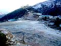
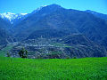
 Martadi at Glance | |
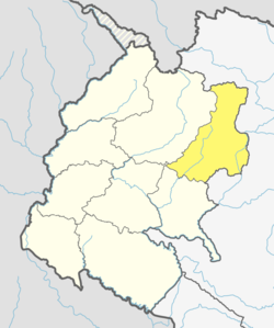
 Martadi Location in Nepal | |
| Coordinates: 29°15′29″N81°13′26″E / 29.258°N 81.224°E | |
| Country | |
| Province | Sudurpaschim |
| Zone | Seti |
| District | Bajura |
| Elevation | 2,030 m (6,660 ft) |
| Population (2011) | |
• Total | 8,807 |
| • Religions | Hindu |
| Time zone | UTC+5:45 (Nepal Time) |
| Area code | 097 |
| Website | http://www.badimalikamun.gov.np |
Martadi is a town and seat of Bajura District Coordination Committee. It is also the headquarters of the Badi Malika Municipality. At the time of the 1991 Nepal census it had a population of 4,618 and had 942 houses in the town but now it has increased by growth rate of 2.62 and reached 8807. [1]
Contents
The town and surrounding area is under the jurisdiction of the Martadi District Police.