Related Research Articles
Kelapa Dua is a town and an administrative district (kecamatan) located in the Tangerang Regency of Banten Province on Java, Indonesia. Located immediately south of the city of Tangerang, it covers an area of 26.22 km2 and had a population of 178,035 at the 2010 Census and 169,340 at the 2020 Census; the official estimate as at mid 2023 was 167,550.

Pandeglang Regency is a regency of Banten province, Indonesia. It is mainly located on the west and south coasts of the island of Java and is the most westerly regency on Java Island, but it also includes several offshore islands such as Panaitan, Deli and Tinjil. The regency has an area of 2,746.81 km2, and a population at the 2010 Census of 1,149,610, rising to 1,272,687 at the 2020 Census; the official estimate as of mid-2023 was 1,312,766 - comprising 672,828 males and 639,938 females. The regency seat is the town of Pandeglang in the northeast of the regency, but the most densely-populated district is the town of Labuan on the west coast.

Benda is a town and an administrative district (kecamatan) of Tangerang City, in Banten Province of Indonesia, on the island of Java. The district covers an area of 5.92 km2, and had a population of 83,017 at the 2010 Census and 83,526 at the 2020 Census; the official estimate as at mid 2023 was 85,769. Jakarta's main international airport, Soekarno–Hatta International Airport is located in the district.
Cibodas is a town and an administrative district (kecamatan) of Tangerang City, in Banten Province of Indonesia, on the island of Java. The district covers an area of 9.61 km2, and had a population of 142,479 at the 2010 Census and 147,279 at the 2020 Census; the official estimate as at mid 2023 was 158,036.
Cipondoh is a town and an administrative district (kecamatan) of Tangerang City, in Banten Province of Indonesia, on the island of Java. The district covers an area of 17.91 km2, and had a population of 216,346 at the 2010 Census and 248,212 at the 2020 Census; the official estimate as at mid 2023 was 231,127.
Larangan is a town and an administrative district (kecamatan) of Tangerang City, in Banten Province of Indonesia, on the island of Java. The district covers an area of 9.40 km2, and had a population of 163,901 at the 2010 Census and 165,599 at the 2020 Census; the official estimate as at mid 2023 was 151,860.
Neglasari is a town and an administrative district (kecamatan) of Tangerang City, in Banten Province of Indonesia, on the island of Java. The district covers an area of 16.08 km2, and had a population of 103,504 at the 2010 Census and 115,520 at the 2020 Census; the official estimate as at mid 2023 was 124,907.
Periuk is a town and an administrative district (kecamatan) of Tangerang City, in Banten Province of Indonesia, on the island of Java. The district covers an area of 9.54 km2, and had a population of 129,384 at the 2010 Census and 141,003 at the 2020 Census; the official estimate as at mid 2023 was 144,640.

Ciputat is a town and an administrative district (kecamatan) in the city of South Tangerang, in Banten Province on Java, Indonesia and is inside the Greater Jakarta metropolitan area. It covers an area of 21.11 km2 and had a population of 192,205 at the 2010 Census and 202,722 at the 2020 Census; the official estimate as at mid 2023 was 222,186.

Pamulang is a town and an administrative district (kecamatan) within the city of South Tangerang, in Banten Province on Java, Indonesia. The district covers an area of 28.74 km2 and had a population of 286,270 at the 2010 Census and 305,563 at the 2020 Census; the official estimate as at mid 2023 was 324,059.

Cikarang is a large industrial, commercial and residential town which includes the administrative headquarters of Bekasi Regency, West Java, Indonesia. The biggest industrial estate in Southeast Asia, Kota Jababeka is located there.

Dompu is a town and the administrative centre of the Dompu Regency, located in the eastern part of the island of Sumbawa, in central Indonesia's province of West Nusa Tenggara. It is the third largest town on the island of Sumbawa, with a district population of 49,854 at the 2010 Census, which by the 2020 Census had grown to 54,987; the official estimate as at mid 2023 was 57,680. It is connected by provincial road to Bima and Sape.

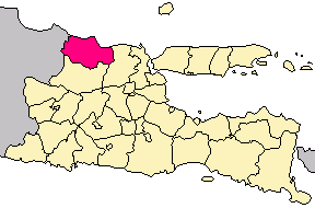
Tuban Regency is a regency in the East Java province of Indonesia. The Dutch name of the regency is 'Toeban'. It covers a land area of 1,839.94 sq. km, and had a population of 1,118,464 at the 2010 Census and 1,198,012 at the 2020 Census; the official estimate as of mid-2023 was 1,258,368. The administrative centre is the coastal town of Tuban.
Pandeglang is a town (kelurahan) and an administrative district (kecamatan) located in the Pandeglang Regency of Banten Province on Java, Indonesia. Located in the northeast of the regency, it covers an area of 16.85 km2 and had a population of 44,039 at the 2010 Census and 43,897 at the 2020 Census; the official estimate as at mid 2023 was 45,279. The administrative centre is in Kabayan kelurahan.
Majasari is an administrative district (kecamatan) located in the northeast corner of Pandeglang Regency in Banten Province on Java, Indonesia. It covers an area of 19.57 km2 and had a population of 46,126 at the 2010 Census and 53,711 at the 2020 Census; the official estimate as at mid 2023 was 55,402. The administrative centre is in Sukaratu kelurahan.
Cadasari is a village and an administrative district (kecamatan) located in the northeast corner of Pandeglang Regency in Banten Province on Java, Indonesia. It covers an area of 26.20 km2 and had a population of 31,425 at the 2010 Census and 37,114 at the 2020 Census; the official estimate as at mid 2023 was 38,283. The administrative centre is in Cadasari village.
Koroncong is a village and an administrative district (kecamatan) located in the northeast corner of Pandeglang Regency in Banten Province on Java, Indonesia. It covers an area of 17.86 km2 and had a population of 17,643 at the 2010 Census and 21,615 at the 2020 Census; the official estimate as at mid 2023 was 22,296. The administrative centre is in Koroncong village.
Banjar is a village and an administrative district (kecamatan) located in the northeast corner of Pandeglang Regency in Banten Province on Java, Indonesia. It covers an area of 30.50 km2 and had a population of 20,780 at the 2010 Census and 35,459 at the 2020 Census; the official estimate as at mid 2023 was 36,576. The administrative centre is in Banjar village.
Kaduhejo is an administrative district (kecamatan) located in the northeast corner of Pandeglang Regency in Banten Province on Java, Indonesia. It covers an area of 33.57 km2 and had a population of 34,474 at the 2010 Census and 42,279 at the 2020 Census; the official estimate as at mid 2023 was 43,610. The administrative centre is in Sukasari village.
Mekarjaya is a village and an administrative district (kecamatan) located in the northeast corner of Pandeglang Regency in Banten Province on Java, Indonesia. It covers an area of 31.34 km2 and had a population of 19,016 at the 2010 Census and 23,083 at the 2020 Census; the official estimate as at mid 2023 was 23,810. The administrative centre is in Mekarjaya village.