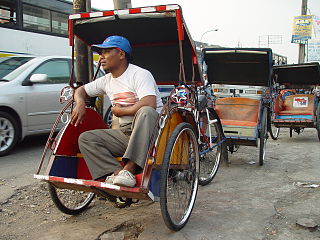
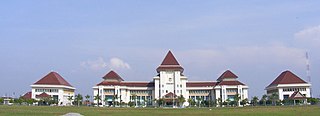
Kelapa Dua is a town and an administrative district (kecamatan) located in the Tangerang Regency of Banten Province on Java, Indonesia. Located immediately south of the city of Tangerang, it covers an area of 26.22 km2 and had a population of 178,035 at the 2010 Census and 169,340 at the 2020 Census; the official estimate as at mid 2023 was 167,550.

Cibinong is a large town and an administrative district (kecamatan) in Bogor Regency, West Java Province, Indonesia which serves as the Regency's administrative seat - not to be confused with the district of the same name in Cianjur Regency. The town is located immediately due south of the city of Depok, which itself lies south of Jakarta, with both Depok and Cibinong being part of the Jakarta Metropolitan Area. The town and district are named after the Binong River. Cibinong District covers a land area of 47.08 km2, and had 326,519 inhabitants at the 2010 Census and 363,424 inhabitants at the 2020 Census; the official estimate as at mid 2023 was 373,988. The administrative headquarters are in the town of Cirimekar.

Karangtengah is a town and an administrative district (kecamatan) of Tangerang City, in Banten Province of Indonesia, on the island of Java. The district covers an area of 10.47 km2, and had a population of 118,473 at the 2010 Census and 117,721 at the 2020 Census; the official estimate as at mid 2023 was 117,440.
Larangan is a town and an administrative district (kecamatan) of Tangerang City, in Banten Province of Indonesia, on the island of Java. The district covers an area of 9.40 km2, and had a population of 163,901 at the 2010 Census and 165,599 at the 2020 Census; the official estimate as at mid 2023 was 151,860.
Cikupa is a village and an administrative district (kecamatan) within Tangerang Regency in the province of Banten, on Java, Indonesia. The district covers an area of 46.00 km2, and had a population of 224,678 at the 2010 Census and 208,302 at the 2020 Census; the official estimate as at mid 2023 was 209,140. The administrative centre is at Budimulya.

Ciputat is a town and an administrative district (kecamatan) in the city of South Tangerang, in Banten Province on Java, Indonesia and is inside the Greater Jakarta metropolitan area. It covers an area of 21.11 km2 and had a population of 192,205 at the 2010 Census and 202,722 at the 2020 Census; the official estimate as at mid 2023 was 222,186.
Kresek is a town and an administrative district (kecamatan) within Tangerang Regency in the province of Banten, on Java, Indonesia. The district covers a land area of 29.99 km2, and had a population at the 2010 Census of 60,735 and at the 2020 Census of 68,039; the official estimate as at mid 2023 was 71,800. The administrative centre is at the town of Kresek, and the district is sub-divided into 9 villages (desa), all sharing the postcode of 15621.

Cikarang is a large industrial, commercial and residential town which includes the administrative headquarters of Bekasi Regency, West Java, Indonesia. The biggest industrial estate in Southeast Asia, Kota Jababeka is located there.
Rangkasbitung is a town and an administrative district (kecamatan), in Banten Province of Java, Indonesia. The district covers an area of 73.76 km2, and had a population of 116,659 at the 2010 Census and 134,945 at the 2020 Census, while the official estimate as of mid-2023 was 139,637.

Dompu is a town and the administrative centre of the Dompu Regency, located in the eastern part of the island of Sumbawa, in central Indonesia's province of West Nusa Tenggara. It is the third largest town on the island of Sumbawa, with a district population of 49,854 at the 2010 Census, which by the 2020 Census had grown to 54,987; the official estimate as at mid 2023 was 57,680. It is connected by provincial road to Bima and Sape.

Tolitoli Regency is a regency of Central Sulawesi Province of Indonesia. It was previously part of a larger Buol Tolitoli Regency, but this was split into two on 4 October 1999 after rapid decentralization of the Indonesian government. The present Tolitoli Regency covers an area of 3,701.54 km2 and had a population of 211,296 at the 2010 Census and 225,154 at the 2020 Census; the official estimate as at mid 2023 was 231,711, comprising 118,180 male and 113,530 female inhabitants. Its regency seat is located at the town of Tolitoli, which is a port town and where the regency's population is concentrated.
Cisauk is a town and an administrative district (kecamatan) located in the Tangerang Regency of Banten Province on Java, Indonesia. The district covers an area of 30.05 km2 and had a population of 64,083 at the 2010 Census and 90,846 at the 2020 Census; the official estimate as at mid 2023 was 91,440. The district centre is at Sampora, and the district is sub-divided into the town (kelurahan) of Cisauk and five villages (desa), listed below with their areas and post codes.
Cisoka is a village and an administrative district (kecamatan) located in the Tangerang Regency of Banten Province on Java, Indonesia. The district covers a land area of 31.21 km2, and had a population of 78,854 at the 2010 Census and 96,433 at the 2020 Census; the official estimate as at mid 2023 was 97,590. The administrative centre is at the town of Cisoka.
Jambe is a village and an administrative district (kecamatan) located in the Tangerang Regency of Banten Province on Java, Indonesia. The district covers a land area of 28.25 km2, and had a population of 40,187 at the 2010 Census and 51,136 at the 2020 Census; the official estimate as at mid 2023 was 55,650. The district administration is at Tiparaya.
Jayanti is a town and an administrative district (kecamatan) located in the Tangerang Regency of Banten Province on Java, Indonesia. It covers a land area of 24.88 km2, and had a population of 63,494 at the 2010 Census and 65,545 at the 2020 Census; the official estimate as at mid 2023 was 70,730. The district administrative centre is at Cikande, and the district is sub-divided into 8 villages (desa), all sharing the postcode of 15611.
Kemiri is a town and an administrative district (kecamatan) located in the Tangerang Regency of Banten Province on Java, Indonesia. It covers an area of 33.45 km2, and had a population of 40,605 at the 2010 Census and 48,061 at the 2020 Census; the official estimate as at mid 2023 was 50,980. The administrative centre is the town of Kemiri, and the district is sub-divided into 7 villages (desa), all sharing the postcode of 15530.
Kronjo is an administrative district (kecamatan) located in the Tangerang Regency of Banten Province on Java, Indonesia. It covers an area of 46.51 km2, and had a population of 55,152 at the 2010 Census and 61,719 at the 2020 Census; the official estimate as at mid 2023 was 65,600. The district administrative centre is at Pagedangan Ilir, which is one of the 10 villages (desa) comprising the district and all sharing the postcode of 15550.
Mekarbaru is a town and an administrative district (kecamatan) located in the Tangerang Regency of Banten Province on Java, Indonesia. It covers a land area of 25.78 km2, and had a population of 35,417 at the 2010 Census and 41,329 at the 2020 Census; the official estimate as at mid 2023 was 44,150. The administrative centre of the district is at the town of Mekarbaru, and the district is sub-divided into 8 villages (desa), all sharing the postcode of 15551.
Pagedangan is a town and an administrative district (kecamatan) located in the Tangerang Regency of Banten Province on Java, Indonesia. The district covers an area of 45.69 km2 and had a population of 95,194 at the 2010 Census and 107,897 at the 2020 Census; the official estimate as at mid 2023 was 111,220. The district centre is at the town of Pagedangan, and the district is sub-divided into the town (kelurahan) of Medang and 10 villages (desa), listed below with their areas and their post codes.
Solear is a town and an administrative district (kecamatan) located in the Tangerang Regency of Banten Province on Java, Indonesia. The district covers a land area of 34.07 km2, and had a population of 73,888 at the 2010 Census and 95,521 at the 2020 Census; the official estimate as at mid 2023 was 100,970. The administrative centre is at the town of Solear.


