Sepatan | |
|---|---|
Town and district | |
 Location | |
 | |
| Interactive map of Sepatan | |
| Country | Indonesia |
| Province | Banten |
| Regency | Tangerang Regency |
| Area | |
• Total | 19.22 km2 (7.42 sq mi) |
| Population (mid 2024 estimate) [1] | |
• Total | 117,734 |
| • Density | 6,126/km2 (15,870/sq mi) |
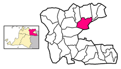
Sepatan is a town and an administrative district (kecamatan) within Tangerang Regency in the province of Banten on Java, Indonesia. The former northern and eastern half of this district were split off in 1992 and 2006 to form a new Pakuhaji District and Sepatan Timur District, respectively; the residual district now covers an area of 19.22 km2 and had a population of 92,353 in 2010 [2] and 116,290 in 2020; [3] the official estimate as at mid 2024 was 117,734 (comprising 60,357 males and 57,377 females). [1] It borders on the city of Tangerang to the southwest, and comprises the town (kelurahan) of Sepatan together with seven rural villages (desa), all eight sharing the postcode of 15520.