
Kaieteur Airport is an airport serving Kaieteur National Park in the Potaro-Siparuni region of Guyana.

Lethem Airport is an airport serving Lethem, a town in the Upper Takutu-Upper Essequibo region of Guyana. The airport has an 1,825-meter long, asphalt-surface runway.
Linden Airport is an airport serving Linden, the capital of the Upper Demerara-Berbice region of Guyana.
Aishalton Airport is an airport serving the village of Aishalton, in the Upper Takutu-Upper Essequibo Region of Guyana. Its only runway is a 915-meter grass surface.

Annai Airport is an airport serving the village of Annai, in the Upper Takutu-Upper Essequibo Region of Guyana. The 1,000-meter runway has 640 metres (2,100 ft) of asphalt paving, with the remainder grass.
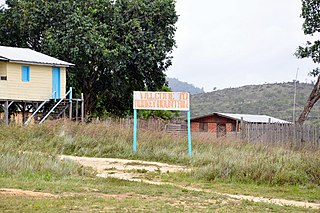
Apoteri Airport is an airport serving the village of Apoteri, in the Upper Takutu-Upper Essequibo Region of Guyana. The runway is a 1,158-meter grass strip.
Awaruwaunau Airport is an airport serving the village of Awarewaunau, an Amerindian village in the Upper Takutu-Upper Essequibo Region of Guyana. The grass-surface runway is merely 570 meters long.
Baramita Airport is an airport serving the Amerindian village of Baramita, in the Barima-Waini Region of Guyana. The solitary, 914-meter runway of the airport is a grass surface.
Bartica Airport is an airport serving the town of Bartica, in the Cuyuni-Mazaruni Region of Guyana. The airport's only runway is a 760-meter asphalt strip.
Imbaimadai Airport is an airport serving the village of Imbaimadai, in the Cuyuni-Mazaruni Region of Guyana. The airport's only runway is a grass-surface, 1,219-meter strip.
Karanambo Airport is an airport serving the village of Karanambo, in the Upper Takutu-Upper Essequibo Region of Guyana. The 1,372-meter long runway is a dirt surface.
Kato Airport is an airport serving the village of Kato, in the Potaro-Siparuni Region of Guyana. The gravel airstrip is 920 meters long.
Lumid Pau Airport is an airport serving the village of Lumid Pau, in the Upper Takutu-Upper Essequibo Region of Guyana. The 1-km long runway has a grass surface.

Mahdia Airport is an airport serving the village of Mahdia, in the Potaro-Siparuni Region of Guyana. The airport's only runway is a 1,067-meter grass strip.
Mountain Point Airport is an airport in the Upper Takutu-Upper Essequibo Region of Guyana. The nearest community is Sand Creek.
Orinduik Airport is an airport serving the mining community of Orinduik in the Potaro-Siparuni Region of Guyana.
Paruima Airport is an airport serving the community of Paruima in the Cuyuni-Mazaruni Region of Guyana.
Ebini Airport is an airport serving the community of Ebini in the Upper Demerara-Berbice Region of Guyana. The 1-kilometer-long runway has a gravel surface.
Monkey Mountain is an indigenous village in the Potaro-Siparuni Region of Guyana. The village is inhabited by the Patamona and Macushi tribes. Monkey Mountain is located near the Brazilian border. The village shares its name with the nearby mountain with a height of 591 metres (1,939 ft). The name is derived from the seasonal migration of monkeys on and around the nearby mountains.
Karasabai is an indigenous village of Macushi Amerindians in the Upper Takutu-Upper Essequibo Region of Guyana. It is located in the South Pakaraima Mountains, and near the Ireng River which flows south to the Amazon River.
