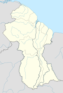
The transport sector comprises the physical infrastructure, docks and vehicle, terminals, fleets, ancillary equipment and service delivery of all the various modes of transport operating in Guyana. The transport services, transport agencies providing these services, the organizations and people who plan, build, maintain, and operate the system, and the policies that mold its development.
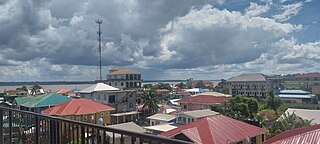
Bartica is a town located on the west bank of the Essequibo River in Cuyuni-Mazaruni, at the confluence of the Cuyuni and Mazaruni Rivers with the Essequibo River in Guyana. It is the regional capital of Cuyuni-Mazaruni.
Trans Guyana Airways Limited is a Guyanese airline which commenced operations in 1956 in Georgetown, Guyana, with a single float airplane. Since then, the company has expanded their fleet to provide domestic and regional transportation, and to Guyana's remote areas.

Cuyuni-Mazaruni is a region of Guyana. Its capital is Bartica, with villages including Issano, Kartabo, Kamarang, and Imbaimadai.
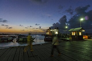
Parika is a port village located in the Essequibo Islands-West Demerara region of Guyana. Its ferry service is operated by the Ministry of Transportation, to and from the Essequibo Islands and West Demerara area. It is a hub for land transport, since it is a route stop for local taxis commonly called "buses."
Guyana Airways was the flag carrier of Guyana. During its operations, Guyana Airways operated services to destinations in the Caribbean, the United States and Canada. The airline was headquartered in Georgetown, Guyana. It was declared insolvent in 2001.

The regions of Guyana are divided into three types of councils: municipal or town councils, neighbourhood democratic councils and Amerindian villages.

Kaieteur Airport is an airport serving Kaieteur National Park in the Potaro-Siparuni region of Guyana.
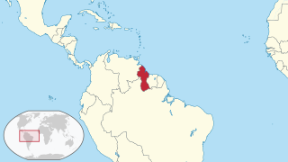
The following is an alphabetical list of topics related to the Co-operative Republic of Guyana.
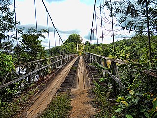
The Denham Suspension Bridge, also known as the Garraway Stream Bridge is a footbridge in Guyana linking Mahdia to Bartica. This suspension bridge was constructed over the Potaro River in an area known as Garraway Stream by a Scottish civil engineer and general contractor, John Aldi, on 6 November 1933.
Imbaimadai Airport is an airport serving the village of Imbaimadai, in the Cuyuni-Mazaruni Region of Guyana. The airport's only runway is a grass-surface, 1,219-meter strip.
Karanambo Airport is an airport serving the village of Karanambo, in the Upper Takutu-Upper Essequibo Region of Guyana. The 1,372-meter long runway is a dirt surface.

Mahdia Airport is an airport serving the village of Mahdia, in the Potaro-Siparuni Region of Guyana. The airport's only runway is a 1,067-meter grass strip.
Mountain Point Airport is an airport in the Upper Takutu-Upper Essequibo Region of Guyana. The nearest community is Sand Creek.
Paruima Airport is an airport serving the community of Paruima in the Cuyuni-Mazaruni Region of Guyana.
Issano is a village of Cuyuni-Mazaruni, Guyana. It's located along the Mazaruni River, and is a hub for mining.
Agatash is a village in the Cuyuni-Mazaruni Region of Guyana. It is located about 3 miles (4.8 km) south of Bartica along the Essequibo River opposite Sloth Island.
