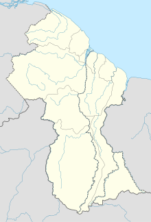
Barima-Waini is a region of Guyana and is located in the northwest of the country. Barima-Waini has three sub-regions: Mabaruma, Matakai, and Moruca.
Trans Guyana Airways Limited is a Guyanese airline which commenced operations in 1956 in Georgetown, Guyana, with a single float airplane. Since then, the company has expanded their fleet to provide domestic and regional transportation, and to Guyana's remote areas.
Baramita, is a community in the Barima-Waini region of northern Guyana, standing about 20 miles west of Matthew's Ridge, at an altitude of 99 metres.

Kaieteur Airport is an airport serving Kaieteur National Park in the Potaro-Siparuni region of Guyana.

Lethem Airport is an airport serving Lethem, a town in the Upper Takutu-Upper Essequibo region of Guyana. The airport has an 1,825-meter long, asphalt-surface runway.
Linden Airport is an airport serving Linden, the capital of the Upper Demerara-Berbice region of Guyana.
Aishalton Airport is an airport serving the village of Aishalton, in the Upper Takutu-Upper Essequibo Region of Guyana. Its only runway is a 915-meter grass surface.
Apoteri Airport is an airport serving the village of Apoteri, in the Upper Takutu-Upper Essequibo Region of Guyana. The runway is a 1,158-meter grass strip.
Bartica Airport is an airport serving the town of Bartica, in the Cuyuni-Mazaruni Region of Guyana. The airport's only runway is a 760-meter asphalt strip.
Imbaimadai Airport is an airport serving the village of Imbaimadai, in the Cuyuni-Mazaruni Region of Guyana. The airport's only runway is a grass-surface, 1,219-meter strip.

Kamarang Airport is an airport serving the town of Kamarang, in the Cuyuni-Mazaruni Region of Guyana.
Karanambo Airport is an airport serving the village of Karanambo, in the Upper Takutu-Upper Essequibo Region of Guyana. The 1,372-meter long runway is a dirt surface.
Kato Airport is an airport serving the village of Kato, in the Potaro-Siparuni Region of Guyana. The gravel airstrip is 920 meters long.
Lumid Pau Airport is an airport serving the village of Lumid Pau, in the Upper Takutu-Upper Essequibo Region of Guyana. The 1-km long runway has a grass surface.

Mahdia Airport is an airport serving the village of Mahdia, in the Potaro-Siparuni Region of Guyana. The airport's only runway is a 1,067-meter grass strip.
Mountain Point Airport is an airport in the Upper Takutu-Upper Essequibo Region of Guyana. The nearest community is Sand Creek.
Orinduik Airport is an airport serving the mining community of Orinduik in the Potaro-Siparuni Region of Guyana.
Paruima Airport is an airport serving the community of Paruima in the Cuyuni-Mazaruni Region of Guyana.
Ebini Airport is an airport serving the community of Ebini in the Upper Demerara-Berbice Region of Guyana. The 1-kilometer-long runway has a gravel surface.
Paramakatoi Airport is an airport serving the village of Paramakatoi, in the Potaro-Siparuni Region of Guyana.


