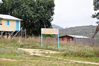
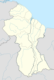
Matthews Ridge is a small village within the Barima-Waini administrative region of Guyana. The village name comes from the name of a public official, Matthew Young, as well as the ridges in the area. The village is divided into three sections, Heaven's Hill, Hell Hill and the valley.

Annai is an Amerindian village in the Upper Takutu-Upper Essequibo Region of Guyana.

Paramakatoi is an Amerindian community in the Potaro-Siparuni Region of Guyana, located in the Pacaraima Mountains. With an altitude of 970 metres (3,180 ft), it is 18 kilometres (11 mi) east of Kurukabaru.
Kwamalasamutu, also Kwamalasamoetoe, is a Tiriyó Amerindian village in the Sipaliwini District of Suriname, and home to the granman of the northern Trios. Kwamalasamutu is the biggest village of the Tiriyó tribe and is located near the disputed border with Guyana.
Bethany Village is a mission located on the Araburia River, a tributary three miles up the Supenaam River in Pomeroon-Supenaam, Essequibo in Guyana.
Rudi Kappel Airstrip is located 9 kilometres (5.6 mi) south of the Tafelberg tepui in Suriname. It was constructed as part of Operation Grasshopper. It used to be named Tafelberg Airstrip, but was renamed Rudi Kappel Airstrip, after the co-pilot of a flight that crashed near Vincent Fayks Airport on 6 October 1959.
Kwamelasemoetoe Airstrip is an airport serving Kwamelasemoetoe, Suriname, a Trio Indian village in the south of Suriname in the Sipaliwini District. The name of the village means bamboo sand, named after nearby Sipaliwini River banks partly overgrown with bamboo.
The Ekareku River is a river of Guyana, a tributary of the Wenamu River.
Fairview (Kurupukari) is an indigenous settlement on the Essequibo River, in the Upper Demerara-Berbice region of Guyana. It is the entry point to the Iwokrama Forest. Former president David A. Granger once referred to Iwokrama as the "green heart of Guyana."
Awaruwaunau Airport is an airport serving the village of Awarewaunau, an Amerindian village in the Upper Takutu-Upper Essequibo Region of Guyana. The grass-surface runway is merely 570 meters long.
Baramita Airport is an airport serving the Amerindian village of Baramita, in the Barima-Waini Region of Guyana. The solitary, 914-meter runway of the airport is a grass surface.
Kato Airport is an airport serving the village of Kato, in the Potaro-Siparuni Region of Guyana. The gravel airstrip is 920 meters long.
Karasabai Airport is an airport serving the Macushi community of Karasabai in the Upper Takutu-Upper Essequibo Region of Guyana. A 1,067 meters long gravel strip is the airport's only runway.
Issano is a village of Cuyuni-Mazaruni, Guyana. It's located along the Mazaruni River, and is a hub for mining.

Monkey Mountain is an indigenous village in the Potaro-Siparuni Region of Guyana. The village is inhabited by the Patamona and Macushi tribes. Monkey Mountain is located near the Brazilian border. The village shares its name with the nearby mountain with a height of 591 metres (1,939 ft). The name is derived from the seasonal migration of monkeys on and around the nearby mountains.
Karasabai is an indigenous village of Macushi Amerindians in the Upper Takutu-Upper Essequibo Region of Guyana. It is located in the South Pakaraima Mountains, and near the Ireng River which flows south to the Amazon River.
Port Kaituma Airport is an airport serving the village of Port Kaituma, in the Barima-Waini Region of Guyana.
Sand Creek is a village in the Upper Takutu-Upper Essequibo Region of Guyana. Sand Creek is inhabited by Wapishana Amerindians. It is located on the Rupununi River. The main language spoken in the village is Wapishana with English as secondary language.
Nappi is an indigenous village of Macushi Amerindians in the Upper Takutu-Upper Essequibo Region of Guyana. It is located in the Rupununi savannah along the Nappi and Maipaima creeks on the edge of the Kanuku Mountains.
Maruranau is an indigenous village of Wapishana Amerindians in the Upper Takutu-Upper Essequibo Region of Guyana. It is located in the Rupununi savannah near the Kwitaro River on the edge of the Kanuku Mountains. A minority of Taruma also inhabit the village.


