
Since the Global Positioning System (GPS) was introduced in the late 1980s there have been many attempts to integrate it into a navigation-assistance system for blind and visually impaired people.

TomTom N.V. is a Dutch multinational developer and creator of location technology and consumer electronics. Founded in 1991 and headquartered in Amsterdam, TomTom released its first generation of satellite navigation devices to market in 2004. As of 2019 the company has over 4,500 employees worldwide and operations in 29 countries throughout Europe, Asia-Pacific, and the Americas.

Bing for mobile is a search tool for handheld mobile devices from Microsoft as part of their Bing search engine. It is designed for mobile device displays. Bing Mobile is built into Windows Mobile and Windows Phone as proprietary software, accessed via the Search key on Windows Phone 7 and Windows Phone 8 devices. It is also available on Windows Phone 8.1, and can be downloaded for other platforms, including and Android.

The iGO Navigation Engine, developed by Hungary-based NNG LLC is a GPS navigation software package. NNG sells some versions of the software directly to users, as well as to device manufacturers, auto makers, network operators and professional transport specialists. Products based on iGO are available in brands including Becker, Clarion, Pioneer, Samsung and Vodafone.

A Personal Navigation Assistant (PNA) also known as Personal Navigation Device or Portable Navigation Device (PND) is a portable electronic product which combines a positioning capability and navigation functions.

A satellite navigation device or satnav device, also known as a satellite navigation receiver or satnav receiver or simply a GPS device, is a user equipment that uses satellites of the Global Positioning System (GPS) or similar global navigation satellite systems (GNSS). A satnav device can determine the user's geographic coordinates and may display the geographical position on a map and offer routing directions.

Here Technologies is a Dutch multinational group specialized in mapping technologies, location data, and related automotive services to individuals and companies. It is majority-owned by a consortium of German automotive companies and American semiconductor company Intel whilst other companies also own minority stakes. Its roots date back to U.S.-based Navteq in 1985, which was acquired by Finland-based Nokia in 2007. Here is currently based in The Netherlands.

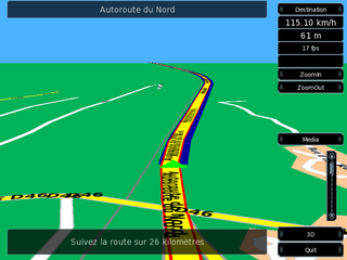
Navit is a free and open-source, modular, touch screen friendly, car navigation system with GPS tracking, realtime routing engine and support for various vector map formats. It features both a 2D and 3D view of map data.

Foursquare City Guide, commonly known as Foursquare, is a local search-and-discovery mobile app developed by Foursquare Labs Inc. The app provides personalized recommendations of places to go near a user's current location based on users' previous browsing history and check-in history.
Google Maps Navigation is a mobile application developed by Google for the Android and iOS operating systems that later integrated into the Google Maps mobile app. The application uses an Internet connection to a GPS navigation system to provide turn-by-turn voice-guided instructions on how to arrive at a given destination. The application requires a connection to Internet data and normally uses a GPS satellite connection to determine its location. A user can enter a destination into the application, which will plot a path to it. The app displays the user's progress along the route and issues instructions for each turn.
Waze Mobile Ltd, doing business as Waze, formerly FreeMap Israel, is a subsidiary company of Google that provides satellite navigation software on smartphones and other computers that support the Global Positioning System (GPS). In addition to turn-by-turn navigation, it incorporates user-submitted travel times and route details while downloading location-dependent information over a cellular network. Waze describes its application as a community-driven initiative that is free to download and use.
Turn-by-turn navigation is a feature of some satellite navigation devices where directions for a selected route are continually presented to the user in the form of spoken or visual instructions. The system keeps the user up-to-date about the best route to the destination, and is often updated according to changing factors such as traffic and road conditions. Turn-by-turn systems typically use an electronic voice to inform the user whether to turn left or right, the street name, and the distance to the next turn.
Telenav, Inc. is a wireless location-based services corporation that provides services including Global Positioning System (GPS) satellite navigation, local search, automotive navigation solutions, mobile advertising, enterprise mobility and workflow automation. The company’s headquarters are located in Santa Clara, California in the United States with additional offices in the U.S., Germany, Japan, Romania, China, and Brazil.

Toyota Entune is an integrated multimedia navigation and telematics system for Toyota automobiles that provides satellite-based information on traffic, weather, sports scores, stocks, and fuel prices via subscription through SiriusXM. When connected to a compatible mobile phone running the Entune app via radio or USB cable, the system provides a browser and other apps, including music services such as iHeartRadio, Pandora and XM Satellite Radio. The cell phone app supported iOS, Android, and Blackberry with different versions utilizing cell data. The system could be controlled with (limited) speech recognition, and optionally include the “Safety Connect” personalization system.

OsmAnd is a map and navigation app for Android and iOS. It uses the OpenStreetMap (OSM) map database for its primary displays, but is an independent app not endorsed by the OpenStreetMap Foundation. It is available in both free and paid versions; the latter unlocks the download limit for offline maps and provides access to Wikipedia points of interest (POIs) and their descriptions from within the app. Map data can be stored on the device for offline use. Using the device's GPS capabilities, OsmAnd offers routing, with visual and voice guidance, for car, bike, and pedestrian. All of the main functionalities work both online and offline.
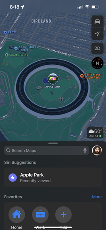
Apple Maps is a web mapping service developed by Apple Inc. As the default map system of iOS, iPadOS, macOS, and watchOS, it provides directions and estimated times of arrival for driving, walking, cycling, and public transportation navigation. A "Flyover" mode shows certain urban centers and other places of interest in a 3D landscape composed of models of buildings and structures.
This article contains a list with gratis satellite navigation software for a range of devices. Some of the free software mentioned here does not have detailed maps or the ability to follow streets or type in street names. However, in many cases, it is also that which makes the program free, avoid the need of an Internet connection, and make it very lightweight. Very basic programs like this may not be suitable for road navigation in cars, but serve their purpose for navigation while walking or trekking, and for use at sea. To determine the GPS coordinates of a destination, one can use sites such as GPScoordinates.eu and GPS visualizer.

Here WeGo is a web mapping and satellite navigation software, operated by HERE Technologies and available on the Web and mobile platforms. It is based on HERE's location data platform, providing its in-house data, which includes satellite views, traffic data, and other location services. Maps are updated every two or three months.
Yandex Maps is a Russian web mapping service developed by Yandex. The service provides detailed maps of the whole world, directions and estimated times of arrival for driving, walking, cycling, kick scooter, and public transportation navigation. It includes a search, information about traffic jams, routing and street panoramas. The service was launched in 2004.

Organic Maps is a free and open-source, offline navigation application that utilizes map data from OpenStreetMap. The app is designed to function without internet connectivity by allowing users to download maps for offline use. Organic Maps emphasizes privacy, as it does not track user locations or collect personal data.
