
Humanitarianism is an active belief in the value of human life, whereby humans practice benevolent treatment and provide assistance to other humans to reduce suffering and improve the conditions of humanity for moral, altruistic, and emotional reasons. One aspect involves voluntary emergency aid overlapping with human rights advocacy, actions taken by governments, development assistance, and domestic philanthropy. Other critical issues include correlation with religious beliefs, motivation of aid between altruism and social control, market affinity, imperialism and neo-colonialism, gender and class relations, and humanitarian agencies. A practitioner is known as a humanitarian.

Humanitarian aid is material and logistic assistance to people who need help. It is usually short-term help until the long-term help by the government and other institutions replaces it. Among the people in need are the homeless, refugees, and victims of natural disasters, wars, and famines. Humanitarian relief efforts are provided for humanitarian purposes and include natural disasters and human-made disasters. The primary objective of humanitarian aid is to save lives, alleviate suffering, and maintain human dignity. It may, therefore, be distinguished from development aid, which seeks to address the underlying socioeconomic factors which may have led to a crisis or emergency. There is a debate on linking humanitarian aid and development efforts, which was reinforced by the World Humanitarian Summit in 2016. However, the conflation is viewed critically by practitioners.
The Directorate-General for European Civil Protection and Humanitarian Aid Operations, formerly known as the European Community Humanitarian Aid Office, is the European Commission's department for overseas humanitarian aid and for civil protection. It aims to save and preserve life, prevent and alleviate human suffering and safeguard the integrity and dignity of populations affected by natural disasters and man-made crises. Since September 2019, Janez Lenarčič is serving as Commissioner for Crisis Management in the Von der Leyen Commission, and since 1 March 2023, Maciej Popowski leads the organisation as the Director-General.

Emergency management or disaster management is a science and a system charged with creating the framework within which communities reduce vulnerability to hazards and cope with disasters. Emergency management, despite its name, does not actually focus on the management of emergencies, which can be understood as minor events with limited impacts and are managed through the day-to-day functions of a community. Instead, emergency management focuses on the management of disasters, which are events that produce more impacts than a community can handle on its own. The management of disasters tends to require some combination of activity from individuals and households, organizations, local, and/or higher levels of government. Although many different terminologies exist globally, the activities of emergency management can be generally categorized into preparedness, response, mitigation, and recovery, although other terms such as disaster risk reduction and prevention are also common. The outcome of emergency management is to prevent disasters and where this is not possible, to reduce their harmful impacts.
The British Red Cross Society is the United Kingdom body of the worldwide neutral and impartial humanitarian network the International Red Cross and Red Crescent Movement. The society was formed in 1870, and is a registered charity with more than 17,200 volunteers and 3,400 staff. At the heart of their work is providing help to people in crisis, both in the UK and overseas. The Red Cross is committed to helping people without discrimination, regardless of their ethnic origin, nationality, political beliefs or religion. Queen Elizabeth II was the patron of the society until her death on 8 September 2022.

Disaster response refers to the actions taken directly before, during or in the immediate aftermath of a disaster. The objective is to save lives, ensure health and safety and to meet the subsistence needs of the people affected. This includes warning/evacuation, search and rescue, providing immediate assistance, assessing damage, continuing assistance and the immediate restoration or construction of infrastructure. The aim of emergency response is to provide immediate assistance to maintain life, improve health and support the morale of the affected population. Such assistance may range from providing specific but limited aid, such as assisting refugees with transport, temporary shelter, and food to establishing semi-permanent settlements in camps and other locations. It also may involve initial repairs to damage or diversion to infrastructure.

OpenStreetMap (OSM) is a free, open geographic database updated and maintained by a community of volunteers via open collaboration. Contributors collect data from surveys, trace from aerial imagery and also import from other freely licensed geodata sources. OpenStreetMap is freely licensed under the Open Database License and as a result commonly used to make electronic maps, inform turn-by-turn navigation, assist in humanitarian aid and data visualisation. OpenStreetMap uses its own topology to store geographical features which can then be exported into other GIS file formats. The OpenStreetMap website itself is an online map, geodata search engine and editor.
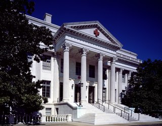
The American Red Cross (ARC), also known as the American National Red Cross, is a nonprofit humanitarian organization that provides emergency assistance, disaster relief, and disaster preparedness education in the United States. It is the designated US affiliate of the International Federation of Red Cross and Red Crescent Societies and the United States movement to the International Red Cross and Red Crescent Movement.
The Sudanese Red Crescent (SRC) is the biggest and most decentralized and widespread humanitarian organization operating in Sudan. The society developed out of the Sudan branch of the British Red Cross Society and was established in 1956. Upon Sudan's independence in March 1956 received official recognition as an independent National Society following the Sudanese Council of Ministers decree No. 869. The National Society covers nearly the entire country with 15 State branches and several sub-branches/units in the provinces/localities and administrative units, with a nationwide community-based network of 35,000 active volunteers and another 300,000 who can be deployed as need arises. It has well-established working relations with public authorities at federal, state and local levels, and good partnership and collaboration with Movement partners and UN specialized agencies and national and international NGOs working in Sudan.
The Mongolian Red Cross Society is the largest humanitarian organization in Mongolia. It was established in 1939 as part of the International Red Cross and Red Crescent Movement and is an auxiliary to the Mongolian Government.
Collaborative mapping, also known as citizen mapping, is the aggregation of Web mapping and user-generated content, from a group of individuals or entities, and can take several distinct forms. With the growth of technology for storing and sharing maps, collaborative maps have become competitors to commercial services, in the case of OpenStreetMap, or components of them, as in Google Map Maker Waze and Yandex Map Editor.

Canaan, Haiti, is a suburb of Croix-des-Bouquets and Thomazeau in the outskirts of Port-au-Prince, by 2016 an estimated population of 200,000 is settling in the about 50 square kilometers large territory that was expropriated in reaction to the devastating 2010 Haiti earthquake. Since 2010 earthquake victims that were fleeing the chaos in the adjacent Port-au-Prince neighborhoods, migrants from rural zones of Haiti and people profiting from the uncontrolled situation invested according to ONU-Habitat data more than 10 million US Dollar in the development of the "new city".
Relief 2.0 or disaster relief 2.0 is the deployment of digital information techniques in the management of disaster relief.
The Maldivian Red Crescent (MRC) is an independent, volunteer, non-profit, humanitarian organization established in the Maldives by virture of the Maldivian Red Crescent Act Law No: 7/2009

Crisis mapping is the real-time gathering, display and analysis of data during a crisis, usually a natural disaster or social/political conflict. Crisis mapping projects usually allows large numbers of people, including the public and crisis responders, to contribute information either remotely or from the site of the crisis. One benefit of the crisis mapping method over others is that it can increase situational awareness, since the public can report information and improve data management.

The Digital Humanitarian Network is a consortium allowing Volunteer and Technical Communities (V&TCs) to interface with humanitarian organizations that seek their services.
Sahana Software Foundation is a Los Angeles, California-based non-profit organization founded to promote free and open-source software (FOSS) for disaster and emergency management. The foundation's mission statement is to "save lives by providing information management solutions that enable organizations and communities to better prepare for and respond to disasters." The foundation's Sahana family of software products includes Eden, designed for humanitarian needs management; Vesuvius, focused on the disaster preparedness needs of the medical community; and legacy earlier versions of Sahana software including Krakatoa, descended from the original Sahana code base developed following the 2004 Indian Ocean tsunami. The word "Sahana" means "relief" in Sinhalese, one of two national languages of Sri Lanka.
Ramani Huria is community-based mapping project in Dar Es Salaam, Tanzania, training university students and local community members to create highly accurate maps of the most flood-prone areas of the city using OpenStreetMap.
A mapathon is a coordinated mapping event and a kind of editathon. The public is invited to make online map improvements in their local area to improve coverage and to help disaster risk assessment and energy management.
Kathmandu Living Labs (KLL) is a living lab and nonprofit civic technology company based in Kathmandu, Nepal that primarily works on mobile technology and mapping. KLL focuses on using GPS/GIS technology for humanitarian aims, sometimes referred to as "humanitarian mapping".
