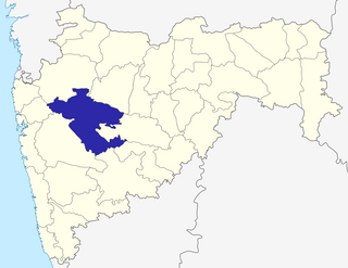
Ahmednagar district is the largest district of Maharashtra state in western India. The historical Ahmednagar city is the headquarters of the district. Ahmednagar was the seat of the Ahmednagar Sultanate of late medieval period. This district is known for the towns of Shirdi associated with Sai Baba, Meherabad associated with Meher Baba, Shani Shinganapur with Shanidev, and Devgad with Lord Dattatreya. Ahmednagar district is part of Nashik Division. Sangamner is the biggest city by development, market, and population, after the city of Ahmednagar.

Pedgaon is a panchayat village in the state of Maharashtra, India. Administratively, Pedgaon is under Shrigonda Taluka of Ahmadnagar District in Maharashtra. There is only the single village of Pedgaon in the Pedgaon gram panchayat.
Kalamb is one of eight tehsils in the Osmanabad district in the state of Maharashtra, India. Headquarters for the tehsil is the town of Kalamb. There are ninety-one panchayat villages in the Kalamb Tehsil.
Takali Dhokeshwar is a village in Ahmednagar District, Maharashtra, India. It is located at the intersection of the Mumbai - Vishakhapattanam highway and the Satara - Nashik road.

Kanodia Purohitan is a panchayat village in the Indian state of Rajasthan. It is situated on Jaisalmer Highway (NH-125), 120 km from Jodhpur.
Washi is a Nagar panchayat village and the headquarters of Washi taluka in Bhoom subdivision of Osmanabad district of Maharashtra state in India. The village of Washi is 22 km by road northeast of the town of Bhoom, and 25 km by road northwest of Yermala. The nearest railway station is 40 km by road southwest to Yedshi in Osmanabad District.
Mankeshwar is a panchayat village in Bhoom Tehsil, Osmanabad district of Maharashtra, India. It is known for its Shiva temple and Goddess Satwai Devi temple.
Wasunde, is the only village in the Vasunde gram panchayat in the Parner Taluka of the Ahmednagar District, state of Maharashtra, India. The village is 4.8 km by road north of Takli Dhokeshwar on State Highway 50.

Parner taluka is a taluka in Ahmednagar district in the state of Maharashtra, India.
Terkheda is a panchayat village in Washi taluka of Osmanabad district in India. Terkheda is the only village listed in its gram panchayat, but it is surrounded by twelve small villages and has an old history; Hindus, Lingayats and Muslims all live together there. The village is surrounded by many hills and is next to the Tirna River. National Highway 211 runs just south of the main village.

Katakanahalli or Katnalli is a village in the southern state of Karnataka, India. Administratively it is under the panchayat village of Hegadihal, in Bijapur Taluka of Bijapur District, Karnataka. It is nearly 15 km from the district headquarters in the city of Bijapur. It's one of the small villages near to Bijapur city.
Vashi is a Village in the state of Maharashtra, India. Administratively, Vashi is under Walwa Taluka of Sangli District in Maharashtra. Vashi is the only village in its gram panchayat. The village of Vashi is 21 km by road south of the city of Uran Islampur and 33 km by road west of the city of Ashta.
Alur is a panchayat village in the state of Maharashtra, India. It is administratively under the Umarga Tahsil of Osmanabad District in Maharashtra. There is only the single village of Alur in the Alur gram panchayat. The village is 31 km by road southeast of Naldurg and 52 km by road southwest of Umarga, but only 13 km by road northeast of Wagdari, in Solapur District.
Lohara Bk. is a Nagar panchayat village in the state of Maharashtra, India. Lohara Bk. is headquarters for and administratively under Lohara Tehsil of Osmanabad District in Maharashtra. There is only the single village of Lohara Bk. in the Lohara (BK) gram panchayat. The village of Lohara Bk. is 22 km by road west of the village of Sastur and 33 km by road east of the town of Tuljapur.
Sastur is a panchayat village in the state of Maharashtra, India. Administratively, Sastur is under Lohara Tehsil of Osmanabad District in Maharashtra. There is only the single village of Sastur in the Sastur gram panchayat. The village of Sastur is 20 km by road northwest of the village of Madaj and 22 km by road east of the village of Lohara Bk..
Madaj is a panchayat village in the state of Maharashtra, India. Administratively, Madaj is under Umarga Tehsil of Osmanabad District in Maharashtra. There is only the single village of Madaj in the Madaj gram panchayat. The village of Madaj is 17 km by road north of the town of Umarga and 20 km by road southeast of the village of Sastur.
Kashi is a panchayat village in the state of Maharashtra, India, on the left (east) bank of the Ghod River, across the river from the village of Tandali. Administratively, Kasti is under Shrigonda Taluka of Ahmadnagar District in Maharashtra. There is only the single village of Kasti in the Kashti gram panchayat. The railroad station is 5 km by road south of the village. Kasti is 16 km by road southwest of the town of Shrigonda, and 14 km by road north of the town of Daund.
Kasare, is a small village in Ahmednagar district of Maharashtra, India. This village is located about equidistant between Talegaon to the northwest and Gogalgaon to the southeast on State Highway 45.
Kasare is a panchayat village that is located in Sakri Taluka subdivision of Dhule district in Maharashtra, India. The village is located on the south bank of the Panjhra River 10 km (6.2 mi) by road south-west of the town Sakri.
Kasare, is a small village in Nandurbar District of Maharashtra, India. Administratively, Kasare is under Shehi gram panchayat, Navapur Taluka of Nandurbar District in Maharashtra. This village is located 2.5 km by road southeast of the village of Shehi, and State Highway 9.


