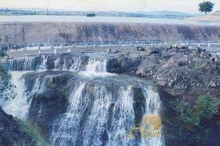
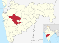
Hanga is a village in Parner taluka in Ahmednagar district of the state of Maharashtra.

The Wainganga is a river in India originating in the Mahadeo Hills in Mundara in Gondwana region near the village Gopalganj in Seoni, Madhya Pradesh. It is a key tributary of the Godavari. The river flows south in a winding course through the states of Madhya Pradesh and Maharashtra, roughly 580 km (360 mi). After joining the Wardha River, the united stream, which is known as the Pranahita River, empties into the Godavari River at Kaleshwaram, Telangana.

The Daman Ganga also called Dawan River is a river in western India. The river's headwaters are on the western slope of the Western Ghats range, and it flows west into the Arabian Sea. The river flows through Maharashtra and Gujarat states, as well as the Union territory of Dadra and Nagar Haveli and Daman and Diu. The industrial towns of Vapi, Dadra and Silvassa lie on the north bank of the river, and the town of Daman occupies both banks of the river's estuary.

The Bhima River is a major river in Western India and South India. It flows southeast for 861 kilometres (535 mi) through Maharashtra, Karnataka, and Telangana states, before joining the Krishna River. After the first sixty-five kilometers in a narrow valley through rugged terrain, the banks open up and form a fertile agricultural area which is densely populated.

Ujjani Dam, also known as Bhima Dam or Bhima Irrigation Project, on the Bhima River, a tributary of the Krishna River, is an earthfill cum Masonry gravity dam located near Ujjani village of Madha Taluk in Solapur district of the state of Maharashtra in India.

Parner taluka is a taluka in Ahmednagar district in the state of Maharashtra in western India.

Mandohol Dam, is an earth-fill dam on Mandohol River in Karjule Hareshwar village of Parner taluka in Ahmednagar district of state of Maharashtra in India.
Tikhol Dam is an earth-fill dam on Kalu river in Tikhol village in Parner taluka of Ahmednagar district of state of Maharashtra in India.
Palashi Dam, is an earth-fill dam on Palashi river in Palashi village in Parner taluka of Ahmednagar district of state of Maharashtra in India.
Rui Chatrapati Dam, is an earth-fill dam on Gopal Ganga river in Rui Chatrapati village in Parner taluka of Ahmednagar district of state of Maharashtra in India.
Lonimavla Dam, is an earth-fill dam in Lonimawala village in Parner taluka of Ahmednagar district of state of Maharashtra in India.
Dhoki Dam, is an earth-fill dam on Kalu river in Dhoki village in Parner taluka of Ahmednagar district of state of Maharashtra in India.
Rui Chatrapati is a village in Parner taluka in Ahmednagar district of state of Maharashtra, India.
Walwan Dam, is a gravity dam on the Indrayani river near Lonavla, Pune district in State of Maharashtra in India. It provides water to the nearby Khopoli Power Plant and to residents of Lonavla and Khandala and neighborhood villages.
Visapur Dam, is an earthfill dam on Hanga river near Srigonda, Ahmednagar district in the state of Maharashtra in India.
Upper Dudhana Dam, is an earthfill dam on Dudhana river near Jalna in the state of Maharashtra in India.
Ozarkhed Dam is an earthfill dam on Unanda River near Dindori, Nashik district in the state of Maharashtra in India. It was constructed in Krishnagaon village which was later moved near Vani. The dam has a canal from which the water is released for irrigational purposes for the east region of Nashik district.

Hatnur dam is an earth fill dam in Jalgaon district of Maharashtra, India. The dam is named after a nearby Hatnur village, which is present by side of the dam.
Morna Dam is an earthfill dam on the Morna river near Gureghar village in Patan tehsil, Satara district in the state of Maharashtra in India.
Morana (Gureghar) Dam, is an earthfill dam on Morana river near Patan, Satara district in the state of Maharashtra in India.


