Khagaria is a town in Indian state of Bihar and the administrative headquarters of Khagaria district. Khagaria is a part of Munger division. It is located at 25.5°N 86.48°E and has an average elevation of 36 metres (118 feet). The Khagaria Junction railway station serves the town.It is situated about 25 km north of Munger.
Bhuban is a town and a NAC, located in the subdivision of Kamakhyanagar, Dhenkanal district in the state of Odisha, India.
Bidasar is a city and a municipality in Sujangarh district in the state of Rajasthan, India. Bidasar is named after Bidawat Rathores, who descended from Bida, son of Rao Jodha. It is also the birth place of Nahar brothers, founders of Zorko franchise startup.
Bikihakola is a census town in Panchla CD Block of Howrah Sadar subdivision in Howrah district in the state of West Bengal, India.
Chakpara is a census town in Bally Jagachha CD Block of Howrah Sadar subdivision in Howrah district in the Indian state of West Bengal. It is a part of Kolkata Urban Agglomeration.
Chikrand is a census town in Chanditala II CD Block in Srirampore subdivision of Hooghly district in the state of West Bengal, India.
Dharchula Dehat is a census town in Pithoragarh district in the state of Uttarakhand, India.
Khalia is a census town in Bally Jagachha CD Block of Howrah Sadar subdivision in Howrah district in the Indian state of West Bengal. It is a part of Kolkata Urban Agglomeration.
Nachhratpur Katabari is a census town in Raiganj CD Block in Raiganj subdivision of Uttar Dinajpur district in the Indian state of West Bengal.
Old Malda is a census town in Malda district in the Indian state of West Bengal. It is a part of the Malda Metropolitan Area. It is located on the eastern bank of the river Mahananda.
Panchpara is a census town in Sankrail CD Block of Howrah Sadar subdivision in Howrah district in the Indian state of West Bengal. It is a part of Kolkata Urban Agglomeration.
Pansemal is a town and a nagar panchayat in Barwani district in the Indian state of Madhya Pradesh.

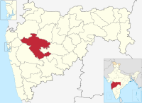
Rahuri is a town and a municipal council in Ahmednagar district in the Indian state of Maharashtra.
Ranapur is a town and a nagar panchayat in Jhabua district in the Indian state of Madhya Pradesh.
Raybag is a taluka in Belgaum district in the Indian state of Karnataka. It derives its name from the two words namely "Rai" and "bagh" in which "Rai" means king and "bagh" means tiger.
Sahapur is a census town in Panchla CD Block of Howrah Sadar subdivision in Howrah district in the Indian state of West Bengal.
Savda is a city and a municipal council in Jalgaon district in the Indian state of Maharashtra. It is also known as Banana City for production of bananas at a good scale.
Uttar Pirpur is a census town in Uluberia II CD Block of Uluberia subdivision in Howrah district in the Indian state of West Bengal. It is a part of Kolkata Urban Agglomeration.
Santoshpur is a census town in Uluberia II CD Block of Uluberia subdivision in Howrah district in the Indian state of West Bengal. It is a part of Kolkata Urban Agglomeration.
Kangan is a town located near Ganderbal, in the Ganderbal district of Jammu and Kashmir, India. It is one of the tehsils in District Ganderbal. It is situated across the Nallah Sindh and spread over a 50-km-long gorge valley, with population of 120,934 and literacy rate of 52.8% and sex ratio 868 per thousand males. Widely regarded for its beauty, it is surrounded by various picnic spots like Sonamarg and Naranag.