Shevgaon taluka

Last updated

Shevgaon taluka
Shevgaon Tehsil in Ahmednagar District.jpg
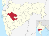
Location of Shevgaon in Ahmednagar district in Maharashtra
CountryFlag of India.svg  India
State Maharashtra
District Ahmednagar district
Headquarters Ahmednagar
Area
  Total1,031.85 km2 (398.40 sq mi)
Population
 (2011)
  Total245,714
  Density240/km2 (620/sq mi)

Shevgaon taluka is a taluka in Ahmednagar subdivision of Ahmednagar district in Maharashtra state of India. [1]

Contents

Area

The table below shows area of the taluka by land type. [2]

Type of LandArea (km2) % of Total Area
Agriculture913.1988.5
Forest11.571.12
Other107.0910.38
Total1031.85100

Villages

There are around 112 villages in Shevgaon taluka. For list of villages see Villages in Shevgaon taluka .

Population

Religions in Shevgaon taluk (2011) [3]
ReligionPercent
Hinduism
90.65%
Islam
7.93%
Buddhism
0.42%
Other or not stated
1.00%

Shevgaon taluka has a population of 245,714 according to the 2011 census. Shevgaon had a literacy rate of 73.94% and a sex ratio of 953 females per 1000 males. The entire population lives in rural areas. Scheduled Castes and Scheduled Tribes make up 14.72% and 1.91% of the population respectively. [4]

Languages of Shevgaon taluk (2011) [5]

   Marathi (89.88%)
   Hindi (4.41%)
   Urdu (3.30%)
   Vadari (0.98%)
  Others (1.43%)

At the time of the 2011 Census of India, 89.88% of the population in the district spoke Marathi, 4.41% Hindi, 3.30% Urdu and 0.98% Vadari as their first language. [5]

Rain Fall

The table below details rainfall from 1981 to 2004. [6]

YearRainfall (mm)
1981-1982407
1983563
1984309
1985247
1986422
1987596
1988824
1989730
1990697
1991391
1992369
1993519
1994584.6
1995363
1996782
1997226
1998780
1999366
2000531
2001349
2002449
2003320
2004715

See also

095270 44983 https://www.google.com/maps?cid=10184565873800887938)

Related Research Articles

<span class="mw-page-title-main">Ahmednagar district</span> District in Maharashtra, India

Ahmednagar district is the largest district of Maharashtra state in western India. The historical Ahmednagar city is the headquarters of the district. Ahmednagar and Sangamner are the largest cities in the district. It was the seat of the Ahmednagar Sultanate of late medieval period. This district is known for the towns of Shirdi associated with Sai Baba, Meherabad associated with Meher Baba, Shani Shinganapur with Shanidev, and Devgad with Lord Dattatreya. Ahmednagar district is part of Nashik Division. The district is bordered by Aurangabad district to the northeast, Nashik district to the northwest, Thane and Pune districts to the southwest, Solapur district to the south and Beed district to the southeast.

<span class="mw-page-title-main">Jamkhed taluka</span> Tehsil in Maharashtra, India

Jamkhed taluka, is a taluka in Karjat subdivision of Ahmednagar district in Maharashtra State of India.

<span class="mw-page-title-main">Akole taluka</span> Tehsil in Maharashtra, India

Akole taluka is a taluka in Ahmednagar district in Maharashtra state of India. Akole consists of many places like Harishchandragad, Kalsubai, Bhandardara (Wilson) Dam, Sandhan Valley, Vishramgad etc. which attract tourists. Akole is not only famous for its natural scenery but, many historical events are also associated with it. The Western Akole is a part of Sahyadri ranges which increase its important.

<span class="mw-page-title-main">Karjat taluka</span> Taluka in Maharashtra, India

Karjat taluka is a taluka in Karjat subdivision of Ahmednagar district in Maharashtra state of western India.

<span class="mw-page-title-main">Kopargaon taluka</span> Tehsil in Maharashtra, India

Kopargaon taluka is a taluka in Shirdi subdivision of Ahmednagar district in Maharashtra state of India.

<span class="mw-page-title-main">Nagar taluka</span> Tehsil in Maharashtra, India

Nagar taluka is a taluka in Ahmednagar subdivision of Ahmednagar district in Maharashtra state of India.

<span class="mw-page-title-main">Nevasa taluka</span> Tehsil in Maharashtra, India

Nevasa taluka (Newasa), is a taluka in Shrirampur subdivision of Ahmednagar district in Maharashtra state of India. Nevasa is a place where Sant Dnyaneshwar wrote the Dnyaneshwari.

<span class="mw-page-title-main">Pathardi taluka</span> Tehsil in Maharashtra, India

Pathardi taluka is a taluka in Ahmednagar subdivision of Ahmednagar district in Maharashtra state of India.

<span class="mw-page-title-main">Rahata taluka</span> Tehsil in Maharashtra, India

Rahata taluka, is a taluka in Shrirampur subdivision of Ahmednagar district in Maharashtra State of India.
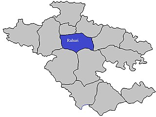
<span class="mw-page-title-main">Rahuri taluka</span> Tehsil in Maharashtra, India

Rahuri taluka, is a taluka in the Shrirampur subdivision of the Ahmednagar district in Maharashtra, western India.
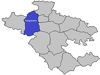
<span class="mw-page-title-main">Sangamner taluka</span> Tehsil in Maharashtra, India

Sangamner taluka, is a taluka in Sangamner subdivision of Ahmednagar district in Maharashtra state of India.

<span class="mw-page-title-main">Shrigonda taluka</span> Tehsil in Maharashtra, India

Shrigonda Taluka, is a taluka in Karjat subdivision of Ahmednagar District in Maharashtra state of India. Its administrative headquarters is the town of Shrigonda.

<span class="mw-page-title-main">Shrirampur taluka</span> Tehsil in Maharashtra, India

Shrirampur taluka, is a taluka in Shrirampur subdivision of Ahmednagar district in Maharashtra state of India.

<span class="mw-page-title-main">Parner taluka</span> Tehsil in Maharashtra, India

Parner taluka is a taluka in Ahmednagar district in the state of Maharashtra in western India.

<span class="mw-page-title-main">Ambegaon taluka</span> Taluka in Maharashtra, India

Ambegaon taluka is a taluka in Shirur subdivision of Pune district of state of Maharashtra in India. One of the twelve most revered Shiva temples or Jyotirlinga, the Bhimashankar Temple is in Khed taluka. But due to Bhimashankar Sanctuary, the road is through Ambegaon taluka.
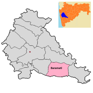
<span class="mw-page-title-main">Baramati taluka</span>

Baramati taluka is a taluka in Baramati subdivision of Pune district of state of Maharashtra in India.

<span class="mw-page-title-main">Bhor taluka</span> Taluka in Maharashtra, India

Bhor taluka is a taluka in Haveli subdivision of Pune district of state of Maharashtra in India. There are 195 villages and 1 town in Bhor Taluka.

<span class="mw-page-title-main">Daund taluka</span> Taluka in Maharashtra, India

Daund taluka is a taluka or subdivision of Pune district of the state of Maharashtra in India. The town of Daund is the only major urban area in this predominantly rural area. Daund railway station is a major railway junction. All southern railways are connected to this route, and also divided the Nagar railway to north Indian railway, like Delhi, Solapur division, Daund junction and then joined to the Pune district junction. To reach the Siddhi Vinayak Siddhatek Ganpati temple, one has to travel 14 km to Daund by road.

<span class="mw-page-title-main">Purandar taluka</span> Tehsil in Maharashtra, India

Purandar taluka is a taluka of Pune district of state of Maharashtra in India. There are 108 villages and 3 towns in Purandhar Taluka.

<span class="mw-page-title-main">Velhe taluka</span> Tehsil in Maharashtra

Velhe Taluka, officially renamed as, Rajgad Taluka, is a taluka in Haveli subdivision of Pune district of state of Maharashtra in India. The Taluka is entirely rural, and consists of 130 villages.

References

  1. Talukas in Ahmednagar district
  2. Talukas geographic information
  3. "Table C-01 Population by Religion: Maharashtra". censusindia.gov.in. Registrar General and Census Commissioner of India. 2011.
  4. "District Census Hand Book – Ahmednagar" (PDF). Census of India . Registrar General and Census Commissioner of India.
  5. 1 2 "Table C-16 Population by Mother Tongue: Maharashtra". censusindia.gov.in. Registrar General and Census Commissioner of India.
  6. Rainfall information of Ahemadnagar district