Mehrgarh is a Neolithic archaeological site situated on the Kacchi Plain of Balochistan in modern-day Pakistan. It is located near the Bolan Pass, to the west of the Indus River and between the modern-day Pakistani cities of Quetta, Kalat and Sibi. The site was discovered in 1974 by the French Archaeological Mission led by the French archaeologists Jean-François Jarrige and Catherine Jarrige. Mehrgarh was excavated continuously between 1974 and 1986, and again from 1997 to 2000. Archaeological material has been found in six mounds, and about 32,000 artifacts have been collected from the site. The earliest settlement at Mehrgarh, located in the northeast corner of the 495-acre (2.00 km2) site, was a small farming village dated between 7000 BCE and 5500 BCE.

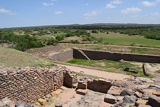
Lothal was one of the southernmost sites of the ancient Indus Valley civilisation, located in the Bhal region of the Indian state of Gujarat. Construction of the city is believed to have begun around 2200 BCE.

The Ochre Coloured Pottery culture (OCP) is a Bronze Age culture of the Indo-Gangetic Plain "generally dated 2000–1500 BCE," extending from eastern Punjab to northeastern Rajasthan and western Uttar Pradesh.

The Gandhara grave culture of present-day Pakistan is known by its "protohistoric graves", which were spread mainly in the middle Swat River valley and named the Swat Protohistoric Graveyards Complex, dated in that region to c. 1200–800 BCE. The Italian Archaeological Mission to Pakistan (MAIP) holds that there are no burials with these features after 800 BCE. More recent studies by Pakistani scholars, such as Muhammad Zahir, consider that these protohistoric graves extended over a much wider geography and continued in existence from the 8th century BCE until the historic period. The core region was in the middle of the Swat River course and expanded to the valleys of Dir, Kunar, Chitral, and Peshawar. Protohistoric graves were present in north, central, and southern Khyber Pakhtunkhwa province as well as in north-western tribal areas, including Gilgit-Baltistan province, Taxila, and Salt Range in Punjab, Pakistan, along with their presence in Indian Kashmir, Ladakh, and Uttarakhand.

Kalibangān is a town located at 29.47°N 74.13°E on the left or southern banks of the Ghaggar in Tehsil Pilibangān, between Suratgarh and Hanumangarh in Hanumangarh District, Rajasthan, India 205 km. from Bikaner. It is also identified as being established in the triangle of land at the confluence of Drishadvati and Sarasvati Rivers. The prehistoric and pre-Mauryan character of Indus Valley civilization was first identified by Luigi Tessitori at this site. Kalibangan's excavation report was published in its entirety in 2003 by the Archaeological Survey of India, 34 years after the completion of excavations. The report concluded that Kalibangan was a major provincial capital of the Indus Valley Civilization. Kalibangan is distinguished by its unique fire altars and "world's earliest attested ploughed field". It is around 2900 BC that the region of Kalibangan developed into what can be considered a planned city.

Dholavira is an archaeological site at Khadirbet in Bhachau Taluka of Kutch District, in the state of Gujarat in western India, which has taken its name from a modern-day village 1 kilometre (0.62 mi) south of it. This village is 165 km (103 mi) from Radhanpur. Also known locally as Kotada timba, the site contains ruins of a city of the ancient Indus Valley civilization. Earthquakes have repeatedly affected Dholavira, including a particularly severe one around 2600 BCE.

Kot Diji is an ancient site which was part of the Indus Valley Civilization, estimated to have been occupied around 3300 BCE. Located about 45 km (28 mi) south of Khairpur in the modern-day province of Sindh, Pakistan, it is on the east bank of the Indus River opposite Mohenjo-daro. The remains consist of two parts: the citadel area on the high ground, and the area around it. The Pakistan Department of Archaeology excavated at Kot Diji in 1955 and 1957.
Rangpur is an ancient archaeological site in Surendranagar district near Vanala on Saurashtra peninsula in Gujarat, western India. Lying on the tip between the Gulf of Khambhat and Gulf of Kutch, it belongs to the period of the Indus Valley civilization, and lies to the northwest of the larger site of Lothal. It is the type site for the Rangpur culture, a regional form of the late phase of the Indus Valley Civilization that existed in Gujarat during the 2nd millennium BCE.

Pottery in the Indian subcontinent has an ancient history and is one of the most tangible and iconic elements of Indian art. Evidence of pottery has been found in the early settlements of Lahuradewa and later the Indus Valley Civilisation. Today, it is a cultural art that is still practiced extensively in the subcontinent. Until recent times all Indian pottery has been earthenware, including terracotta.
Banawali is an archaeological site belonging to the Indus Valley civilization period in Fatehabad district, Haryana, India and is located about 120 km northeast of Kalibangan and 16 km from Fatehabad. Banawali, which is earlier called Vanavali, is on the left banks of dried up Sarasvati River. Comparing to Kalibangan, which was a town established in lower middle valley of dried up Sarasvathi River, Banawali was built over upper middle valley of Sarasvati River.

Bhirrana, also Bhirdana and Birhana, is an archaeological site, located in a small village in the Fatehabad district of the north Indian state of Haryana. Bhirrana's earliest archaeological layers predates the Indus Valley civilisation times, dating to the 8th-7th millennium BCE. The site is one of the many sites seen along the channels of the seasonal Ghaggar river, identified by ASI archeologists to be the Rigvedic Saraswati river.
Alamgirpur is an archaeological site of the Indus Valley civilization that thrived along Yamuna River from the Harappan-Bara period, located in Meerut district, Uttar Pradesh, India. It is the easternmost known site of the civilization.
Bhagwanpura, also known as Baghpur, is a village in Kurukshetra district, Haryana, India. It is an archaeological site that lies on the bank of Hakra Ghaggar channel. Situated 24 km northeast of Kurukshetra, the site is notable for showing an overlap between the late Harappan and Painted Grey Ware cultures. Painted Grey Ware is generally associated with the Vedic people, so this area can be said as the junction of two great civilizations of India.
Manda is a village and an archaeological site in the Jammu district of the Union Territory of Jammu and Kashmir, India. It was excavated by Archaeological Survey of India during 1976-77 by J. P. Joshi. The site contains ruins of an ancient Indus Valley civilization.

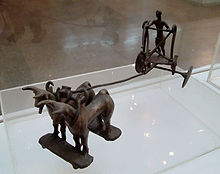
Sinauli is an archaeological site in western Uttar Pradesh, India, at the Ganga-Yamuna Doab. The site gained attention for its Bronze Age solid-disk wheel carts, found in 2018, which were interpreted by some as horse-pulled "chariots".
Loteshwar is a village and an archaeological site belonging to Indus Valley civilisation located at Patan district, Gujarat, India. This site is locally also known as Khari-no-timbo and located on a high sand dune on left bank of Khari river, a tributary of Rupen river.
Kunal is a pre-Harappan Indus Valley civilisation settlement located, just 30 km from Fatehabad City in Fatehabad district of Haryana state in India. Compared to other IVC sites, such as cities like Rakhigarhi and towns like Kalibangan, Kunal site was a village. Excavation at Kunal show 3 successive phases of Pre-Harappan indigenous culture on the Saraswati river who also traded with Kalibanga and Lothal. Kunal, along with its other contemporary sites Bhirrana and Rakhigarhi on Sarasvati-Ghaggar river system, is recognised as the oldest Pre-Harappan settlement, with Kunal being an older cultural ancestor to Rehman Dheri in Pakistan< which is on the Tentative List for future World Heritage Sites.
Tigrana is a village and Indus Valley civilisation (IVC) archaeological sites in the Bhiwani district of Haryana state of India. It lies on the NH-709A approximately 7 kilometres (4.3 mi) north of the district headquarters town of Bhiwani.

Hakra Ware culture was a material culture which is contemporaneous with the early Harappan Ravi phase culture of the Indus Valley in Northern India and eastern-Pakistan. This culture arises in the 4th millennium with the first remnants of Hakra Ware pottery appearing near Jalilpur on the Ravi River about 80 miles (130 km) southwest of Harappa in 1972. Along with this, numerous other areas including Kunal, Dholavira, Bhirrana, Girwas, Farmana and Rakhigarhi areas of India contained Hakra Ware pottery.

The Jorwe culture was a Chalcolithic archaeological culture which existed in large areas of what is now Maharashtra state in Western India, and also reached north into the Malwa region of Madhya Pradesh. It is named after the type site of Jorwe. The early phase of the culture is dated to c. 1400-1000 BCE, while the late phase is dated to c. 1000-700 BCE.


