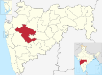
Ahmednagar district officially known as Ahilyanagar district is the largest district of Maharashtra state in western India. The historical Ahmednagar city is the headquarters of the district. Ahmednagar and Sangamner are the largest cities in the district. It was the seat of the Ahmednagar Sultanate of late medieval period. This district is known for the towns of Shirdi associated with Sai Baba, Meherabad associated with Meher Baba, Shani Shinganapur with Shanidev, and Devgad with Lord Dattatreya. Ahmednagar district is part of Nashik Division. The district is bordered by Aurangabad district to the northeast, Nashik district to the northwest, Thane and Pune districts to the southwest, Solapur district to the south and Beed district to the southeast.

Jamkhed taluka, is a taluka in Karjat subdivision of Ahmednagar district in Maharashtra State of India.

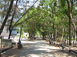
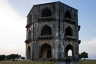
Akole taluka is a taluka in Ahmednagar district in Maharashtra state of India. Akole consists of many places like Harishchandragad, Kalsubai, Bhandardara (Wilson) Dam, Sandhan Valley, Vishramgad etc. which attract tourists. Akole is not only famous for its natural scenery but, many historical events are also associated with it. The Western Akole is a part of Sahyadri ranges which increase its important.

Karjat taluka is a taluka in Karjat subdivision of Ahmednagar district in Maharashtra state of western India.

Nagar taluka is a taluka in Ahmednagar subdivision of Ahmednagar district in Maharashtra state of India.

Nevasa taluka (Newasa), is a taluka in Shrirampur subdivision of Ahilyanagar district in Maharashtra state of India. Nevasa is a place where Sant Dnyaneshwar wrote the Dnyaneshwari.

Pathardi taluka is a taluka in Ahmednagar subdivision of Ahmednagar district in Maharashtra state of India.

Rahata taluka, is a taluka in Shrirampur subdivision of Ahmednagar district in Maharashtra State of India.
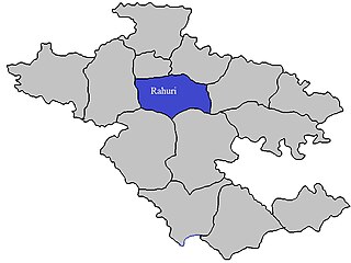
Rahuri taluka, is a taluka in the Shrirampur subdivision of the Ahmednagar district in Maharashtra, western India.
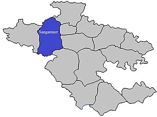
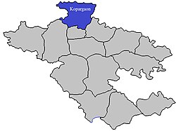
Sangamner taluka, is a taluka in Sangamner subdivision of Ahmednagar district in Maharashtra state of India.

Shevgaon taluka is a taluka in Ahmednagar subdivision of Ahmednagar district in Maharashtra state of India.

Shrigonda Taluka, is a taluka in Karjat subdivision of Ahmednagar District in Maharashtra state of India. Its administrative headquarters is the town of Shrigonda.

Shrirampur taluka, is a taluka in Shrirampur subdivision of Ahmednagar district in Maharashtra state of India.

Parner taluka is a taluka in Ahmednagar district in the state of Maharashtra in western India.
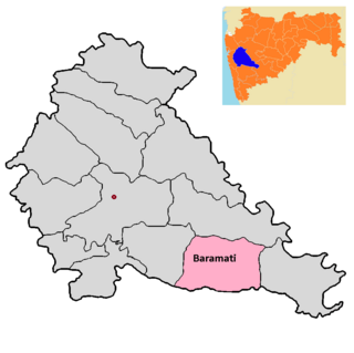
Baramati taluka is a taluka in Baramati subdivision of Pune district of state of Maharashtra in India.

Bhor taluka is a taluka in Haveli subdivision of Pune district of state of Maharashtra in India. There are 195 villages and 1 town in Bhor Taluka.

Daund taluka is a taluka or subdivision of Pune district of the state of Maharashtra in India. The town of Daund is the only major urban area in this predominantly rural area. Daund railway station is a major railway junction. All southern railways are connected to this route, and also divided the Nagar railway to north Indian railway, like Delhi, Solapur division, Daund junction and then joined to the Pune district junction. To reach the Siddhi Vinayak Siddhatek Ganpati temple, one has to travel 14 km to Daund by road.

Purandar taluka is a taluka of Pune district of state of Maharashtra in India. There are 108 villages and 3 towns in Purandhar Taluka.

Velhe Taluka, officially renamed as, Rajgad Taluka, is a taluka in Haveli subdivision of Pune district of state of Maharashtra in India. The Taluka is entirely rural, and consists of 130 villages.
Murud taluka is a taluka in Raigad district of the Indian state of Maharashtra.