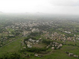
Hanga is a village in Parner taluka in Ahmednagar district of the state of Maharashtra.

The Bhima River is a major river in Western India and South India. It flows southeast for 861 kilometres (535 mi) through Maharashtra, Karnataka, and Telangana states, before joining the Krishna River. After the first sixty-five kilometers in a narrow valley through rugged terrain, the banks open up and form a fertile agricultural area which is densely populated.

Junnar is a city in the Pune district of the Indian state of Maharashtra. The city has history dating back to the first millennium. The nearby fort of Shivneri was the birthplace of Maratha king Shivaji, the founder of the Maratha Empire. Junnar was declared the first tourism taluka in Pune district by the government of Maharashtra on 9 January 2018.
Shirur is an administrative subdivision of the Pune district in the Indian state of Maharashtra. It is located on the eastern boundary of the district, on the banks of the Ghod River. The town is also called Ghodnadi to distinguish it from other locations that have the same name. Ghodnadi in Marathi Language means Ghod River.
Bhoyare Gangarda is a typical village in Parner tehsil of Ahmednagar district, Maharashtra, India.
Takali Dhokeshwar is a village in Ahmednagar District, Maharashtra, India. It is located at the intersection of the Mumbai - Vishakhapattanam highway and the Satara - Nashik road.
Kasare, is a small village in Ahmednagar district of Maharashtra, India. This village is located near Takli Dhokeshwar.
Wasunde, is the only village in the Vasunde gram panchayat in the Parner Taluka of the Ahmednagar District, state of Maharashtra, India. The village is 4.8 km (3.0 mi) by road north of Takli Dhokeshwar on State Highway 50.

Parner taluka is a taluka in Ahmednagar district in the state of Maharashtra in western India.
Ghanegaon is a village in Parner taluka in Ahmednagar district of state of Maharashtra, India.
Randhe is a village in Parner taluka in Ahmednagar district of state of Maharashtra, India.
Rui Chatrapati is a village in Parner taluka in Ahmednagar district of state of Maharashtra, India.
Sherikasari is a newly separated small village from Alkuti village of Parner Taluka in Ahmednagar District of state of Maharashtra, India.
Shirapur is a village in Parner taluka in Ahmednagar district of state of Maharashtra, India.
Wankute is a village in Parner taluka in the Ahmednagar district of the state of Maharashtra, India.
Pimpalgaon Joge Dam, is an earthfill dam on Ar Pushpavati river, a tributary of Kukadi River near Junnar, Pune district in the state of Maharashtra in India.

Kukadi River is a river of Maharashtra, India, a tributary of the Ghod River. Its origin is near Kukdeshwar, where Lord Mahadeva's ancient temple is situated on the origin of Kukadi River. Several notable temples lie on its banks including the Vigneshwara Temple, Ozar and Malanga Devi temple. The Yedgaon Dam dams the river, creating an artificial lake. During the months when it is visible, the riverbed is considered to be a wonder of nature, characterized by rock erosion from water movement and gorges that are gouged with large potholes. Folk tales abound about the river. The river valley is characterized by grape vineyards.
Chorachiwadi is a panchayat village in Maharashtra, India. Administratively, Chorachiwadi is in the Shrigonda taluka of Ahmadnagar District in Maharashtra.


