Chankhu is a village development committee in Dolakha District in the Janakpur Zone of north-eastern Nepal. At the time of the 1991 Nepal census it had a population of 1,332 people living in 285 individual households.
Chyama is a village development committee in Dolakha District in the Janakpur Zone of north-eastern Nepal. At the time of the 1991 Nepal census it had a population of 2,419 people living in 479 individual households.
Dudhpokhari is a village development committee in Dolakha District in the Janakpur Zone of north-eastern Nepal. At the time of the 1991 Nepal census it had a population of 2,572 people living in 473 individual households.
Dandakharka is a village development committee in Dolakha District in the Janakpur Zone of north-eastern Nepal. At the time of the 1991 Nepal census it had a population of 3,827 people living in 760 individual households.
Phasku is a village development committee in Dolakha District in the Janakpur Zone of north-eastern Nepal. At the time of the 1991 Nepal census it had a population of 4,580 people living in 953 individual households.
Gairimudi is a village development committee in Dolakha District in the Janakpur Zone of north-eastern Nepal. At the time of the 1991 Nepal census it had a population of 4,299 people living in 886 individual households.
Thulopatal is a village development committee in Dolakha District in the Janakpur Zone of north-eastern Nepal. At the time of the 1991 Nepal census it had a population of 3,099 people living in 614 individual households.
Syama is a village development committee in Dolakha District in the Janakpur Zone of north-eastern Nepal. At the time of the 1991 Nepal census it had a population of 4,781 people living in 941 individual households.
Suspa Kshemawati is a village development committee in Dolakha District in the Janakpur Zone of north-eastern Nepal. At the time of the 1991 Nepal census it had a population of 3,020 people living in 625 individual households.
Hawa is a village development committee in Dolakha District in the Janakpur Zone of north-eastern Nepal. At the time of the 1991 Nepal census it had a population of 1,833 people living in 372 individual households.
Jhule is a village development committee in Dolakha District in the Janakpur Zone of north-eastern Nepal. At the time of the 1991 Nepal census it had a population of 2,491 people living in 489 individual households.
Sureti is a village development committee in Dolakha District in the Janakpur Zone of north-eastern Nepal. At the time of the 1991 Nepal census it had a population of 2,844 people living in 600 individual households.
Khupachagu is a village development committee in Dolakha District in the Janakpur Zone of north-eastern Nepal. At the time of the 1991 Nepal census it had a population of 1,479 people living in 310 individual households.
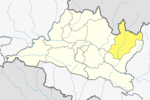
Lakuri Danda is a village development committee in Dolakha District in the Bagmati Zone of north-eastern Nepal. At the time of the 1991 Nepal census it had a population of 3,456 people living in 689 individual households.
Lamidanda is a village development committee in Dolakha District in the Janakpur Zone of north-eastern Nepal. At the time of the 1991 Nepal census it had a population of 3,601 people living in 811 individual households.
Shailungeshwar is a village development committee in Dolakha District in the Janakpur Zone of north-eastern Nepal. At the time of the 1991 Nepal census it had a population of 3,632 people living in 736 individual households.
Mirge is a village development committee in Dolakha District in the Janakpur Zone of north-eastern Nepal. At the time of the 1991 Nepal census it had a population of 3,216 people living in 693 individual households. Now it is ward no 3 of Baiteshwar rural municipality.

Namdu is a village development committee in Dolakha District in the Janakpur Zone of north-eastern Nepal. At the time of the 1991 Nepal census it had a population of 4,938 people living in 1,062 individual households.
Orang, Nepal is a village development committee in Dolakha District in the Janakpur Zone of north-eastern Nepal. At the time of the 1991 Nepal census it had a population of 1,771 people living in 378 individual households.
Pawati is a village development committee in Dolakha District in the Janakpur Zone of north-eastern Nepal. At the time of the 1991 Nepal census it had a population of 4,346 people living in 857 individual households.