
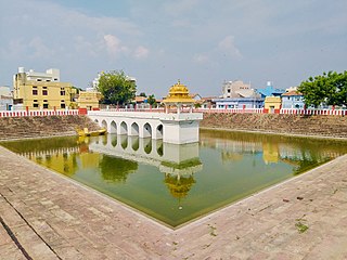
Jagtial is a city in and the district headquarters of Jagtial district of Telangana state, India. Located about 190 kilometres (118 mi) north of the state capital Hyderabad, it has an average elevation of 293 metres (961 ft). In 2011 the population was about 104,000

Karimnagar district is one of the 33 districts of the Indian state of Telangana. Karimnagar city is its administrative headquarters. The district shares boundaries with Peddapalli, Jagityal, Sircilla, Siddipet, Jangaon, Hanamkonda district and Jayashankar Bhupalapally districts.
Raikal It is located in the Jagtial district, Telangana, India
Dharmapuri is a village and the mandal headquarters of Dharmapuri mandal in Jagtial district of Telangana, India.

Kondagattu Anjaneya Swamy Temple is a temple dedicated to Lord Anjaneya Swamy. It is one of the famous temples, located in Muthyumpeta village of Mallial mandal, Jagitial district, Telangana, India. It is located about 15 km from Jagtial, 35 km from Karimnagar.

Korutla municipality is the second largest town and revenue division in the Jagtial district in the Indian state of Telangana. It is a historical town ruled by Jain Kings and second largest town in Jagtial district. It is the headquarters of Koratla constituency. It is located about 23 kilometres (14 mi) from the district headquarters Jagtial, 235 kilometers from Hyderabad, 73 kilometers from Karimnagar and 76 kilometers from Nizamabad.
Gollapally is a village located in Gollapalle mandal of Jagtial district in Telangana, India. Before the reorganisation of districts in Telangana, Gollapally was part of Karimnagar district. And in this village there is a river named ganga
Sarangapur is a village Sarangapur mandal in Jagtial district of the Indian state of Telangana. Before reorganisation of districts in Telanaga in 2016, Sarangapur mandal was a part of Karimnagar district.
Medipalle is a mandal in Jagtial District, Telangana, India.
Mallial is a mandal of Jagtial district in the state of Telangana in India.
Kodimial is a village in Kodimial mandal of Jagtial district in the state of Telangana in India.
Metpally is a town and Revenue Division and third largest town in Jagtial district of the Indian state of Telangana. It is located 222 km away from state capital Hyderabad, 67 km from Nizamabad, 80 km from Karimnagar and 33 km far away from District Headquarter Jagtial. It have great history many Dynasties ruled including Sathavahana's and Kakatiya's. The Kakatiyas built a temple named Chennakesava.
Pegadapally is a village in Pegadapally mandal of Jagtial district in the state of Indian state of Telangana.
Peddapur is a village in Koratla mandal of Jagtial district, Telangana.
Vellulla is a village in Metpally mandal, Jagtial district, Telangana, India. Vellulla is 4.6 kilometers away from its mandal's main town Metpally and 160 kilometers away from Hyderabad.
Mallapur is a mandal in the Jagtial district of the Indian state of Telangana.
Maddulapalli is a village of jagtial district pegadapalli mandal Assembly constituency : Dharmapuri assembly constituency Lok Sabha constituency : Peddapalli parliamentary constituency, Telangana state of India.

Jagtial Assembly constituency is a constituency of the Telangana Legislative Assembly, India. It is one among the 3 constituencies in Jagtial district. It is part of Nizamabad Lok Sabha constituency.
Jagtial district is a district located in the northern region of the Indian state of Telangana. Its administrative headquarters is the city of Jagtial. The district shares boundaries with Nirmal, Mancherial, Karimnagar, Peddapalli, Sircilla and Nizamabad districts.

Rajanna Sircilla district is a district in the Indian state of Telangana. Sircilla is the district headquarters. The district shares boundaries with Karimnagar, Siddipet, Jagtial, Kamareddy, and Nizamabad districts.

