Kavoor, Mangalore

Last updated

Kavoor
Suburb and ward
Kavoor city of Mangalore 2023.jpg
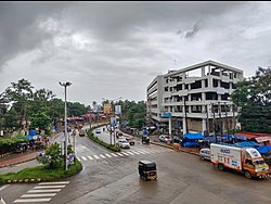
Kavoor junction in Mangalore
India Karnataka location map.svg
Red pog.svg
Kavoor
Location in Karnataka, India
Coordinates: 12°55′34″N74°51′30″E / 12.92616°N 74.85821°E / 12.92616; 74.85821
CountryFlag of India.svg  India
State Karnataka
District Dakshina Kannada
City Mangalore
Regional Tulu Nadu
Government
  Body Mangalore City Corporation
Area
[1]
  Total441.88 ha (1,091.91 acres)
Population
 (2011)
  Total16,321
Languages
  Official Kannada
  Regional Tulu, Beary, Konkani
Time zone UTC+5:30 (IST)
PIN
575015
Vehicle registration KA-19

Kavoor is a suburban area and the name of a ward in the city of Mangalore in the Mysore division of the Indian state of Karnataka. Kannada and Tulu are the two most commonly spoken languages in Kavoor. This place got the name as "Kavoor" because of the Saint "Kuvera Maharshi" who had visited this place. It connects major cities like Surathkal, Kankanady, Kinnigoli, and Bajpe.

Contents

Overview

Kavoor is a neighborhood and ward [2] of the city of Mangalore, in the Dakshina Kannada district of Karnataka about 7 kilometres (4.3 mi) north of the city's central shopping area of Market Street and the City Center shopping mall. [3] The Mangalore-Bajpe Airport Road passes through the area and links Kavoor to Mangalore International Airport. [4]

Kavoor is primarily a residential area with a mix of independent houses and apartment complexes. The neighbourhood has witnessed significant development in recent years. New buildings for Kavoor police station were opened in June 2014. [5]

Notable tourist spots nearby

Bus

Kavoor has a good network of public buses that connect it to different parts of Mangalore City and nearby towns.The Karnataka State Road Transport Corporation (KSRTC) [8] and private bus operators run regular services from Kavoor to different destinations. [9] [10]

Rail

Mangalore Central railway station in the city centre is about 7 kilometres (4.3 mi) away. [3]

Air

Mangalore International Airport is about 3.5 kilometres (2.2 mi) to the north. [3]

Religious places

Nearby Educational Institutes

See also

Related Research Articles

<span class="mw-page-title-main">Mangalore</span> City in Karnataka, India

Mangalore, officially known as Mangaluru, is a major industrial port city in the Indian state of Karnataka and on the west coast of India. It is located between the Arabian Sea and the Western Ghats about 352 km (219 mi) west of Bangalore, the state capital, 14 km north of Karnataka–Kerala border, 297 km south of Goa. Mangalore is the state's only city to have all four modes of transport—air, road, rail and sea. The population of the urban agglomeration was 619,664 according to the 2011 national census of India. It is known for being one of the locations of the Indian strategic petroleum reserves.

<span class="mw-page-title-main">Arsikere</span> City in Karnataka, India

Arsikere is a city and taluka in the Hassan district in the state of Karnataka, India. It is the second largest city in Hassan district, demographically. Arsikere city municipal council consists of 35 wards. This region is known for its coconut production and is also called Kalpataru Nadu. Arsikere Junction is a major railway junction in the South Western Railway which links Mangalore and Mysore to North Karnataka and a central place for tourists who visit nearby places that do not have rail access, such as Belur, Halebidu and Shravanabelagola, Harnahalli, and Kodimata.

<span class="mw-page-title-main">Kadri Park</span> Park in Karnataka, India

Kadri Park is a park located in Kadri Gudde. It is the largest park in Mangalore. This park contains a musical fountain and has hosted the Karavali Utsav. The park is famous for flower shows in Mangalore.

<span class="mw-page-title-main">Deralakatte</span> Place in Karnataka, India

Deralakatte is a major educational, healthcare, commercial and residential locality in the south-eastern part of Mangalore city in the Dakshina Kannada district of Karnataka state. It is 9 km (5.6 mi) away from the Karnataka-Kerala state border. It is popularly known as the University Town owing to its student population and universities. The stretch from Thokottu junction to Konaje is known as the Medical corridor road due to the presence of many premium educational institutions and healthcare facilities. It is close to Mangalore University, Konaje, Mudipu Infosys, Soorya Infratech Park, Thokottu & Ullal. Ullal beach, Someshwar Beach, Pilikula Nisargadhama are some of the nearest tourist destinations. This locality houses the NITTE University, Yenepoya University, Father Muller Charitable Institutions, Fathers Mullers Homeopathic Medical college hospital and Kanachur Groups of institutions and Hospital. It is a largest University locality in Mangalore after Manipal university in terms of students from all over the country and other parts of the world.

Padubidri or Padubidre or Padubedre in Tulu language is a small town in coastal district of Udupi in Karnataka state, India.

Kinnigoli is a major suburb in the outskirts of Mangalore Tehsil. It is located approximately 32 km from Mangalore City, 5 km from Kateel, 8 km from Mulki and 17 km from the Mangalore International Airport. Kinnigoli is a fast developing hamlet.

Kaikamba also known as Gurupura Kaikamba is a suburban town of Mangalore, Dakshina Kannada District, Karnataka State, west coast of India. Kaikamba lies between Moodabidri and Mangalore city in Dakshina Kannada district. This town lies on Mangalore – Moodabidri Highway National Highway 169. It is 8 km away from Bajpe, where Mangalore International Airport is located. Population of Kaikamba is about 15,325 as per 2009 census. Parts of Kaikamba are administered by Kandavara Panchayat and Ganjimutt Panchayat. Efforts are being made to include this town into Mangalore city corporation limits by the year 2015. The proposed KIADB Software export promotional park is 5 km away.

<span class="mw-page-title-main">Kalasa</span> Town in Karnataka, India

Kalasa is a tehsil located in Chikkamagaluru district in Karnataka. Kalasa is home to the Kalaseshwara Temple dedicated to Lord Shiva. Kalasa lies 92 Kilometres South-west of Chickmagalur and is located on the banks of the Bhadra River. Kannada language is spoken here dominantly.

<span class="mw-page-title-main">Pilikula Nisargadhama</span> Place in Karnataka, India

Pilikula Nisargadhama is a multi-purpose tourist attraction, at Vamanjoor, eastern part of Mangalore city in Karnataka, managed by the District Administration of Dakshina Kannada. It is a major tourist attraction of Mangalore. It attracts large number of tourists due to the availability of multiple facilities.

Punacha is a village in the southern state of Karnataka, India. It is located in the Bantwal taluk of Dakshina Kannada district in Karnataka.

<span class="mw-page-title-main">Ullal beach</span> Beach in Mangalore, Ullal

Ullal Beach is situated on the southwestern seaboard of the Indian sub-continent, adjacent to Ullal town, 10 km south of the city of Mangalore, Karnataka, India. Attractions are its picturesque stretch of Coconut trees, fishermen's lane, the ruined fort of Abbakka Devi and 16th century Jain temples. A resort is also situated nearby.

<span class="mw-page-title-main">Bejai</span> Commercial & Residential locality in Karnataka, India

Bejai is one of the major localities in Mangalore city, Karnataka, India. The series of Bharath malls, Bharath mall & Bharath mall 2, are located here. It is one of the upscale & the busiest residential cum commercial localities of Mangalore. Bejai - Kadri belt is also regarded as the Manhattan of Mangalore with many high-rise buildings.

<span class="mw-page-title-main">Bondel</span> Area of Mangalore in Karnataka, India

Bondel is a residential locality in Mangalore city, Karnataka, India. It is one of the upscale residential localities of Mangalore. Bondel along with Maryhill houses many highrise buildings and also developing rapidly as a commercial center. It lies in Airport road, which originates in KPT Junction and extends till Mangalore International Airport. Kavoor, one of the major localities of Mangalore is located nearby. This locality is close to the airport too.

John Richard Lobo, popularly known as J. R. Lobo, is an Indian politician with the Indian National Congress and former MLA of Mangalore South constituency in Karnataka, India. MLA J.R Lobo proposed the installation of musical fountain with laser show at Kadri Park, which is the largest lung space in the city. J.R Lobo also proposed the construction of the 3D 8K Planetarium at Pilikula in Mangalore, which was inaugurated in March 2018.

Maryhill is a locality in Mangalore city, Karnataka, India. It is one of the upscale residential localities of Mangalore. Maryhill, along with Bondel houses many highrise buildings and is also developing rapidly as a commercial center. Tulu is the main language which is spoken and understood by everyone in this locality. Konkani, Kannada are the other languages that is commonly used. Maryhill is predominantly a residential area and famous for Helipad. Many people use the Helipad daily for morning and evening walk. There are around 10 to 15 youth who enthusiastically gather at Maryhill helipad every Sunday at 8 am to fly their radio controlled aircraft. Instructors in the group train their pupils to fly these aircraft and also to operate radio-controlled motor cars.

<span class="mw-page-title-main">Panambur Beach</span> Beach in Mangalore, Panambur

Panambur Beach is a beach on the shores of the Arabian Sea in the city of Mangalore in the Indian state of Karnataka.

<span class="mw-page-title-main">NITK Beach</span> Beach in Mangalore, Surathkal

NITK Beach also known as Surathkal beach is on the Arabian Sea coast at Surathkal, 16 km (9.9 mi) north of the centre of Mangalore city, in the Dakshina Kannada district of Karnataka, India. It is a private beach that was later named after the nearby NITK.

<span class="mw-page-title-main">Tourist attractions in Mangalore</span> Overview of tourist attractions in Mangalore, Karnataka, India

The city of Mangalore is proclaimed as the gateway to Karnataka and lies nestled between the blue waters of the Arabian Sea and the green, towering hills of the Western Ghats. The 184 square km city is spread out over the backwaters of the two rivers, Netravati and Gurpura.

<span class="mw-page-title-main">Swami Vivekananda Planetarium</span>

Swami Vivekananda Planetarium, also called Pilikula Planetarium, at Pilikula Nisargadhama in Mangalore is the first 3D planetarium in India. It is also only such planetarium in the country with hybrid modern technology innovations coupled with 3D technology of 8K digital and opto-mechanical (hybrid) projection system. It is a part of the Pilikula Nisargadhama, which is also named Dr Shivaram Karanth Biological Park. It is planned and built to provide the best learning experience for students and enthusiasts on Zodiacal system of planets. Its creation is attributed to Pilikula Regional Science Centre.

<span class="mw-page-title-main">Permude</span> Gram panchayat in Karnataka, India

Permude is a village (panchayat) located in the Mangalore taluk, Dakshina Kannada district, in Karnataka state, India. The name, "Permude", derived from Perda Mudde, is a reference to the milk that was once locally produced in large quantities. Permude is located approximately 360 kilometers from the state capital, Bangalore. Nearby villages include Bajpe and Kinnigoli. According to 2011 census information, Permude's location code or village code is 617478. The village comprises an area of 742.69 hectares. Permude falls under the Mangalore Special Economic Zone (MSEZ).

References

  1. Census of India 2001:District Census Handbook:Dakshinna Kannada District. Director of Census Operations, Karnataka. p. 79.
  2. "Bharatiya Janata Party released 60 wards final list for Mangalore City Corporation election | Mega Media News English". Mega Media News. 30 October 2019. Retrieved 27 May 2023.
  3. 1 2 3 Google Maps distance calculator measurement from Kavoor Junction
  4. "Bus services launched to Mangalore International Airport". India Today. 1 November 2022. Retrieved 20 May 2023.
  5. "New building of Kavoor police station inaugurated". coastaldigest.com - The Trusted News Portal of India. 3 June 2014. Retrieved 26 May 2023.
  6. "Pilikula Nisargadhama in Mangalore". The Print. 14 April 2023. Retrieved 20 April 2023.
  7. "Kavoor lake development in Mangalore by Mangalore city corporation 2023". The Hindu. Retrieved 2 May 2023.
  8. "KSRTC bus services". India Today. 1 November 2022. Retrieved 14 May 2023.
  9. "Mangalore city Buses" . Retrieved 19 April 2023.
  10. "City buses to operate out of State Bank Service Bus Terminal". The Hindu . 1 April 2023. Retrieved 20 May 2023.
  11. "Brahmalingeshwara Temple in Kavoor" . Retrieved 20 April 2023.
  12. "Jumma Masjid Kavoor" (PDF). Retrieved 20 April 2023.