Kasaragod is a municipal town and administrative headquarters of Kasaragod district in the state of Kerala, India. Established in 1966, Kasaragod was the first municipal town in the district. It is the northernmost district of Kerala and is also known as Saptha Bhasha Sangama Bhoomi.
Kanhangad is a town, located in the Kasaragod District, state of Kerala, India.

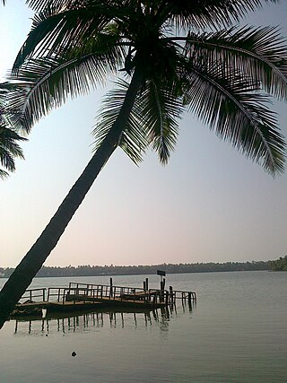
The Kerala backwaters are a network of brackish lagoons and canals lying parallel to the Arabian Sea of the Malabar coast of Kerala state in south-western India. It also includes interconnected lakes, rivers, and inlets, a labyrinthine system formed by more than 900 km (560 mi) of waterways, and sometimes compared to bayous. The network includes five large lakes linked by canals, both man made and natural, fed by 38 rivers, and extending virtually half the length of Kerala state. The backwaters were formed by the action of waves and shore currents creating low barrier islands across the mouths of the many rivers flowing down from the Western Ghats range. In the midst of this landscape there are a number of towns and cities, which serve as the starting and end points of backwater cruises. There are 34 backwaters in Kerala. Out of it, 27 are located either closer to Arabian Sea or parallel to the sea. The remaining 7 are inland navigation routes.

Kannur, formerly known in English as Cannanore, is a city and a municipal corporation in the state of Kerala, India. It is the administrative headquarters of the Kannur district and situated 274 kilometres (170 mi) north of the major port city and commercial hub Kochi and 137 kilometres (85 mi) south of the major port city and a commercial hub, Mangalore. During the period of British colonial rule in India, when Kannur was a part of the Malabar District, the city was known as Cannanore. Kannur is the sixth largest urban agglomeration in Kerala. As of 2011 census, Kannur Municipal Corporation, the local body which administers mainland area of city, had a population of 232,486.

Payyanur, IPA: [pɐjːɐn̺ːuːɾ], is a municipal town and a taluk, a sub-district administrative unit, in the Kannur district of Kerala, India. On 10 March 2018, Kerala Chief Minister Pinarayi Vijayan inaugurated Payyanur as the fifth taluk in the district. Payyanur taluk comprises 22 villages including 16 de-linked from the Taliparamba taluk and six from the Kannur taluk. The town is situated on the banks of the Perumba River.

Muzhappilangad Drive-in Beach is a beach on the Malabar Coast in the state of Kerala in southwestern India. It is considered as the longest drive-in beach in Asia and is featured among the top 6 best beaches for driving in the world in BBC article for Autos.
Nileshwaram or Nileshwar or Neeleswaram is a municipality and a major town in Kasaragod District, state of Kerala, India. It is one of the three municipalities in Kasaragod district; the others are Kasaragod and Kanhangad. Nileshwaram is located on the estuary of Kavvayi Backwaters and Neeleshwaram River. Nileshwar is referred to as the cultural capital of Kasaragod, the northernmost district, of Kerala. "The first Chief Minister of Kerala and communist leader E. M. S. Namboodiripad had contested elections to the Assembly from the Neeleswaram segment."
Valiyaparamba is a coastal island in Hosdurg taluk, Kasaragod district, Kerala state, India.
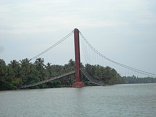
Kavvayi Backwaters located near Payyanur is the third largest backwater in Kerala and the largest one in north Kerala. The Kavvayi Kayal (backwaters) is dotted with several small and large islands. Valiyaparamba island is the largest among them and stretches over 16 square kilometres (6.2 sq mi).
Kuniyan River, also known as Kuniyan stream, is a river which flows along the border of Kannur and Kasaragod districts in the Indian state of Kerala. It connects the Tejaswini River and the Olavara River which join the Kavvayi Backwaters.

Kasaragod is one of the 14 districts in the southern Indian state of Kerala. Its northern border Thalappady is located just 10 km south to Ullal, which is the southernmost portion of the major port city Mangalore, on the southwestern Malabar coast of India.

Kunhimangalam is a census town situated in the northern coastal part of Kannur District in Kerala state on the outskirt of Payyanur. The population in 2011 was around 19,000 including Hindus, Christians and Muslim residents. The village lies in an agricultural region.

Ramanthali is a village in Kannur district in the Indian state of Kerala. It boasts the gateway for Indian Naval Academy in Ezhiamala.
There are places of worship considered important in the Kannur district. Kannur District is one of the 14 districts in the state of Kerala, India. The town of Kannur is the district headquarters, and gives the district its name.

Kannur Railway Station, also formerly known as Cannanore, is the largest railway station serving the City of Kannur in Kerala. It lies in the Shoranur–Mangalore section of the Southern Railways of the Indian Railways. It is the largest railway station in terms of area and number of tracks in North Malabar region. At ₹62 crore in financial year 2018–19, it is the fifth largest in terms of passenger revenues in Kerala, and second largest under Palakkad division. Almost all major trains connecting the other parts of Kerala, Tamil Nadu, Andhra Pradesh and North India halt here. Kannur and Kannur South are two different stations which serve Kannur city.

The following outline is provided as an overview of and topical guide to Kerala:

Anthoor is a municipality in the Kannur district of the North Malabar region in the Indian state of Kerala. Anthoor is located roughly 15 km from the Kannur City, and 7 km from Taliparamba town.

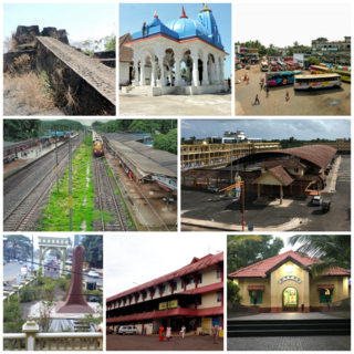
Kasaragod District is the northernmost district in the southwestern Indian coastal state of Kerala. The district has a long history starting from pre-historic times to the modern period.

Olayambadi is a small village about 21 km from Payyanur town in the Kannur district of Kerala state, South India.
Waterways have always been an important mode of transport in Kerala. The total length of navigable route in Kerala was 1,900 kilometres and the navigable rivers constitute about 54 per cent of the waterways. The 41 West-flowing rivers together with the backwaters are an integrated part of the inland navigation system in Kerala. In Kerala water transportation through these channels are mainly small distant passenger services, informal country boats, freight transportation to PSU's such as Fertilisers and Chemicals Travancore, Kochi etc.