Greystones is a coastal town and seaside resort in County Wicklow, Ireland. It lies on Ireland's east coast, 3.5 km (2.2 mi) south of Bray and 24 km (15 mi) south of Dublin city centre and has a population of 18,140 (2016). The town is bordered by the Irish Sea to the east, Bray Head to the north and the Wicklow Mountains to the west. It is the second largest town in County Wicklow.

County Longford is a county in Ireland. It is in the province of Leinster. It is named after the town of Longford. Longford County Council is the local authority for the county. The population of the county was 46,634 at the 2022 census. The county is based on the historic Gaelic territory of Annaly (Anghaile), formerly known as Teffia (Teathbha).

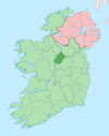
Ballymahon on the River Inny is a town in the southern part of County Longford, Ireland. It is located at the junction of the N55 National secondary road and the R392 regional road.

Longford is the county town of County Longford in Ireland. It had a population of 10,008 at the 2016 census. It is the biggest town in the county and about one third of the county's population lives there. Longford lies at the meeting of Ireland's N4 and N5 National Primary Route roads, which means that traffic travelling between Dublin and County Mayo, or north County Roscommon passes around the town. Longford railway station, on the Dublin-Sligo line, is used heavily by commuters.

Longford is a town in the northern midlands of Tasmania, Australia. It lies 145 m above sea level at the convergence of the Macquarie River and the South Esk River, 21 km south of Launceston and a 15-minute drive from the airport. It is just south of the Illawarra Road, a road connecting the Bass and Midland Highways. It has a population of 3,863 and is part of the Northern Midlands Council area. The region is predominantly agricultural, noted for wool, dairy produce and stock breeding.

Edgeworthstown or Mostrim is a small town in County Longford, Ireland. The town is in the east of the county, near the border with County Westmeath. Nearby towns are Longford 12 km to the west, Mullingar 26 km to the east, Athlone 40 km to the south and Cavan 42 km to the north. The N4 and N55 roads meet in the town.

Granard is a town in the north of County Longford, Ireland, and has a traceable history going back to AD 236. It is situated just south of the boundary between the watersheds of the Shannon and the Erne, at the point where the N55 national secondary road and the R194 regional road meet. It is 20 km north-east of Longford.

Ballysadare, locally also Ballisodare, is a town in County Sligo, Ireland. It is about 7 kilometres south of Sligo town. The town developed on an important crossing of the Owenmore River.

Arvagh, or Arva, is a village in County Cavan, Ireland, on the shores of Garty Lough and overlooked by Bruse Mountain. It is located on the junction of the R198 and R203 regional roads.

Dundrum is a village in County Tipperary, Ireland. In the 2016 census, the population was 165. It is in the barony of Kilnamanagh Lower.

Tarmonbarry, officially Termonbarry, is a village in County Roscommon, Ireland. It is located where the N5 National primary route crosses the River Shannon. East of the bridge, part of the village lies in County Longford. As of the 2016 census, the population of the village was 443 people. The village is a few kilometres west of the county town of Longford, near Strokestown and Roosky.
Drumlish is a village in County Longford, Ireland on the R198 regional road 10 km (6.2 mi) north of Longford Town.

Newtownforbes is a village in County Longford, Ireland. It was historically called Lisbrack, an anglicisation of the Irish name.
Brickeens is a very small townland in County Longford, Ireland. It is about five kilometres north of Keenagh and eight kilometres south of Longford town. Brickeens townland has an area of approximately 146 acres (0.2 sq mi), and had a population of 21 people as of the 2011 census. Evidence of ancient settlement in the townland include two ringforts.

Ballymcgovern is a village and townland in County Cavan, Ireland. It lies on the border with County Leitrim, within the parish of Templeport and barony of Tullyhaw on the Ballinamore to Ballyconnell road, the regional R205 road (Ireland).

Gardiner is a town in the south-central part of Ulster County, New York, United States. The population was 5,610 at the 2020 census.
Cor is a townland in the civil parish of Templeport, County Cavan, Ireland. It lies in the Roman Catholic parish of Templeport and barony of Tullyhaw.

Keenagh is a townland in the civil parish of Templeport, County Cavan, Ireland. It lies in the Roman Catholic parish of Templeport and barony of Tullyhaw.
Rosehill is a townland in the civil parish of Templeport, County Cavan, Ireland. It lies in the Roman Catholic parish of Templeport and barony of Tullyhaw.

Legan is a village in County Longford, Ireland. As of the 2016 census, the village population was 215.