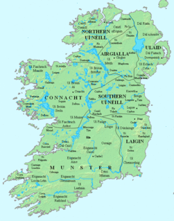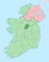
County Longford is a county in Ireland. It is in the province of Leinster. It is named after the town of Longford. Longford County Council is the local authority for the county. The population of the county was 40,873 at the 2016 census. The county is based on the historic Gaelic territory of Annaly (Anghaile), formerly known as Teffia (Teathbha).

County Cavan is a county in Ireland. It is in the province of Ulster and is part of the Border Region. It is named after the town of Cavan and is based on the historic Gaelic territory of East Breffny (Bréifne). Cavan County Council is the local authority for the county, which had a population of 76,176 at the 2016 census.

Longford is the county town of County Longford in Ireland. It has a population of 10,008 according to the 2016 census. It is the biggest town in the county and about one third of the county's population lives there. Longford lies at the meeting of Ireland's N4 and N5 National Primary Route roads, which means that traffic traveling between Dublin and County Mayo, or north County Roscommon passes around the town. Longford railway station, on the Dublin-Sligo line, is used heavily by commuters.

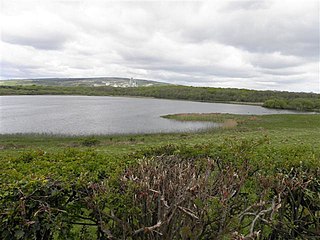
Lough Gowna is a fresh water lake which is the uppermost lake on the River Erne. It is located on the border between County Longford and County Cavan, with the largest part of the lake being in County Longford.
Killoe is a rural community and parish in County Longford, Ireland, located approximately 6 miles north of Longford Town. It is home to Cairn Hill or Carn Clonhugh - the highest peak in County Longford.

The Diocese of Ardagh and Clonmacnoise is a Roman Catholic diocese in Ireland.

The River Inny is a river within the Shannon River Basin in Ireland. It is 88.5 kilometres (55.0 mi) in length, and has a number of lakes along its course.

Newtownforbes is a village in County Longford, Ireland. It was historically called Lisbrack, an anglicisation of the Irish name.

The Black Pig's Dyke or Worm's Ditch is a series of discontinuous linear earthworks in southwest Ulster and northeast Connacht, Ireland. Remnants can be found in north County Leitrim, north County Longford, County Cavan, County Monaghan and County Fermanagh. Sometimes, the Dorsey enclosure in County Armagh and the Dane's Cast in County Down are considered to be part of the dyke.
Cloncollow is a townland in the Parish of Tomregan, Barony of Loughtee Lower, County Cavan, Ireland.

Annagh is a townland in the Parish of Tomregan, Barony of Tullyhaw, County Cavan, Ireland.

Larry Cunningham was an Irish country music singer, who was one of the leading figures of the showband scene in the 1960s and 1970s. Cunningham accomplished a series of "firsts" during his career. In 1964, Cunningham broke into the British charts with "Tribute to Jim Reeves", the first time an Irish artist had done such a thing.

Derrycassan (from Irish: Doire an Cásain meaning either the "Path through the Oakwood" or "Cassan's Oakwood" is a townland in the civil parish of Templeport, County Cavan, Ireland. It lies in the Roman Catholic parish of Templeport and barony of Tullyhaw. The local pronunciation is Dorrahasson.

Sruhagh is a townland in the civil parish of Templeport, County Cavan, Ireland. It lies in the Roman Catholic parish of Templeport and barony of Tullyhaw.

Camagh is a townland in the civil parish of Templeport, County Cavan, Ireland. It lies in the Roman Catholic parish of Templeport and barony of Tullyhaw. The local pronunciation is Commagh.

Mullaghmore is a townland in the civil parish of Templeport, County Cavan, Ireland. It lies in the Roman Catholic parish of Templeport and barony of Tullyhaw.
Larkfield fort is a ringfort (rath) and National Monument located in County Longford, Ireland. On the Record of Monuments and Places it bears the code LF006-021----.

Between the 5th and 12th centuries, an Irish sept claiming descent from Coirpre mac Néill ruled a barony of north Tethbae, called Cairpre Gabra. Their territory corresponds to the barony of Granard in modern county Longford in Ireland.
Aughnacliffe, officially Aghnacliff , is a village in County Longford, Ireland. It is located close to Lough Gowna and the border with County Cavan.

The Finn River, also known as the River Finn, is a small river that flows through parts of County Fermanagh and parts of County Monaghan in the south of Ulster, the northern province in Ireland. In certain places, the river forms part of the boundary between County Fermanagh, which is part of Northern Ireland, and County Monaghan, which is part of the Republic of Ireland. Two very short stretches of the river, just north of Redhills and at Castle Saunderson, near Belturbet, also form part of the boundary between County Fermanagh and County Cavan. This means that some stretches of the river form part of the border between Northern Ireland and the Republic of Ireland, these short stretches also forming part of the external border of the European Union.


