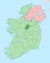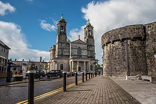
Ballymahon (Irish : Baile Uí Mhatháin, meaning 'Mahon's town') [2] on the River Inny is a town in the southern part of County Longford, Ireland. It is 19 km north-east of Athlone, at the junction of the N55 and R392 roads. [3]
Ballymahon derives its name from the Irish language term Baile Uí Mhatháin or Baile Mathuna, meaning "Town of Mahon". This may refer to Mahon (Mathgamain mac Cennétig), a southern chieftain and the elder brother of Brian Boru, who is believed by some to have fought a battle in 960 in the vicinity of Ballymahon at Shrule (in Irish Sruaith Fhuil, River of Blood) where he defeated O'Rourke of Cavan and laid claim to lands in the area. This is disputed by others who claim Mahon may relate to a sub chieftain of the O'Farrells who ruled over this part of County Longford in the 14th century. [4]
The earliest documentary evidence of Ballymahon is from the year 1578, when lands in the area were granted to the Dillon family, later Earls of Roscommon. [5] By 1654, the maps of William Petty's Down Survey shows Ballymahon as a group of houses situated at the southern end of the present town, on the right bank of the River Inny.
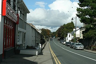
Two main families, the Shuldham family of Moigh House and the King-Harman family of Newcastle House, developed the town in the mid-nineteenth century. [6] The buildings in the town are of late Georgian architecture, with two and three-storey gabled houses, colour-washed and in rows of three and four. From 1788 to 1853, the Roman Catholic bishops of Ardagh and Clonmacnoise resided in the town, [5] and the parish church served as a Pro-Cathedral until St Mel's Cathedral was built in Longford.[ citation needed ]
The River Inny, a tributary of the River Shannon, flows westwards through Ballymahon in the direction of Lough Ree three miles from the town. A stretch of the Inny from Newcastle Bridge to Ballymahon town is used for beginner to intermediate kayaking, canoeing and time trials.[ citation needed ]
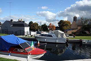
The Royal Canal also passes westwards through Ballymahon from Dublin to Clondra, County Longford. [7] Following extensive works the canal has been restored and is now fully navigable.[ citation needed ] Brannigan Harbour, c.1 km from Ballymahon town, is on the Royal Canal and is a common point for boats and barges to stop and pass.[ citation needed ]
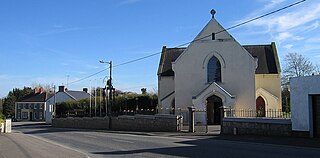
Churches in the town include St Matthew's Roman Catholic church (built 1906) which is constructed in a Gothic-style and located on the northwest side of Ballymahon. [8] St Catherine's Church of Ireland church (built 1800, rebuilt 1824) has a narrow spire which is a prominent feature in the town. [9]
Ballymahon Courthouse and Market House, originally built in the early 19th century, is a community library. It is situated in the centre of the town (built 1819). [10]
Opposite St Catherine's Church is the old RIC police barracks built on the northern edge of what local tradition holds was a castle or fortress of the O'Farrell Clan, earthworks of which can still be seen off the Fairgreen/Thomand Lodge Road. It became a Garda station after the establishment of the Irish Free State and remained in service until 1996 when a new, smaller, station was built on the southern bank of the river opposite the old mill. The barracks was attacked during the War of Independence in August 1920. [11] The attack was led by General Seán MacEoin, Seán Connolly (who fired the first shot in the Easter Rising and was later killed himself in the Selton Hill ambush) and Frank Davis. A small party of local volunteers also took part in the raid which mainly aimed to seize firearms. MacEoin later visited the barracks to campaign during an election campaign in the 1950s. Ruairí Ó Brádaigh was held here in the 1950s during the IRA Border War which ended in 1962.[ citation needed ]
Ballymahon is on the N55 road, [12] a National Secondary route leading from Athlone, 22 kilometres by road to the south, towards Belfast and Northern Ireland. The county town of Longford lies 22 kilometres by road to the north.
The R392 road links Ballymahon to Mullingar in the east and to Roscommon in the west, via Lanesborough–Ballyleague. [12] This route was a portion of an ancient ceremonial way from Rathcroghan to the Hill of Tara. Intact portions of the ancient roadway can be seen at the nearby Corlea Trackway and the ceremonial route attests to the straightness of the R392.[ citation needed ]
The Royal Canal links Ballymahon to Dublin, via several towns such as Mullingar and Maynooth, and to the River Shannon at Clondra.[ citation needed ]
Bus services include Bus Éireann route 466 which links Ballymahon with Athlone railway station in County Westmeath, [13] and Local Link route 24 to Longford town and Longford railway station. [14]
Ballymahon has a primary school, St. Matthew's National School, which had an enrollment of over 360 pupils as of 2019. [15] There are also two secondary schools in the area: Mercy Secondary School and Ballymahon Vocational School.[ citation needed ] The nearest third-level college is Athlone Institute of Technology in Athlone, approximately 22 km away.[ citation needed ]
Ballymahon is home to the Bog Lane Theatre.[ citation needed ] It also hosts the Oliver Goldsmith Summer School, a festival of literature which is held on the June Bank Holiday Weekend, with poetry readings held at Goldsmith's birthplace in Pallas.[ citation needed ] Ballymahon also plays host to the annual Still Voices International Film Festival. [16]
The town's Gaelic football (GAA) club is Ballymahon GAA, [17] and its association football (soccer) club is Ballymahon AFC.[ citation needed ]
Ballymahon is twinned with the two adjacent towns of Landévant and Landaul in the Morbihan region of Brittany in north-west France. Twinning events and cross-cultural tours are held annually. [18]
Athlone is a town on the border of County Roscommon and County Westmeath, Ireland. It is located on the River Shannon near the southern shore of Lough Ree. It is the second most populous town in the Midlands Region with a population of 22,869 in the 2022 census.
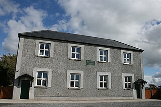
Tang is a village and a 'half-parish' in County Westmeath, on the N55 national secondary road between Athlone and Ballymahon, County Longford. Tang forms part of the ecclesiastical parish of Drumraney. It is in County Westmeath but on the border with County Longford from which it is separated by the Dungorman River which flows into Lough Ree 3 km downstream via the River Inny. The village is 15 km north-east of Athlone
County Longford is a county in Ireland. It is in the province of Leinster. It is named after the town of Longford. Longford County Council is the local authority for the county. The population of the county was 46,634 at the 2022 census. The county is based on the historic Gaelic territory of Annaly (Anghaile), formerly known as Teffia (Teathbha).
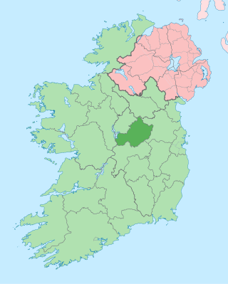
County Westmeath is a county in Ireland. It is in the province of Leinster and is part of the Eastern and Midland Region. It formed part of the historic Kingdom of Meath, which was named Mide because the kingdom was located in the geographical centre of Ireland. Westmeath County Council is the administrative body for the county, and the county town is Mullingar. At the 2022 census, the population of the county was 95,840.
Mullingar is the county town of County Westmeath in Ireland. It is the third most populous town in the Midland Region, with a population of 22,667 in the 2022 census.
The Royal Canal is a canal originally built for freight and passenger transportation from Dublin to Longford in Ireland. It is one of two canals from Dublin to the River Shannon and was built in direct competition to the Grand Canal. The canal fell into disrepair in the late 20th century, but much of it has since been restored for navigation. The length of the canal to the River Shannon was reopened on 1 October 2010, but a final spur branch, to Longford Town, remains closed.
Castlepollard is a village in north County Westmeath, Republic of Ireland. It lies west of Lough Lene and northeast of Lough Derravaragh and Mullingar.
Edgeworthstown or Mostrim is a small town in County Longford, Ireland. The town is in the east of the county, near the border with County Westmeath. Nearby towns are Longford 12 km to the west, Mullingar 26 km to the east, Athlone 40 km to the south and Cavan 42 km to the north. The N4 and N55 roads meet in the town. The town is in the townland of Edgeworthstown and in the civil parish of Mostrim.
The N55 road is a national secondary road in Ireland linking Athlone to Cavan town.
Glassan or Glasson, also the Village of the Roses, is a small village in rural County Westmeath, Ireland. It is 10 km (6.2 mi) north of Athlone, on the N55 national secondary road, not far from the shores of Lough Ree.
Raharney is a village in east County Westmeath, Ireland. It had a population of 221 according to the 2016 census.
Abbeyshrule is a village in south-east County Longford, Ireland, on the River Inny and the Royal Canal. The village is in a civil parish of the same name.
The Diocese of Ardagh and Clonmacnoise is a Latin Church diocese of the Catholic Church in Ireland.
Lanesborough–Ballyleague, more commonly known simply as Lanesborough, is a town in the midlands of Ireland. Lanesborough is on the County Longford (east) side and Ballyleague on the County Roscommon (west) side of the River Shannon, at the northern tip of Lough Ree.
Newtowncashel is a village located near Lough Ree in County Longford, Ireland. Newtowncashel won the Irish Tidy Towns Competition in 1980.
The R392 road is a regional road in Ireland linking Lanesborough, County Longford on the N63 to Mullingar, County Westmeath.
The River Inny is a river within the Shannon River Basin in Ireland. It is 88.5 kilometres (55.0 mi) in length, and has a number of lakes along its course.
Tubberclare or Tubberclair is a village and townland in County Westmeath, Ireland, between Ballymahon and Athlone. It lies 9 km (6 mi) from Athlone, on the N55 national secondary road, and 2 km (1 mi) north of Glasson. Toberclare is the official spelling of the name in English.
Kilkenny West, previously Maherquirke or Dillons country, is a barony in west County Westmeath, Ireland. It was formed by 1542. It is bordered by County Longford to the west; it is also bordered by three other Westmeath baronies: Rathconrath, Brawny and Clonlonan. The largest centre of population in the barony is the village of Glassan.
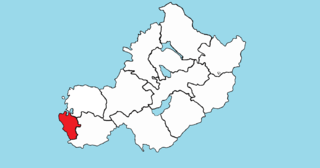
Brawny is a barony in south–west County Westmeath, Ireland. It was formed by 1672. It is bordered by County Roscommon to the west. It also borders two other Westmeath baronies: Kilkenny West and Clonlonan. The largest centre of population in the barony is the town of Athlone.